TAMPA, May 21, 2014—General Atomics Aeronautical Systems, Inc. (GA‑ASI), a leading manufacturer of Remotely Piloted Aircraft (RPA) systems, radars, and electro-optic and related mission systems solutions, today announced the successful second endurance flight...
Japan Launches New Satellite to Survey Disasters
TOKYO, May 24, 2014—Japan successfully launched a new mapping satellite on Saturday that will be used to survey damage from natural disasters and changes affecting rainforests. The Advanced Land Observing Satellite-2 (ALOS-2) will be able to see scars left by...
LiDAR Services International Announces Major LiDAR Contract Awards
Calgary, Alberta, Canada, May 29, 2014—LiDAR Services International (LSI) is pleased to announce two major contract awards, one in Canada and the other in Central America. LSI has been awarded the second and final phase of the Mackenzie Valley Highway new route...
Lockheed Martin Commercial Launch Services to Launch Worldview-3 Satellite on August 13
DENVER, May 22, 2014—Lockheed Martin [NYSE:LMT] Commercial Launch Services (LMCLS) will launch the WorldView-3 commercial remote sensing spacecraft, placing it into orbit on August 13 for DigitalGlobe, a leading provider of commercial high-resolution earth...
Teledyne and German Aerospace Center Formalize Commercial Space Imaging Partnership
THOUSAND OAKS, Calif., May 20, 2014—Teledyne Technologies Incorporated (NYSE:TDY) announced today that its subsidiary, Teledyne Brown Engineering, Inc. (TBE), in Huntsville, Ala., and the German Aerospace Center (DLR) formalized their commercial space imaging...
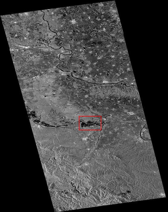
Sentinel-1A Satellite Aids Balkan Flood Relief
Although not yet operational, the European Space Agency's new Sentinel-1A satellite has provided radar data for mapping the floods in Bosnia and Herzegovina.
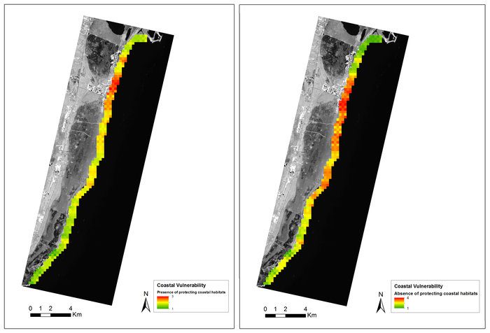
Satellites Aid Sustainable Forest Management
Under the Space for Ecosystems project, the European Space Agency is working with international partners to exploit Earth observation satellites as an information source for many types of ecosystem service assessments.
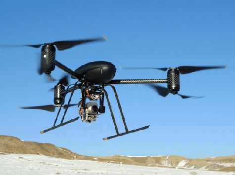
LA Police Avoid the D Word
The Los Angeles Police Department added two new unmanned aircraft systems to its toolbox, but the department is shunning the use of the word drone to avoid negative connotations.

USAF Deploys Advanced Surveillance Drones to Japan
The U.S. Air Force's deployment of drones to a key U.S. ally is intended to demonstrate Washington's commitment to security in Asia as part of the rebalancing of its Pacific forces.
GeoPlanner for ArcGIS Enables Resilient Design
Redlands, California, May 14, 2014—Esri recently released a web app called GeoPlanner for ArcGIS that brings the power of geodesign to land-based planning. GeoPlanner for ArcGIS is a JavaScript-based application that requires no plug-ins and has been designed to...
