DAYTON, Ohio, July 21, 2014—Woolpert, a national geospatial, infrastructure management and design firm headquartered in Dayton, announced that it has been awarded a one-year contract with the West Virginia Department of Transportation, Division of Highways to...
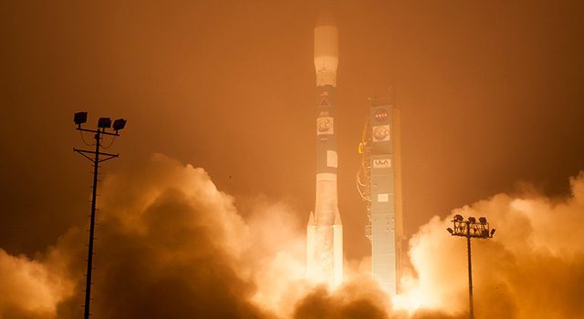
NASA Launches Long-Awaited Carbon Mission
The Orbiting Carbon Observatory-2 satellite aims to pinpoint atmospheric carbon dioxide, the leading human-produced greenhouse gas responsible for warming our world.
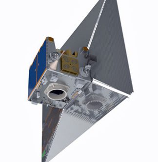
Satellite Sail Could Mitigate Orbital Debris Problem
At the end of its mission, the descent of Surrey Satellite Technology Ltd.’s TechDemoSat-1 satellite will be assisted by a specialized de-orbit sail just one-thousandth of an inch thick.

Skycatch Aims to Offer Drones for Hire
Skycatch, like Google's recently purchased satellite venture, is seeking ways to make high-resolution, easily accessible aerial imagery a part of how the everyday world works.
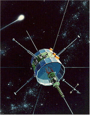
Citizen Scientists Take Control of Abandoned NASA Satellite
With NASA's blessing and following a successful crowd-funding campaign, a group of citizen scientists have taken control of an abandoned NASA satellite with plans to put it back to work.
Geographic Calculator 2014 SP1 Now Available with New Jobs to Streamline Workflow
Hallowell, Maine, July 22, 2014—Blue Marble Geographics (bluemarblegeo.com) is pleased to announce the release of the Geographic Calculator 2014 Service Pack 1 (SP1). This interim release features new job functions including the Area Calculation Tool and the Line...
Insitu Demonstrates Long Endurance Capabilities of the Integrator Unmanned Aircraft
BINGEN, Wash., July 22, 2014—Insitu announced today the successful 24-hour flight of its Integrator unmanned aircraft. The flight demonstrated Integrator's expanded endurance at an increased gross take-off weight with payload on board. The event is the first of...
Finmeccanica-Selex ES’s Mini and Micro UAVs See Success in Tests for the Forza NEC Programme
ROME, July 18, 2014—Finmeccanica-Selex ES’s ASIO-B and SPYBALL-B UAVs have passed their factory acceptance tests, leaving them ready for delivery to the Italian Army for its Forza NEC modernisation programme. With the systems ready to be welcomed into operation,...
TerraGo Brings Mobile Note Sharing and Collaboration to the Edge of the Enterprise
Washington, D.C., July 23, 2014—IDC predicts that by 2015, 37% of the workforce — approximately 1.3 billion workers — will be considered mobile.  To help organizations truly harness the mobile workforce, unprecedented availability of geographic data, rise of...
URISA Recommends Adding Addresses as a Framework Data Theme
Des Plaines, Ill., July 22, 2014—The URISA Board of Directors recently recommended that the Federal Geographic Data Committee (FGDC) add addresses as an eighth framework data theme to the National Spatial Data Infrastructure (NSDI), and, in support of that,...
