Madison, Ala., Aug. 27, 2014—GeoCue Group is pleased to present “A Conversation with the NOAA Coastal Services Center.†Part of the NOAA Coastal Services Center’s mission is to provide geospatial products and services to enable the effective management of the...
Leidos Awarded Contract by National Geospatial-Intelligence Agency
RESTON, Va., Aug. 25, 2014—Leidos (NYSE: LDOS), a national security, health and engineering solutions company was awarded a prime contract by the National Geospatial-Intelligence Agency (NGA) to provide mapping production services. The single-award...
Lockheed Martin and Electro Optic Systems to Establish Space Debris Tracking Site
DENVER and CANBERRA, Australia, Aug. 25, 2014—Under a new strategic cooperation agreement, Lockheed Martin [NYSE: LMT] and Electro Optic Systems Pty Ltd are developing a new space object tracking site in Western Australia that will paint a more detailed picture of...
OGC Announces New Urban Planning Domain Working Group
Aug. 20, 2014—An OGC Urban Planning Domain Working Group (SWG) has been chartered to define the role for OGC standards and related activities within the Urban Planning discipline and to provide an open forum for the discussion and presentation of interoperability...
Tetracam and Pix4D Forge Global Alliance to Improve Farming Through Remote Sensing
Chatsworth, Calif., and Lausanne, Switzerland, Aug. 21, 2014—Tetracam and Pix4D today jointly announced a global alliance that combines the technological strengths of both companies to improve farming by means of airborne remote sensing. The alliance is only the...
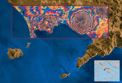
Monitoring Restless Super Volcanoes from Space
Eruptions of super volcanoes are a thousand times larger than those of normal volcanoes and only a handful exist around the world. Learn how satellites keep an eye on these giants.
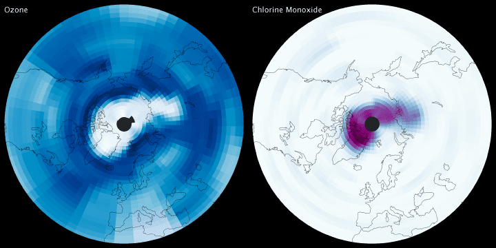
Celebrating an Aura of Success
On the 10th anniversary of the launch of NASA’s Aura spacecraft, view 10 examples of how the satellite has changed our view of dust, pollution, aerosols and ozone in our atmosphere.
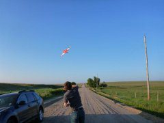
UAS Used to Study Colorado Thunderstorm Activity
Several organizations teamed to conduct the first multiple, unmanned aircraft interception of a telltale rush of cold air preceding a thunderstorm at the Pawnee National Grassland in northeast Colorado on Aug. 14, 2014.
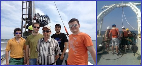
Ships Ensuring Accurate Satellites
Satellites provide useful information when properly calibrated. Learn how ocean research can play a key role in making Earth observation satellites more useful.
BlackBridge and MDA Launch Joint Persistent Change Monitoring Solution
Berlin, Aug. 13, 2014—BlackBridge announces a strategic partnership with the U.S. company, MDA Information Systems LLC (MDA), to introduce a new change monitoring solution, RapidEye Persistent Change Monitoring (RapidEye PCM™). This new solution incorporates...
