June 24, 2015 — The Sidwell Company, the national industry leader of GIS solutions for Local Government, was recently designated by Esri as an ArcGIS Online Specialty Partner. This designation recognizes partners who demonstrate skills and experience in delivering...
Positive Feedback from Teledyne Optech's 2015 Imaging & Lidar Solutions Conference
June 24 2015 — Teledyne Optech is pleased to announce the successful conclusion of the 2015 Imaging and Lidar Solutions Conference (ILSC) on Friday, June 12. Visitors from across the globe came together in Toronto to share ideas, learn about Teledyne Optech...
MMIST deploys MapLink Pro Mobile to support SkyLink Parachutist Situational Awareness System
June 24, 2015 — ENVITIA is pleased to announce that Mist Mobility Integrated Systems Technology Inc. (MMIST), a Canadian full solution provider of Precision Aerial Delivery products and services, has chosen MapLink Pro Mobile to provide the map visualisation...
Commercial UAV Expo Announces 2015 Conference Program
Portland, Maine, USA, June 24, 2015 — The organizers of Commercial UAV Expo announced the 2015 Conference Program today. The program will delve into key issues faced by large-enterprise organizations when implementing Unmanned Aerial System (UAS), including...

NASA Completes Intensive Study of Louisiana Gulf Coast Levees and Wetlands
NASA regularly captures data about Gulf Coast fluctuations, measuring change as well as ongoing loss of land. These measurements are particularly helpful after storms and hurricanes to understand wetland change and obtain a complete picture of coastal zone change.
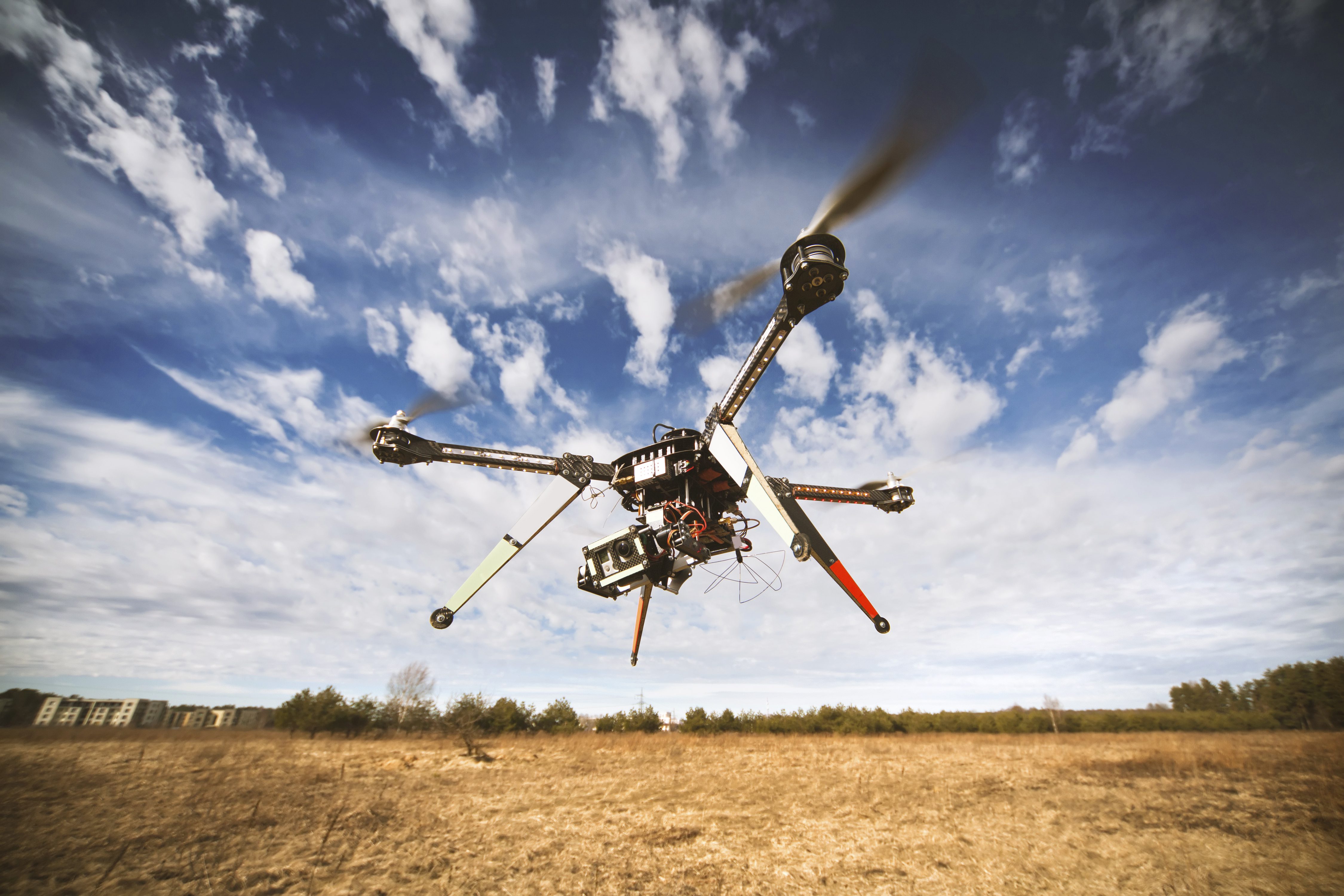
Auburn University Launches First FAA-Approved UAS Flight School
Auburn University's unmanned aircraft system (UAS) flight school is getting up and running following approval by the Federal Aviation Authority in April 2015. Auburn's Aviation Center has been teaching flight training for more than 75 years, and the school has embraced this next generation of commercial interest.

UAE Drones for Good Award Accepting Entries
The 2016 United Arab Emirates (UAE) Drones for Good Award is accepting online video and proposal submissions until Nov. 1, 2015. Initially developed in 2014, the award features a $1 million cash prize and is dedicated to transforming these exciting technologies into practical solutions for improving people's lives.
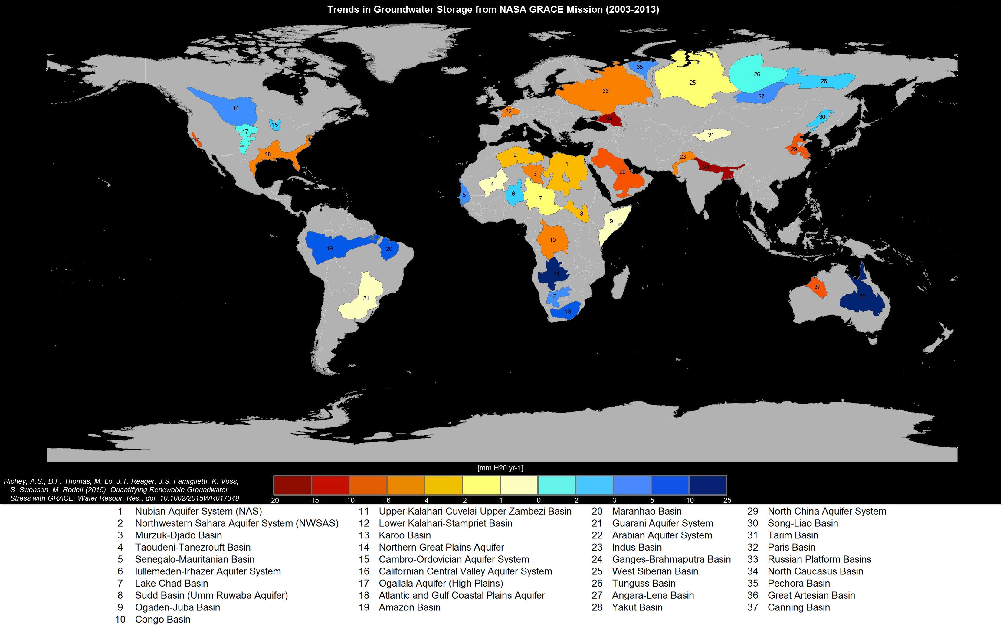
World's Largest Groundwater Basins in Distress
Human consumption is rapidly draining some of its largest groundwater basins, yet there’s little to no accurate data about how much water remains in them, according to two new studies led by UC Irvine that use data from NASA Gravity Recovery and Climate Experiment...
Dates Announced For the 2nd International Drone Expo
LOS ANGELES – June 23, 2015 – The International Drone Expo (IDE), previously LA Drone Expo, is the largest global commercial drone community gathering open to the public with 125 exhibitors and more than 6500 buyers. IDE 2015 will be held December 11 – 12 at...
Indonesia Regional Planning and Development Sector Powers Up Mobile Mapping by SuperPad
June 23, 2015 — Supergeo Technologies, the leading GIS software provider, announces that Deli Serdang Regional Sector for Planning and Development, Indonesia selects SuperPad, the mapping application designed for Windows Mobile, to power up fieldwork quality. The...
