Heerbrugg, Switzerland, 9 September 2015 — The Leica Geosystems Geospatial Solutions Division is very pleased to announce that the Carl Pulfrich Award 2015 has been awarded to Dr. Christoph Strecha. With developing algorithms in the areas of feature detection and...
VisionMap Thermal Airborne Imaging System Maps German Pipelines
Tel Aviv, Israel, September 9, 2015 —VisionMap, a leading provider of aerial survey and mapping systems, announced that its thermal airborne imaging system, MIST, was recently used to map and monitor pipeline infrastructure in Herten, Germany. The survey was...
1Spatial Helps to Create a Central Source of Geospatial Truth for the City of Marseille
Cambridge, September 9, 2015, 1Spatial, the global spatial software firm which manages the world’s largest spatial data, helps Marseille’s GIS team to simplify the administration and management of its geospatial data and tools. Marseille, like many large, modern...
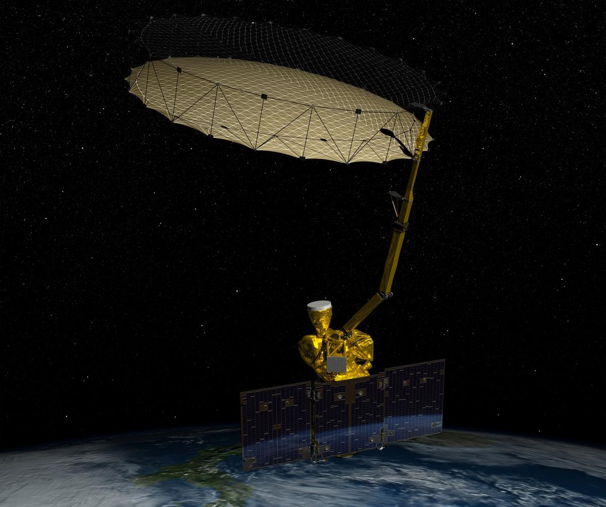
New Soil-Moisture-Mapping Satellite Carries on After Lost Instrument
A NASA satellite launched just seven months ago lost the use of one of two science instruments, but the space agency said the mission to map global soil moisture will continue.
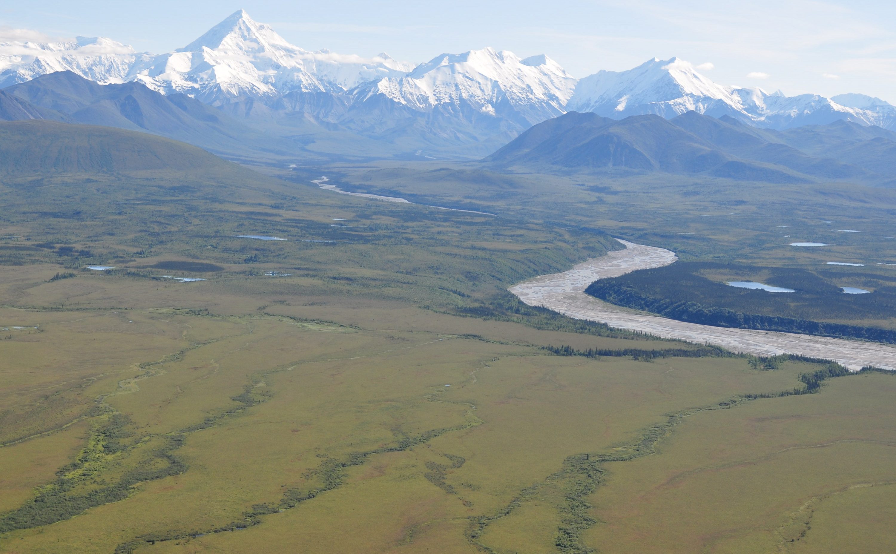
ABoVE Campaign to Examine Climate Change in Arctic
As part of a broad effort to study the environmental and societal effects of climate change, NASA has begun a multiyear field campaign to investigate ecological impacts of the rapidly changing climate in Alaska and northwestern Canada, such as the thawing of permafrost, wildfires and changes to wildlife habitats.

European Scientists Creating Interoperable Ocean Sensors
NeXOS is developing standards and technologies that would allow users to share data and operate the sensors via the Web, creating a complete, end-to-end system that would dramatically reduce the complexity and cost of gathering and disseminating ocean observation.

Chinese Satellites Help Protect Angkor Wat
Chinese satellites are using remote sensing to collect and process real-time images of Cambodia's Angkor Wat, the magnificent temple of the Khmer Empire.
Mississippi’s Geospatial Cluster Distributes Awards at Joint Annual Meeting
Stennis Space Center, MS, September 8, 2015  –The Enterprise for Innovative Geospatial Solutions (EIGS) announced its key business metrics and business award winners for the 2015 US Small Business Administration Geospatial Regional Innovative Cluster. EIGS...
Geospatial World Forum 2016 Opens Call for Papers
Amsterdam, September 8, 2015 -Â Geospatial Media and Communications today announced the first call for papers for its flagship event, Geospatial World Forum 2016. The call for papers also include call for workshop proposals, which allow companies/institutions to...
HolisticImaging Announces UnlimitedAerial 1.1
Graz, September 8, 2015 – HolisticImaging™, is pleased to announce the release of UnlimitedAerial™ version 1.1, which adds UAS support, oblique camera support and orthophoto support to our production pipeline. Naturally, all our algorithms are designed to handle...
