December 10, 2015 — Professor Sir Martin Sweeting, Executive Chairman of Surrey Satellite Technology Ltd (SSTL) and the Surrey Space Centre at the University of Surrey, has been admitted to Honorary Fellowship of the Royal Aeronautical Society (RAeS). Sir Martin...
SuperGIS Desktop Supports Italian Waste Management Organization
December 10, 2015 — The global GIS solution and software provider, Supergeo Technologies Inc. announces that ATO2 – Ancona, a regional waste management organization in Italy, has selected SuperGIS Desktop as their solution to process geospatial data. Located in...
Delegates Hail the First Capturing Reality Forum a Great Success!
December 9, 2015 — The first Capturing Reality Forum held in Salzburg, Austria from 23-25 November 2015, has been hailed a great success by its audience of international delegates and visitors; with its focus on the use of laser scanning, 3D imaging and LiDAR to...
MAPPS, NSPS Issue Call for Presentations for 2016 National Surveying and Mapping Conference
December 9, 2015 (Reston, VA) — MAPPS, the national association of private sector geospatial firms, and the National Society of Professional Surveyors (NSPS), the national voice of the professional surveying community, today issued a call for presentations for the...
Bluesky's 3D Aerial Maps Inform Flood Risk Assessments for Planning Applications
Leicestershire, December 9, 2015 — Aerial photography and detailed 3D height models of the UK are being used to assess the risk of flooding, and help development projects progress through the planning process. Working with Betts Hydro, part of engineering...
Finding the Right Address: a Matter of Life or Death
December 9, 2015 — An Ordnance Survey software pilot has helped save lives, so say the Community First Responders (CFRs ) who used it. The prototype mobile web app was used by a sample of CFRs from across the country over an eight week period. During this time the...
MAPPS Winter Conference Offers New Format, Insightful Programming
December 9, 2015 (Reston, VA) — MAPPS (www.mapps.org), the national association of private sector geospatial firms, recently unveiled a new and exciting format for the Winter Conference, as well as a compelling lineup of sessions and programming. The conference...
Getmapping Wins a Place on the G-Cloud 7 Framework
December 9, 2015 — Getmapping Plc has been re-appointed as a supplier of cloud-based GIS data and software services to the UK Public Sector under the G-Cloud 7 Framework. Managed by the Crown Commercial Service (CCS), the G-Cloud is an online catalogue available to...
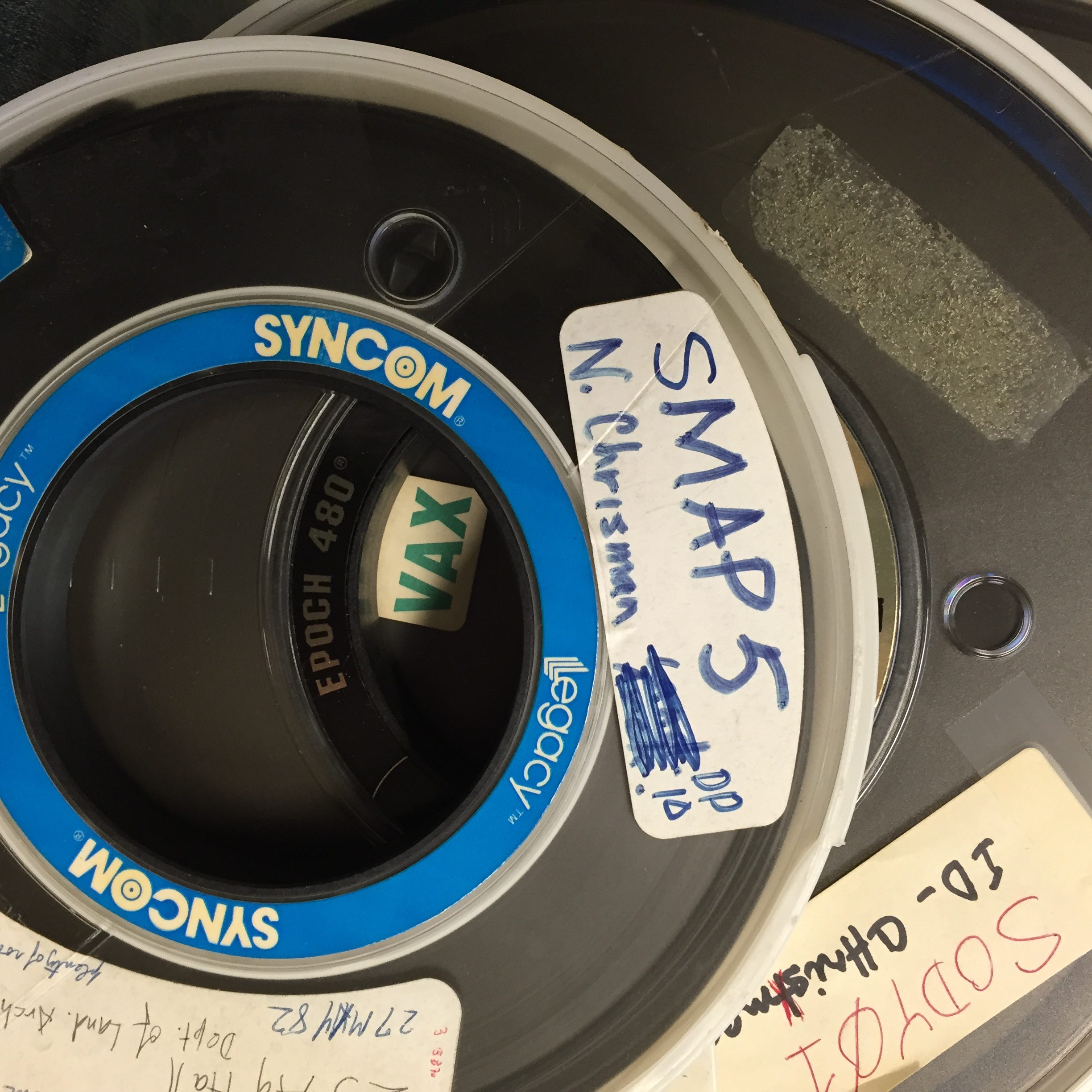
Library of Congress Collecting Geospatial History
Recently, the Geography and Map Division at the U.S. Library of Congress has undertaken a large-scale project to collect manuscripts, technical information, algorithms, software and hardware from the earliest days of computer cartography.
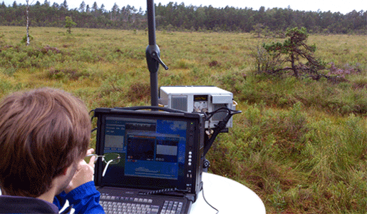
New Camera Measures Greenhouse Gases
A new camera from Sweden's Linköping University and Stockholm University can photograph and film methane in the air to help measure and monitor greenhouse gases.
