According to a report recently published in Nature Climate Change, satellite data is helping to reveal that there's a critical point where Antarctica's huge ice shelves act as a safety band, holding back the ice that flows to the sea.
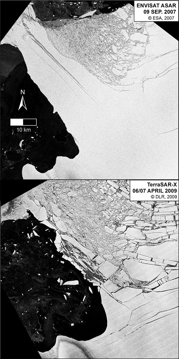
According to a report recently published in Nature Climate Change, satellite data is helping to reveal that there's a critical point where Antarctica's huge ice shelves act as a safety band, holding back the ice that flows to the sea.
ExpoDronica 2016 Brings for the First Time in the World Land, Sea and Air Drones - The drone industry has taken off in 2015 and it expects to have an exponential growth throughout 2016, which will allow to develop new applications and a greater choice of solutions. -...
Date: February 8, 2016 — Today Pix4D launches Pix4Dmapper Ag: a photogrammetric software that converts multispectral images into agriculture-specific maps for better crop management and analysis. The software is being released in conjunction with Sequoia: a...
NEWTON, MA (USA) — Caliper Corporation, the leader in the development of cost-effective professional map software, has announced that is has become an associate member of the Open Geospatial Consortium. As an Associate Member, Caliper will participate in OGC's...
8 February 2016 — Monitoring Earth’s surface every day, ESA’s Proba-V minisatellite has had a ringside seat as the second largest lake in Bolivia gradually dried up. Lake Poopó has now been declared fully evaporated. The three 100-m resolution Proba-V images...
8 February 2016 — The Open Geospatial Consortium (OGC)  Point Cloud Domain Working Group (Point Cloud DWG) formed late last year to assess the current state of standards and best practices in the management of point cloud data and to guide OGC activities in...
The HAI Heli-Expo 2016 is coming up sooner than you expect: Feb.29 - Mar.3 in Louisville, KY. Red Hen Systems will be there with our latest innovations for the aviation industry, built upon what we are known for-aerial video mapping with data multiplexing tool...
Supergeo Technologies Inc., the total GIS software and solution provider announces that Nexgeo has selected SuperGIS Desktop for processing and visualizing geospatial data. Headquartered in Seoul, Nexgeo is a Korean consulting firm and construction contractor involved...
Bothell, Washington, February 5, 2016 — EagleView Technology Corporation, a leading technology provider of aerial imagery, data analytics and GIS solutions, announced that its wholly owned subsidiary, Pictometry International Corp., has designed and is developing an...
Redlands, California—February 5, 2016 — Esri announced the availability of the ArcGIS Open Data Initiative for Law Enforcement, which allows police agencies of any size to build and share authoritative data for better policing and community engagement. The Esri...
