On February 22 at ILMF 2016 in Denver, RIEGL launched two new High-Speed Mobile Mapping Turnkey Systems featuring this high performance VUX-1HA kinematic LiDAR sensor! RIEGL is proud to announce the first launch customers in the United States for these systems, David...
6th Digital Earth Summit & ISDE’s 10th Anniversary
The 6th Digital Earth Summit, together with a celebration of the tenth anniversary of ISDE, will be held on 7-8 July 2016 in Beijing, China. This series of summits is one of the academic events regularly organized by the International Society for Digital Earth (ISDE),...
Esri Workbook Teaches Spatial Analysis Techniques
Redlands, California—February 23, 2016—GIS Tutorial 2: Spatial Analysis Workbook, published by Esri, will help experienced geographic information system (GIS) software users hone their spatial analysis skills using Esri's ArcGIS technology. The fourth edition of...
VisionMap to Release LightSpeed Version 4.0
Tel Aviv, Israel – February 23, 2016 — VisionMap, leading provider of aerial survey and mapping systems, has announced the upcoming release of LightSpeed 4.0, the newest version of its flagship photogrammetric processing suite. LightSpeed 4.0 includes several...
GEOINT 2016 Symposium Registration Now Open
Herndon, Virginia, Feb. 23, 2016 —The United States Geospatial Intelligence Foundation (USGIF) opened registration and housing for its GEOINT 2016 Symposium, which will take place May 15-18 at the Gaylord Palms Resort & Convention Center in Orlando, Fla. The...
Esri Releases Latest Version of ArcGIS Full Motion Video
Redlands, California—February 23, 2016—Esri released the latest version of ArcGIS Full Motion Video (FMV), a technology designed to work with video from drones, manned aircraft, and stationary video surveillance cameras. The release of ArcGIS FMV continues to...
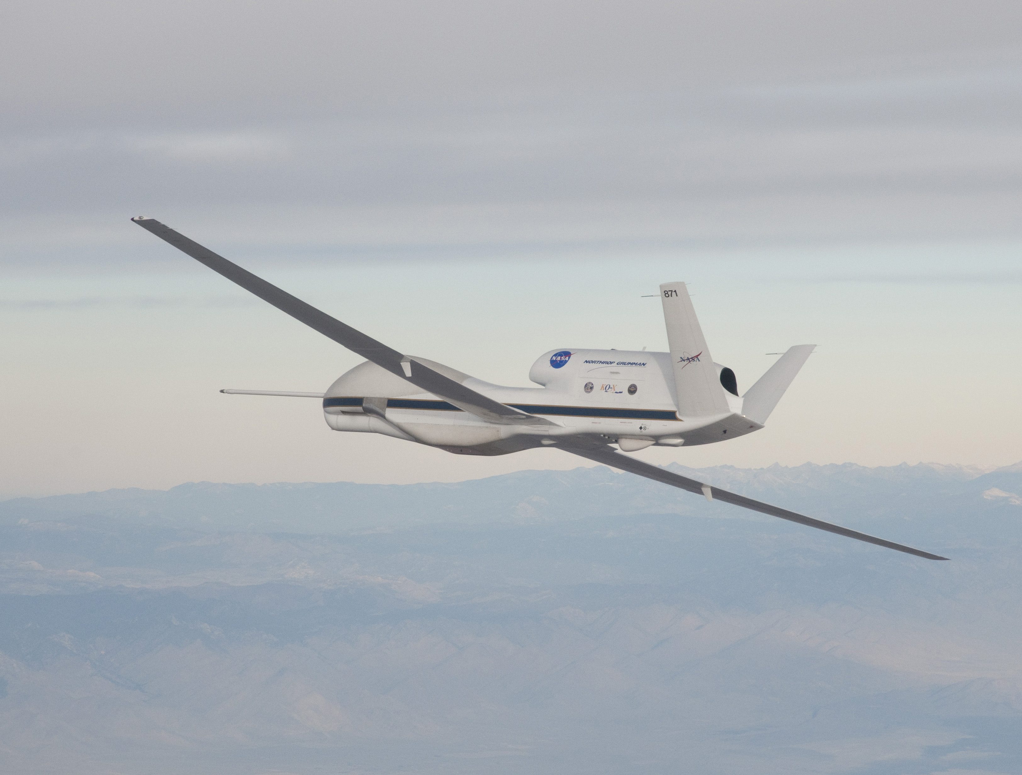
NASA UAS Monitors Pacific Storms
Extreme weather predictions on the U.S. West Coast could become more accurate with help from NASA’s Global Hawk unmanned aircraft system (UAS).
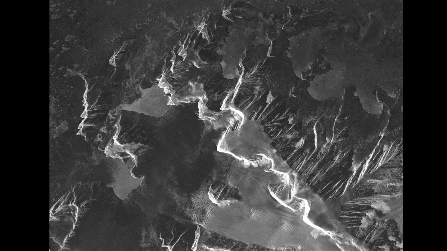
Satellites Help Antarctic Researchers Navigate Icy Seas
The crew aboard the Dagmar Aaen, a research ship traveling around the Antarctic Peninsula to investigate how climate change is impacting the local environment, is receiving high-resolution radar images from the German Aerospace Center (DLR) to help navigate the icy waters.
Zeroing in on the Market for Unmanned Aerial Vehicles, Velodyne LiDAR Announces New Puck LITE
MORGAN HILL, Calif. (Feb. 22, 2016) — Aiming at the burgeoning market for unmanned aerial vehicles (UAVs), Velodyne LiDAR today unveiled its new Puck LITE™ -- at 590 grams, the world’s lightest 16-channel LiDAR sensor. Puck LITE will make its public debut on...
Faster Detection of Landmines Using Radar
Every 20 to 30 minutes, somewhere in the world, a person – often a child – steps on a landmine. It is estimated that over 100 million anti-personnel mines are buried worldwide and a further 200 to 250 million are thought to remain in military storage facilities....
