In our latest release we have primarily focused on optimising and stabilising the backend and on adding new elements to provide an improved user experience throughout the OpenRouteService 3.3 based on OpenStreetMap data. After many requests from our community, we for...
Esri Offers Free Self-Paced E-Learning to Customers through New Training Site
Redlands, California —Esri will give all customers that have a qualifying product with a current maintenance subscription unlimited access to free self-paced e-Learning through its new Training website, Esri president Jack Dangermond announced today. “Esri...
Two New ArcGIS Apps for the Field to Launch at Esri User Conference
Redlands, California —Esri will launch two new ArcGIS apps for field operating efficiency at the upcoming Esri User Conference, to be held June 27–July 1 in San Diego. Amid much excitement, attendees will be able to see live demos and even experiment with...
See Where Imagery and GIS Go Next in The ArcGIS Imagery Book: New View. New Vision
Redlands, California —Getting a more intelligent picture of our planet just got easier thanks to an explosion in new imagery data collection sources, like drones and microsatellites, coupled with new image processing and analysis capabilities in Esri technology....
Charlotte Uses Cityworks Across Entire City
Sandy, UT – More than a thousand users from five separate departments at the City of Charlotte, North Carolina, are using Cityworks® to strategically advance work and asset management efforts across operating systems. Prior to Cityworks, a wide array of work...
USGIF Accredits James Madison University
Herndon, VA (June 27, 2016)—James Madison University’s (JMU) Department of Integrated Science and Technology in Harrisonburg, Va., was recently named an accredited program by the United States Geospatial Intelligence Foundation (USGIF). The department is now...
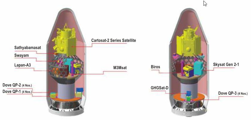
ISRO Launches 20 Satellites from One Rocket
On June 22, 2016, the Indian Space Research Organization (ISRO) successfully launched 20 satellites from its PSLV C-34 rocket.
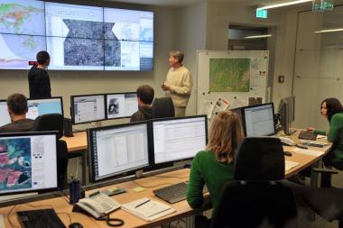
Humanitarian Project Aims to Provide Satellite Data
The German Aerospace Center (DLR) set up the EO4HumEn+ Project to better provide satellite data for humanitarian aid organizations worldwide.
Septentrio Offers Enhanced Georeferencing Solutions for Drone Aerial Surveys
TORRANCE, Calif. – June 27, 2016 – Septentrio is featuring its enhanced suite of drone survey tools for GIS professionals at the 2016 Esri User Conference in San Diego this week. “Aerial surveys by unmanned aircraft are increasingly becoming the technique...
3DR Announces Partnership with Esri; Site Scan Support for Esri Drone2Map
Berkeley, CA, June 27, 2016 -- Today at the Esri User Conference, 3DR announced that it has teamed up with the world's leading provider of GIS solutions to seamlessly integrate 3DR’s Site Scan with Esri Drone2Map. Designed for the field professional, Site Scan is an...
