Members of the Open Geospatial Consortium (OGC®) recently approved the release of 7 draft public OGC Engineering Reports, products of the recently completed OGC Interoperability Testbed 12 Aviation Thread. Testbed 12’s Aviation Thread was sponsored by FAA and...
Arizona Department of Transport chooses 1Spatial Technology to Validate its State-Wide Road Network
CAMBRIDGE, England — 1Spatial ( www.1spatial.com) is the global spatial software firm, which manages the world’s largest spatial data. The Arizona Department of Transport has bought 1Spatial’s 1Integrate product to validate its state-wide road network. The...
Bentley Announces the Finalists in 2016 Be Inspired Awards Program Recognizing Innovation in Infrastructure Design, Construction, and Operations
EXTON, Pa., U.S.A. – Bentley Systems, Incorporated, a leading global provider of comprehensive software solutions for advancing infrastructure, today announced the project finalists in the 2016 Be Inspired Awards program. The annual awards honor the extraordinary...
Esri Named among the Top 25 Fastest Growing Cloud Companies
Redlands, California — Smart mapping leader Esri announced today that it has been recognized in a new report by PwC as one of the 25 fastest growing cloud companies. The report assesses some of the ways cloud computing continues to change and shape the software...
Fire-Detection Satellite BIROS Releases BEESAT-4 Picosatellite
On Sept. 9, 2016, the Bi-Spectral Infrared Optical System (BIROS) fire-detection satellite, developed and built by the German Aerospace Center (DLR), released the Berlin Educational and Experimental Picosatellite (BEESAT-4) into space 515 kilometers above the Norwegian Svalbard archipelago.
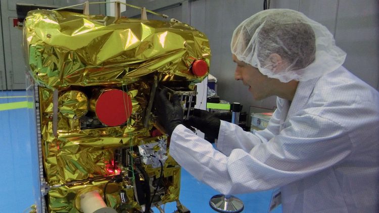
Phase One Industrial Launches iXU-RS Aerial Camera Series Featuring Innovative Central Lens Shutter Design
COPENHAGEN― Phase One Industrial today introduced the iXU-RS aerial camera series, featuring a breakthrough central lens shutter design. The new shutter technology is based on an innovative direct drive concept with electronic charging that enhances exposure speed...
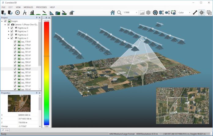
SimActive Brings Picture-in-Picture 3D Viewing with Version 6.5
SimActive Inc. released Correlator3D version 6.5 with a new picture-in-picture (PiP) feature.
European Space Imaging Partner in Newly Launched MARSAT consortium
MARSAT consortium announced it is ready to provide innovative space-based applications using satellite-derived information for the maritime and coastal industry. MARSAT’s main goal is to create integrated satellite-based services to improve safety and efficiency in...
Topcon Releases Two New UAV Mapping Kits
Topcon Positioning Group has announced two new mapping kits for its Sirius Pro fixed-wing UAS (unmanned aerial system). Each kit supplies a different sensor package, enabling the Sirius to adapt to different applications. All Sirius fixed-wing UAV platforms include...
Leidos Wins $777M GSA Contract For Army Geospatial Mapping Program
RESTON, Va. - Leidos (NYSE: LDOS) will support the Army Geospatial Center's (AGC) High-Resolution, 3-D (HR3D) Geospatial Information program through a prime contract from the General Services Administration (GSA). The single-award task order awarded under the GSA One...
