Orbit GT releases its premiere Indoor Mapping product with a spectaculare range of functionalities. It’s availabe for download today. “Indoor Mapping v17 is an awesome new releaseâ€, says Peter Bonne, CEO of Orbit GT. “It’s wonderful blend of point cloud...
Pix4D Speaks at UN Panel on Food Security
Today the United Nations Commission on Science and Technology for Development ( CSTD) will hold an expert panel meeting on the role of science, technology, and innovation in ensuring food security by 2030. Pix4D’s agricultural business manager Jorge Fernandez will...
New Book ˜GNSS Survey & Engineering'
Geomares Education is introducing a new book ‘GNSS Survey & Engineering’, written by Huibert-Jan Lekkerkerk. GNSS Survey & Engineering aims at providing the everyday professional GPS user with enough background for the understanding and correct operation...
3rd Annual Drone World Expo to Be Held October 3-4, 2017 in San Jose; Speaker Proposals Now Be Accepted for Educational Program
SAN JOSE, CA - Following an extremely successful gathering for the commercial drone industry, the Drone World Expo team with the help of an outstanding Advisory Board, is preparing for its 3rd annual event, which will return to the San Jose Convention Center,...
RFI for US Army Geospatial Center SETA Services
THIS IS A REQUEST FOR INFORMATION (RFI) ONLY. The US Army Corps of Engineers, Army Geospatial Center (AGC), is issuing this Request for Information (RFI) / Sources Sought to perform market research in order to determine the availability of firms which possess the...
GEO Jobe Welcomes Jeff Lawrence to role in Unmanned Aerial Vehicle (UAV) Business Development
NASHVILLE, Tenn. -- GEO Jobe, a leading GIS software and solution provider offering UAV mapping services, welcomes Jeff Lawrence to the team in the role of business development of UAV services. Lawrence is a licensed UAV pilot and experienced professional skilled in...
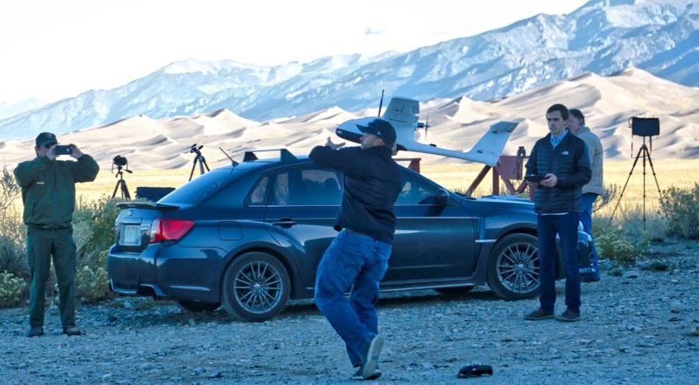
Collaborative UAS Project Maps Great Sand Dunes National Park
An innovative mapping project using unmanned aircraft systems within the Great Sand Dunes National Park and Preserve in south-central Colorado was completed by a collaboration among UAS Colorado, Black Swift Technologies, the National Park Service and Wohnrade Civil Engineers Inc.
Sanborn Expands Oblique Imagery Collection
COLORADO SPRINGS, Colo. — The Sanborn Map Company, Inc. (Sanborn), an industry leader in acquisition and processing of high-resolution oblique aerial imagery, announces the recent addition of 35 newly available oblique imagery datasets to its extensive oblique...
NOAA Releases First GOES-16 Image from Harris Corporation-Built Imager and Ground System
MELBOURNE, Fla. - The National Oceanic and Atmospheric Administration (NOAA) has released the first image taken by Harris Corporation’s (NYSE:HRS) Advanced Baseline Imager (ABI) onboard their next-generation weather satellite. The image taken from the Geostationary...
Airbus Defence and Space Delivers Propulsion Test Module for the Orion Programme to NASA
Bremen, 24/01/2017 - Mid-January 2017 Airbus Defence and Space delivered to NASA a propulsion test module for the Orion programme. The Propulsion Qualification Test Model (PQM) will be used to check that the Orion European Service Module (ESM) spacecraft’s...
