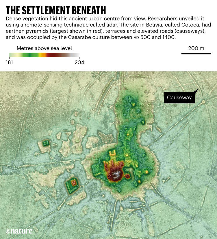
Mysterious mounds in the southwest corner of the Amazon Basin were once the site of ancient urban settlements, scientists have discovered.
Mysterious mounds in the southwest corner of the Amazon Basin were once the site of ancient urban settlements, scientists have discovered.
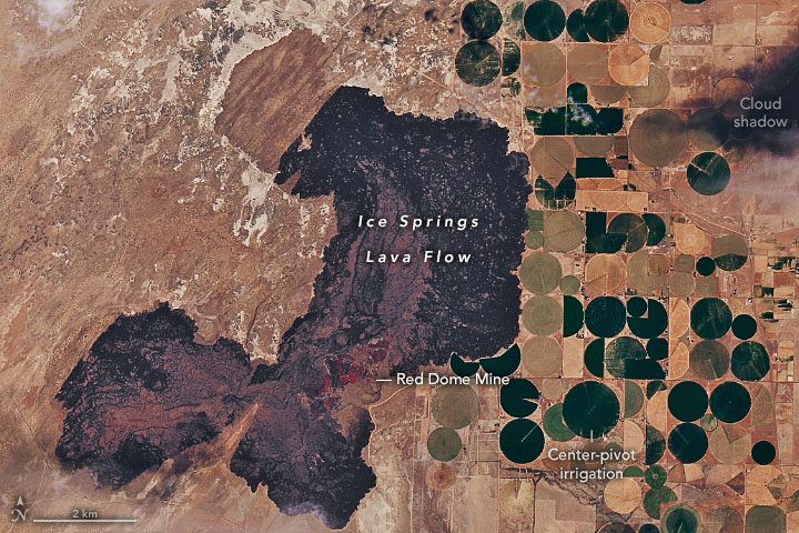
The Ice Springs lava flow lies about 10 miles (16 kilometers) west of the town of Fillmore, Utah, in the Black Rock Desert.
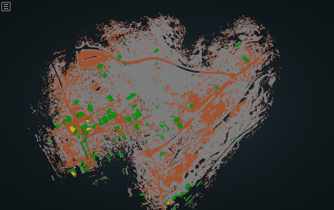
Scientists from the University of California (UC) Merced have digitally mapped the fragile remains of the once-flourishing gold rush ghost town of Bodie, Calif., as part of the Bodie 3D Project.
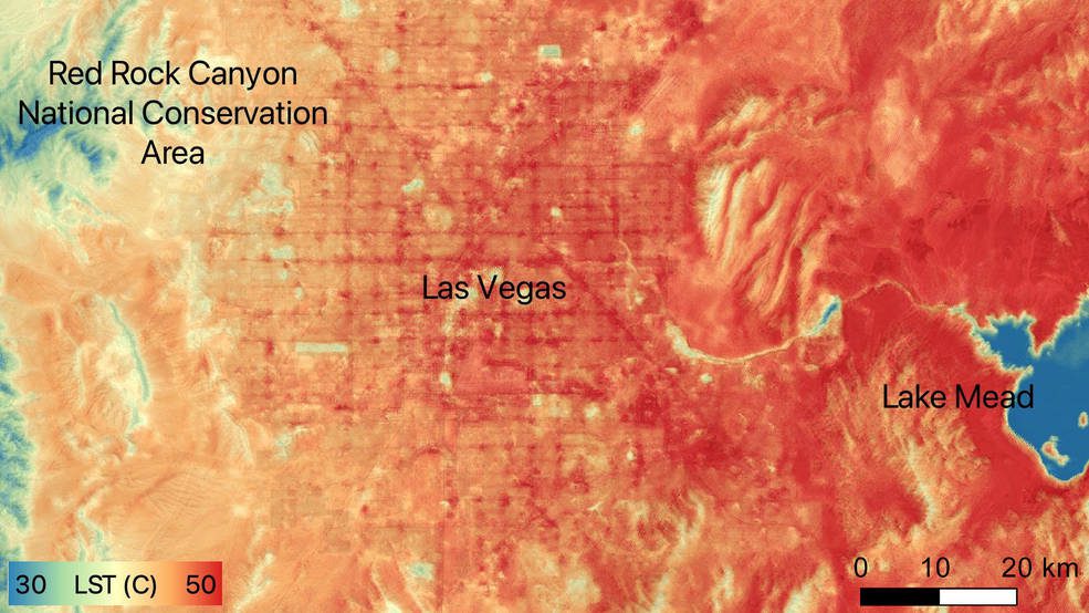
On June 10, 2022, Las Vegas reached a record daily high temperature of 109 degrees Fahrenheit (43 degrees Celsius), and temperatures of the ground surface itself were higher still.
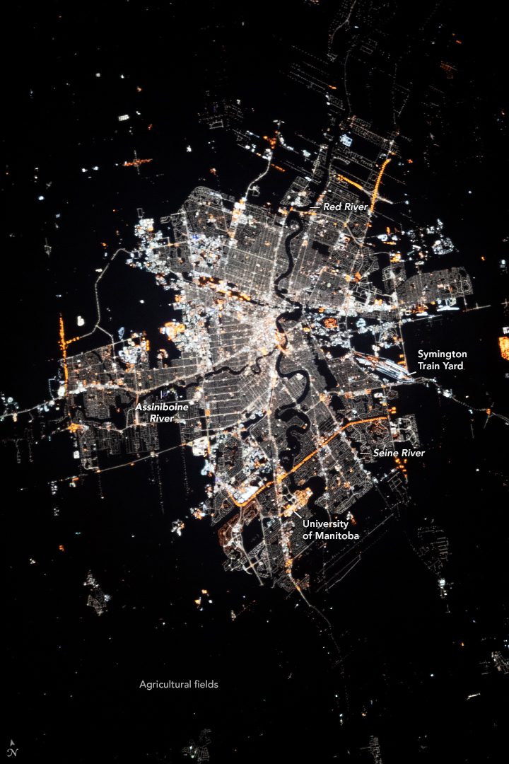
While in orbit above southern Canada, an astronaut aboard the International Space Station (ISS) took this nighttime photograph of Winnipeg, in the Province of Manitoba, Canada.
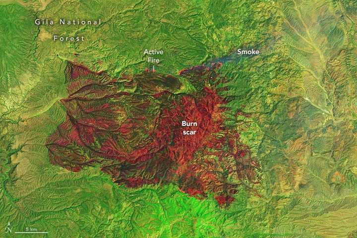
The state has seen more than half a million acres burned this year in early season wildland fires, and forecasters predicted conditions could worsen through the end of the month.
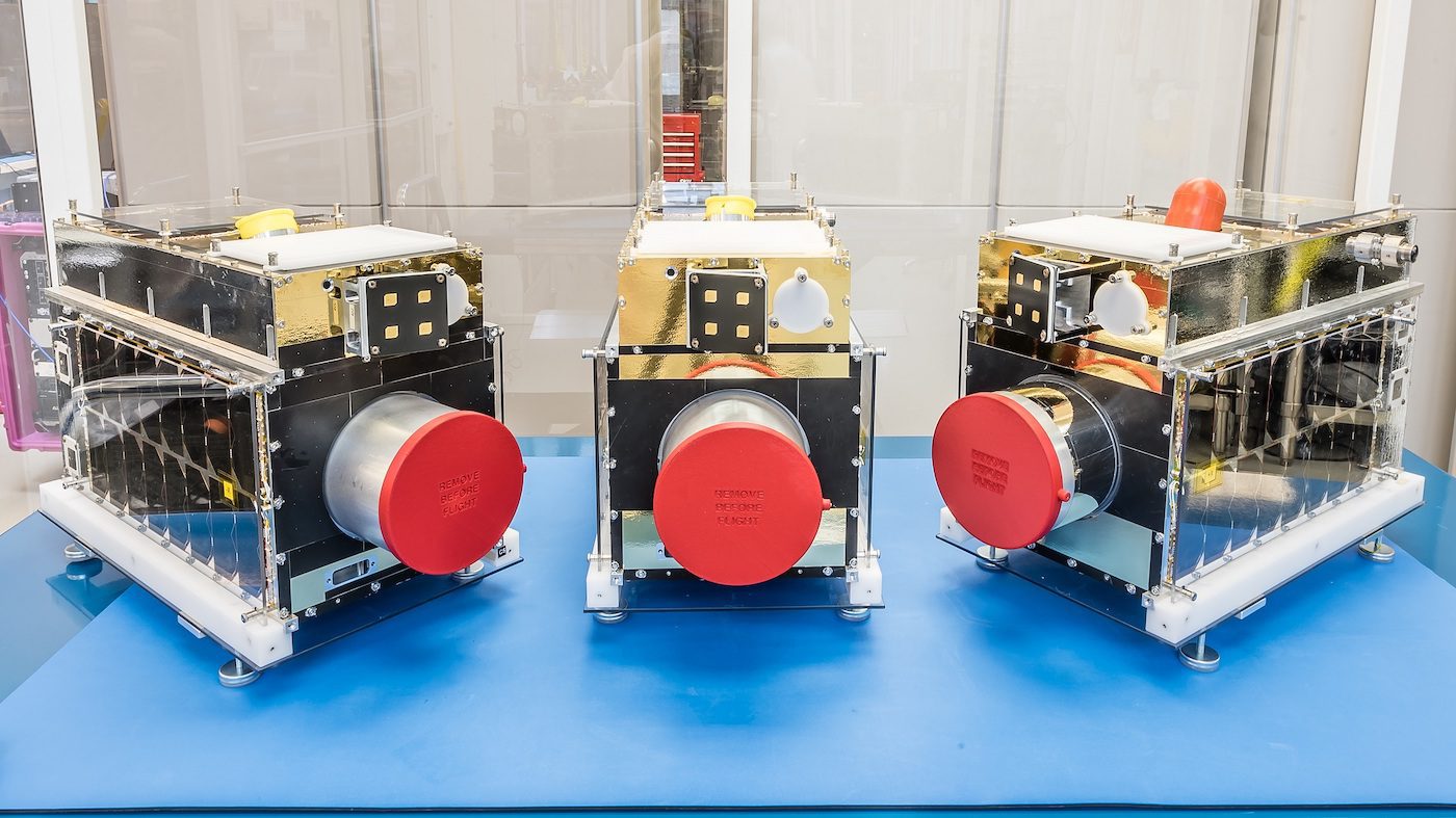
On May 5, 2022, Space Flight Laboratory (SFL) and GHGSat Inc. announced the successful completion of laboratory testing on the GHGSat-C3, C4 and C5 microsatellites at SFL's facility in Toronto.
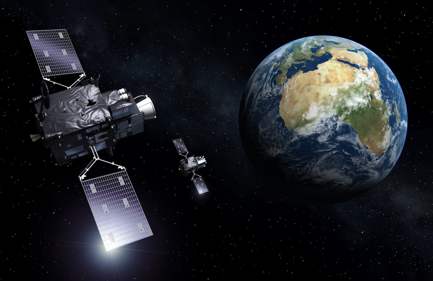
From geostationary orbit, 36,000 kilometers above Earth's surface, this state-of-the-art European instrument will continuously monitor lightning over more than 80% of Earth's disc for early warnings of dangerous storms.

Space Foundation, a nonprofit advocate organization founded in 1983, announced that honorees accepted awards at the 37th Space Symposium held April 4-7, 2022, at The Broadmoor in Colorado Springs, Colo., for their distinguished achievements in the global space ecosystem.
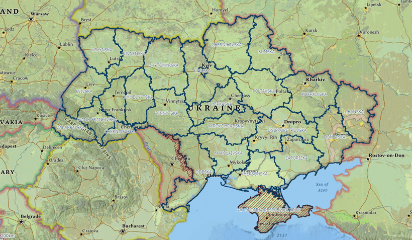
As a geopolitical and devastating humanitarian crisis unfolds in Ukraine, The HALO Trust (HALO) is partnering with Esri to mobilize an immediate and impactful humanitarian response.
