Thanks to the European Space Agency (ESA), airports now can use satellites to identify and manage obstacles that could pose a risk to flight safety.
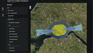
Thanks to the European Space Agency (ESA), airports now can use satellites to identify and manage obstacles that could pose a risk to flight safety.
MacDonald, Dettwiler and Associates (MDA) announced on Feb. 24, 2017, that it will acquire commercial remote-sensing company DigitalGlobe for $2.4 billion, the biggest deal to date in the ongoing consolidation in the Earth-imaging market.
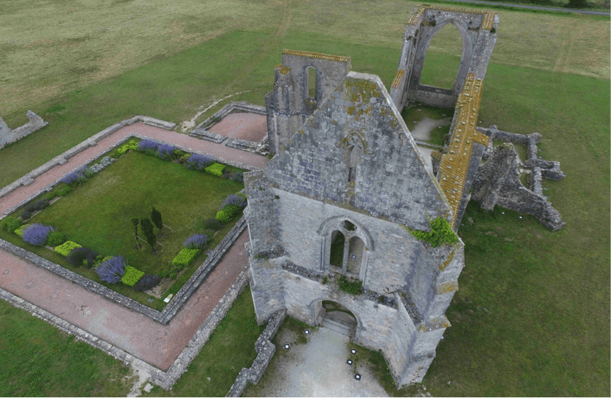
Exploring ways to expand and better their services, participants in a multi-technology project showcased what can be achieved by combining aerial photography, photogrammetry-based 3D modeling and 3D printing.
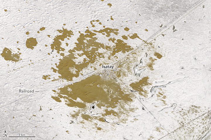
Looking down from space in winter, the patch of Earth around Isatay looks greenish brown: a misleading color. This remote part of Kazakhstan”a country with just 8 percent arable land”is far from verdant.

NASA upgraded its Earth Polychromatic Imaging Camera (EPIC) imagery website that provides daily views of Earth from 1 million miles away, now allowing the public to choose natural or enhanced color images of Earth as well as zoom into an area on the globe.
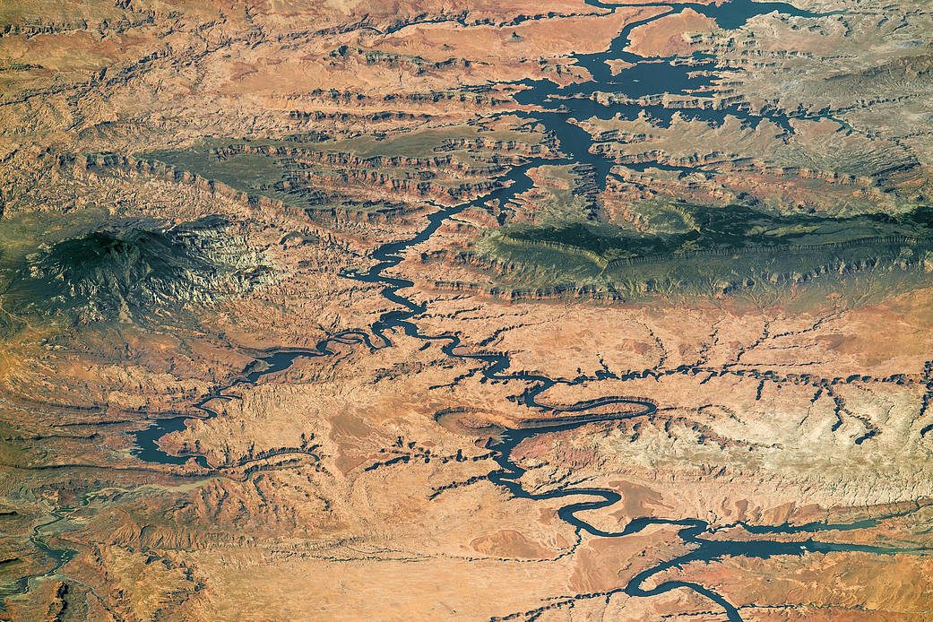
A panorama photograph taken by an astronaut aboard the International Space Station shows nearly the full length of Lake Powell, the reservoir on the Colorado River in southern Utah and northern Arizona.
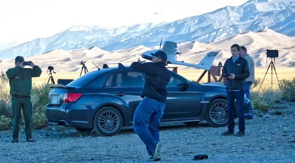
An innovative mapping project using unmanned aircraft systems within the Great Sand Dunes National Park and Preserve in south-central Colorado was completed by a collaboration among UAS Colorado, Black Swift Technologies, the National Park Service and Wohnrade Civil Engineers Inc.
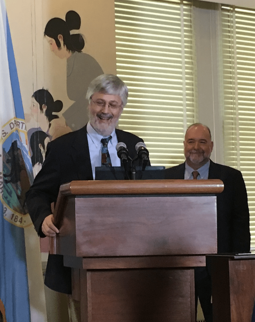
Dr. Curtis E. Woodcock, a longtime innovator in space-based Earth observation at Boston University, and the Tropical Rainfall Measuring Mission (TRMM) team, which paved the way for the next generation of satellite precipitation observations, received the 2016 William T. Pecora Award for achievement in Earth remote sensing.
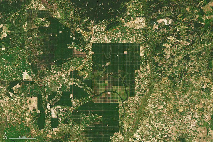
Between 2001 and 2014, the annual forest loss rate in Cambodia increased by 14.4 percent: a total of 1.44 million hectares”5,560 square miles”of forest. In broad swaths of the country, densely forested landscapes”even those in protected areas”have been clear-cut during the last decade for rubber plantations and timber.
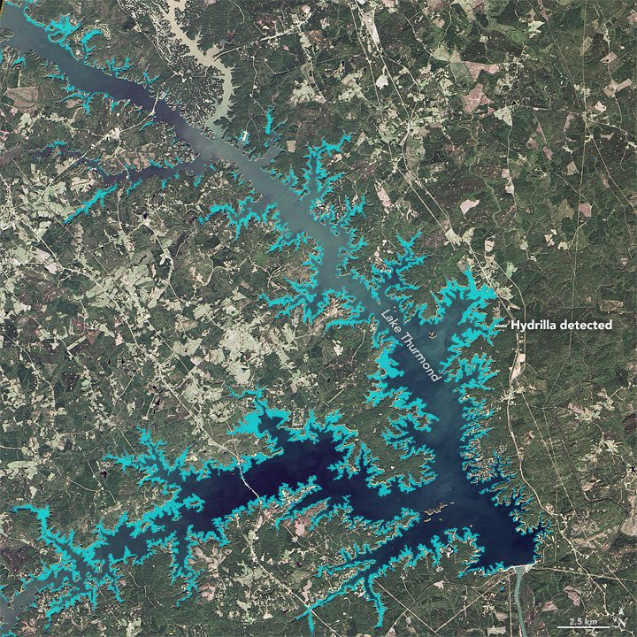
Around Lake Thurmond, a large reservoir that straddles Georgia and South Carolina, something's not right with the birds. The lake is full of vegetation”particularly an invasive aquatic plant known as Hydrilla verticillata”and the area is full of birds that are distressed or dying.
