MacDonald, Dettwiler and Associates (MDA) completed its acquisition of DigitalGlobe. The newly combined company will offer a broader set of space-based solutions, increased scale and a more-diversified revenue base.
MacDonald, Dettwiler and Associates (MDA) completed its acquisition of DigitalGlobe. The newly combined company will offer a broader set of space-based solutions, increased scale and a more-diversified revenue base.
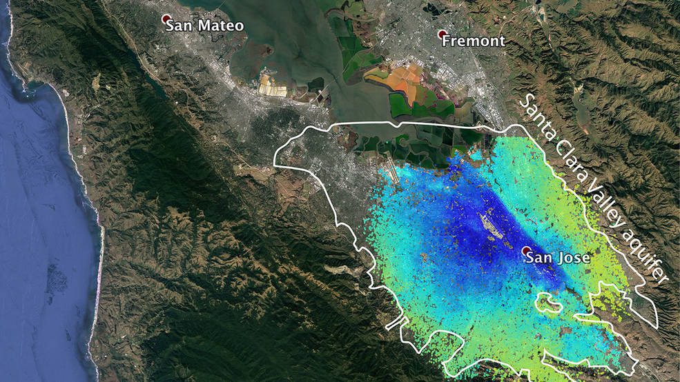
Underground water reserves in California's Silicon Valley rebounded quickly from the state's recent severe drought, demonstrating the success of aggressive conservation measures, according to a new space-based study by NASA and university scientists.
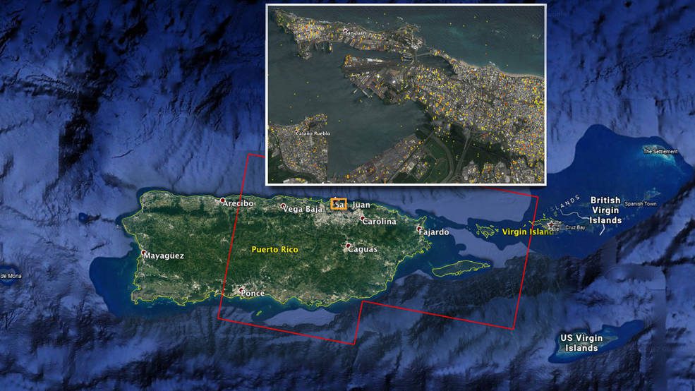
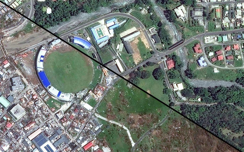
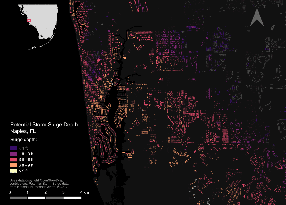
A NASA-produced map showing areas of eastern Puerto Rico that were likely damaged by Hurricane Maria has been provided to responding agencies, including the Federal Emergency Management Agency (FEMA).
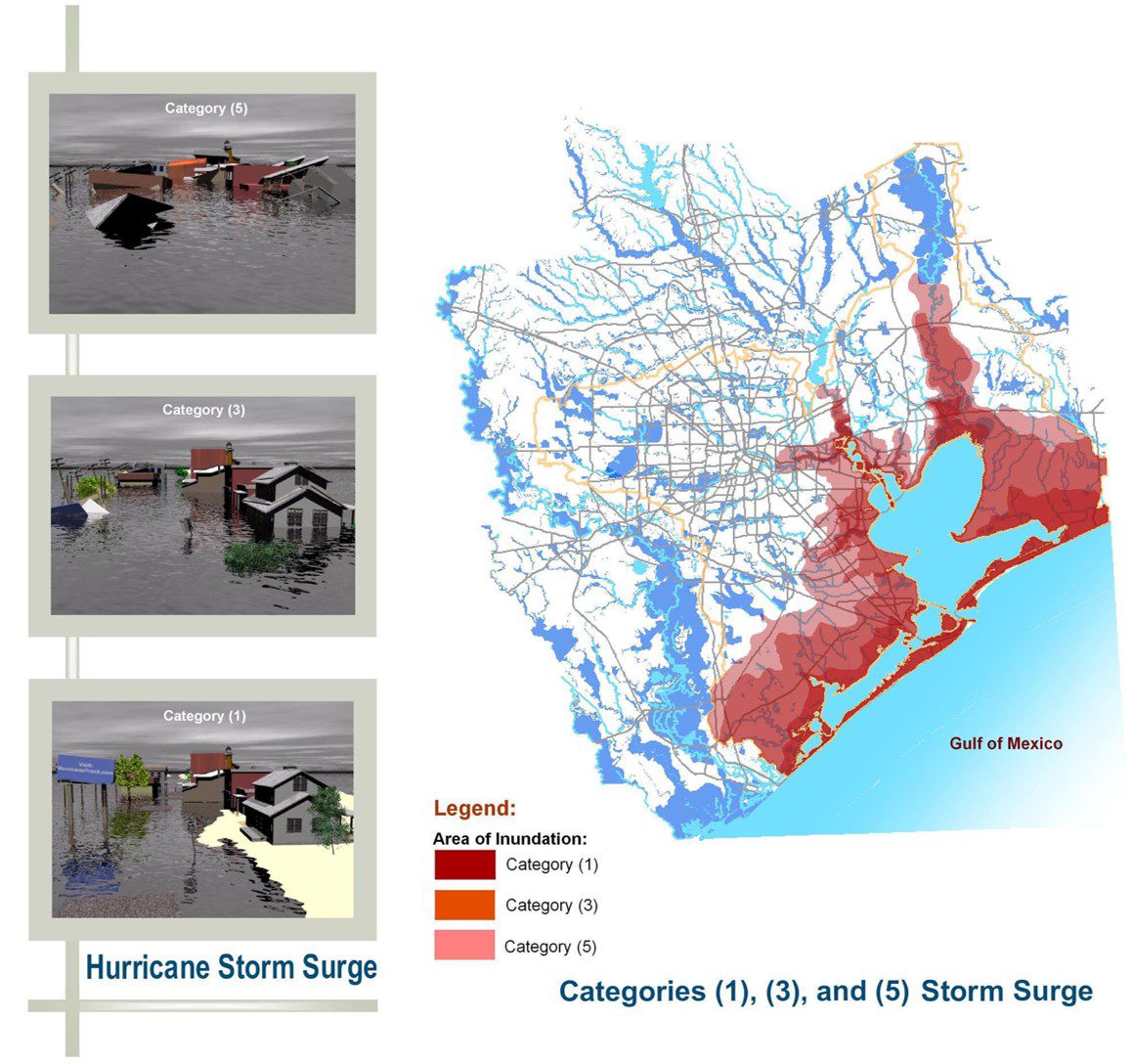
The prevalence of such extreme weather events with the rise of the number and intensity of hurricanes that rolled through the region, bringing with them violent winds and rains, highlighted the importance of utilizing decision-support tools such as these that help communities better plan for disasters, expedite response operations and better position resources to minimize the impact of these inevitable and disastrous events.
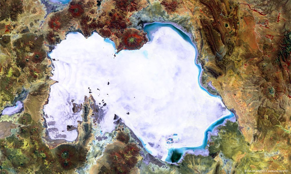
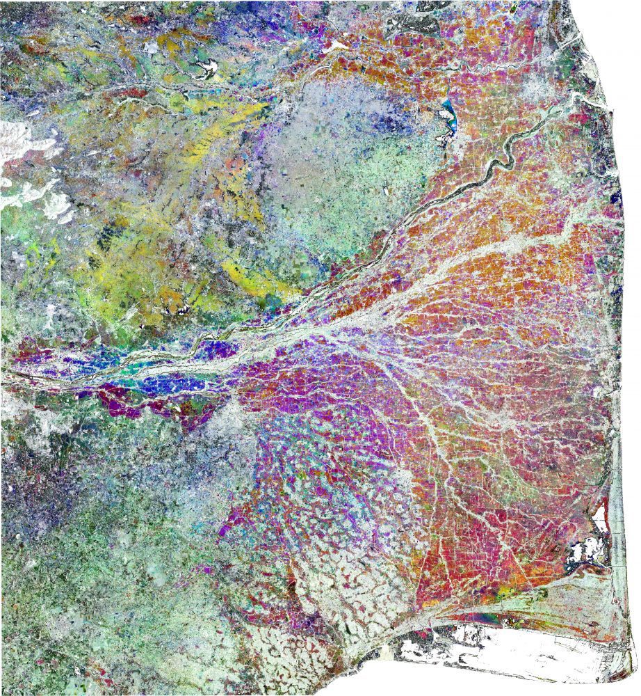
Covering 10,500 square kilometers, Bolivia's Salar de Uyuni is the world's largest salt plain.
Hurricane Harvey in Houston, Irma across the Caribbean and Florida, and the earthquake that struck off the southern coast of Mexico have left communities grieving for lost relatives and in need of urgent support to rebuild the vital infrastructure of their towns and cities.
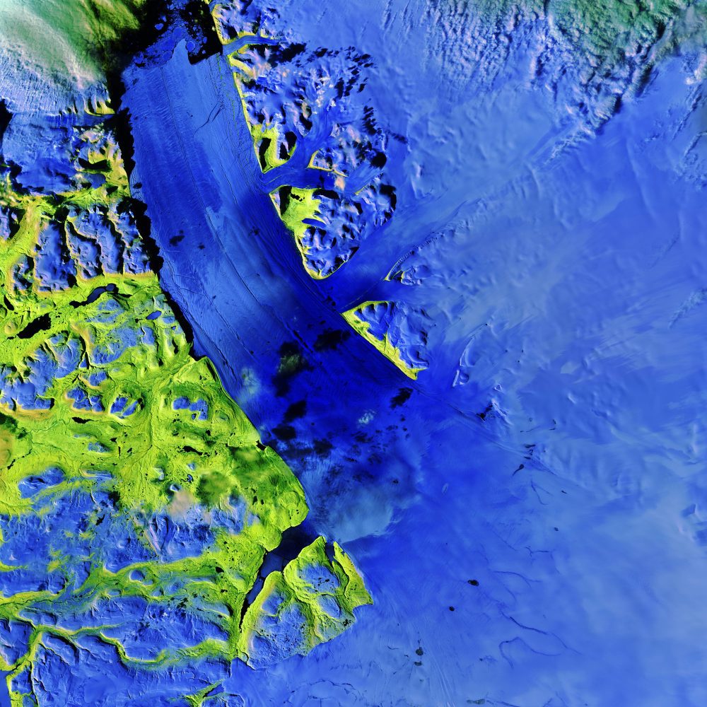
The Copernicus Sentinel-2A satellite takes us over the Petermann Glacier in northwest Greenland in this false-color image captured on Aug., 16 2017.
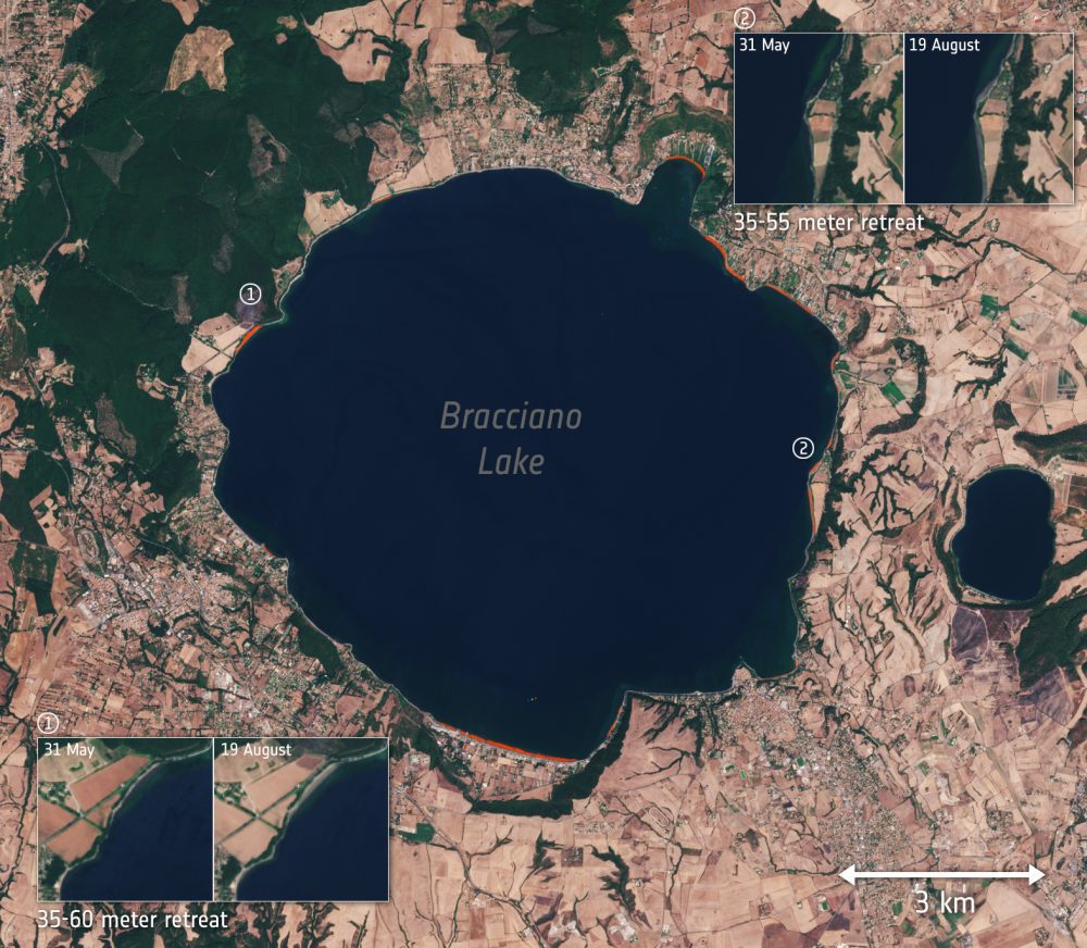
Scientists are using satellite data to monitor the drought that has gripped Italy in 2017. Wildfires, water scarcity and billions of euros worth of damage to agriculture are just some of the effects of this summer's drought”not to mention the relentless heat.
For the first time in India, a state government is using satellites to assess lost crops so farmers can benefit from speedy insurance payouts.
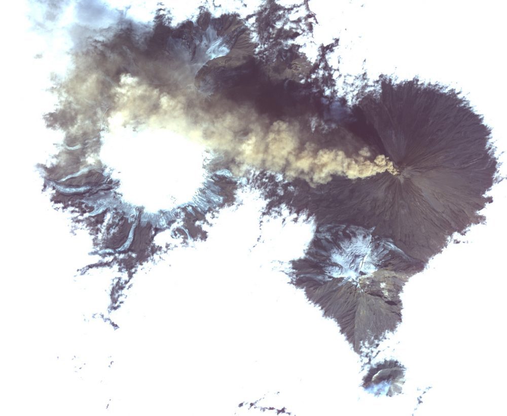
Shiveluch, one of the world’s most active volcanoes, is seen poking through above a solid cloud deck, with an ash plume streaming to the west.
