Space Flight Laboratory (SFL) confirmed that six radio frequency geolocation microsatellites developed for HawkEye 360 of Herndon, Va., successfully communicated with ground control.
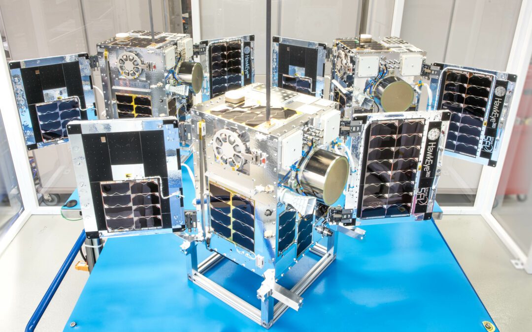
Space Flight Laboratory (SFL) confirmed that six radio frequency geolocation microsatellites developed for HawkEye 360 of Herndon, Va., successfully communicated with ground control.
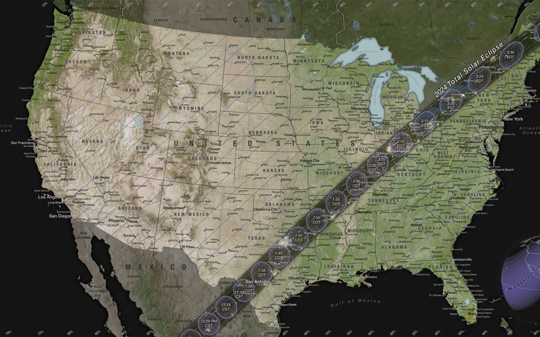
On April 8, 2024, most of North America will have the chance to see the Moon pass in front of the Sun during a solar eclipse.
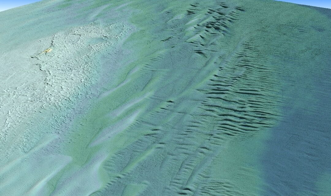
Tetra Tech Inc. used a Teledyne Optech CZMIL SuperNova Topobathymetric lidar system to successfully complete a project for the National Oceanic and Atmospheric Administration (NOAA) to update all its bathymetric maps in the Great Lakes region, which includes refined maps of the marine ecology.
When NASA sends astronauts to the South Pole region of the Moon for the first time with its Artemis campaign, they will capture photos with a handheld camera to help advance scientific research and discovery for the benefit of all.
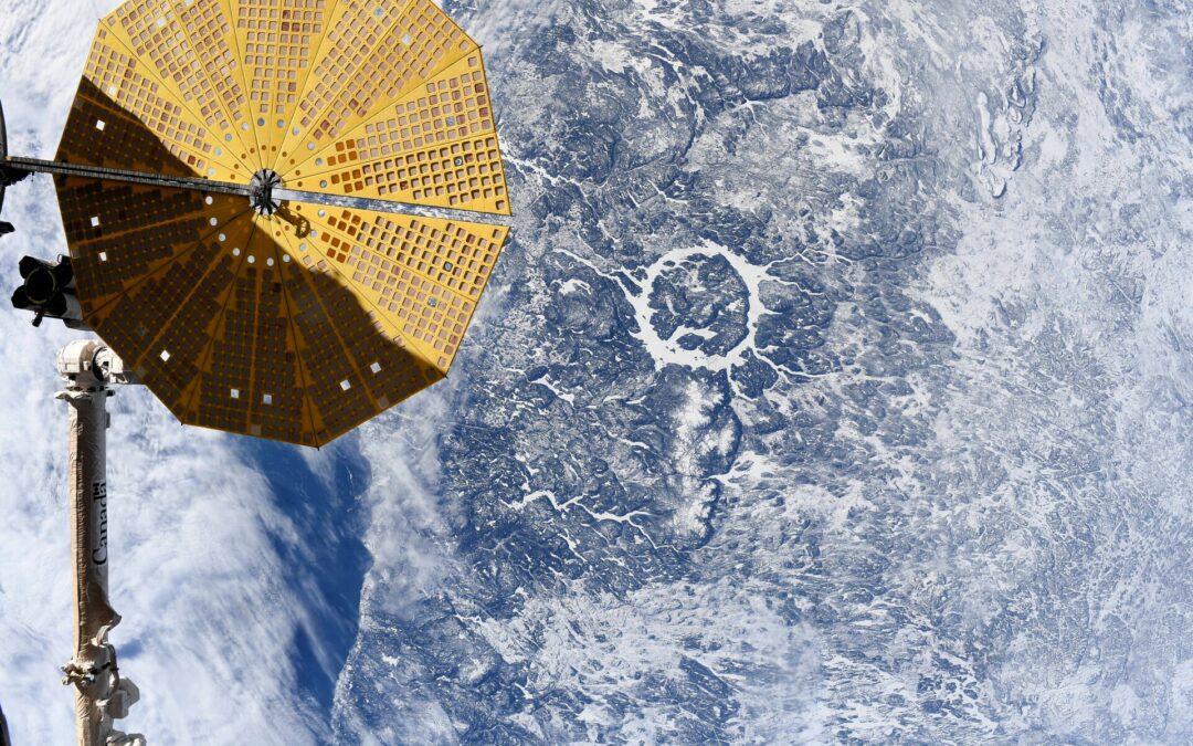
Manicougan Crater seen from the International Space Station on Feb. 5 2024, by ESA astronaut Andreas Mogensen.
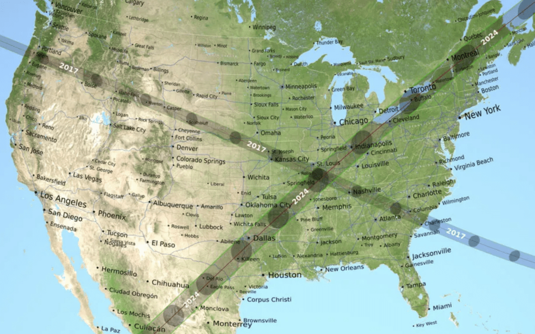
On April 8, 2024, the Moon’s shadow will sweep across the United States, as millions will view a total solar eclipse.
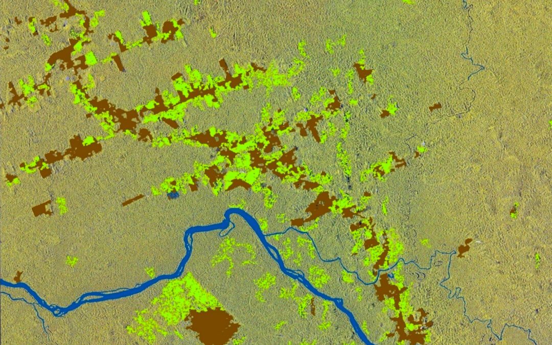
EO4SECURITY, a pioneering European Space Agency (ESA) project monitoring environmental crimes and illegal activities, became operational in January 2024.
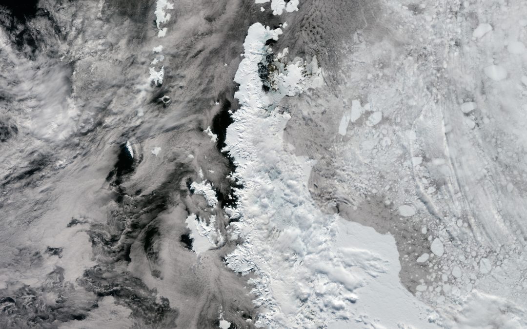
The Antarctic Peninsula is the northernmost and warmest region of the Antarctic continent.
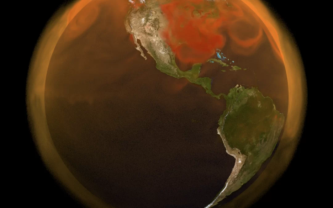
The U.S. Greenhouse Gas Center will serve as a hub for collaboration between agencies across the U.S. government as well as non-profit and private-sector partners.
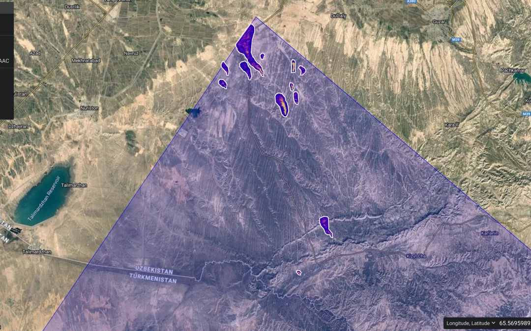
More than a year after first detecting methane plumes from its perch aboard the International Space Station, data from NASA’s Earth Surface Mineral Dust Source Investigation (EMIT) instrument is now being used to identify point-source emissions of greenhouse gases with a proficiency that has surprised even its designers.
