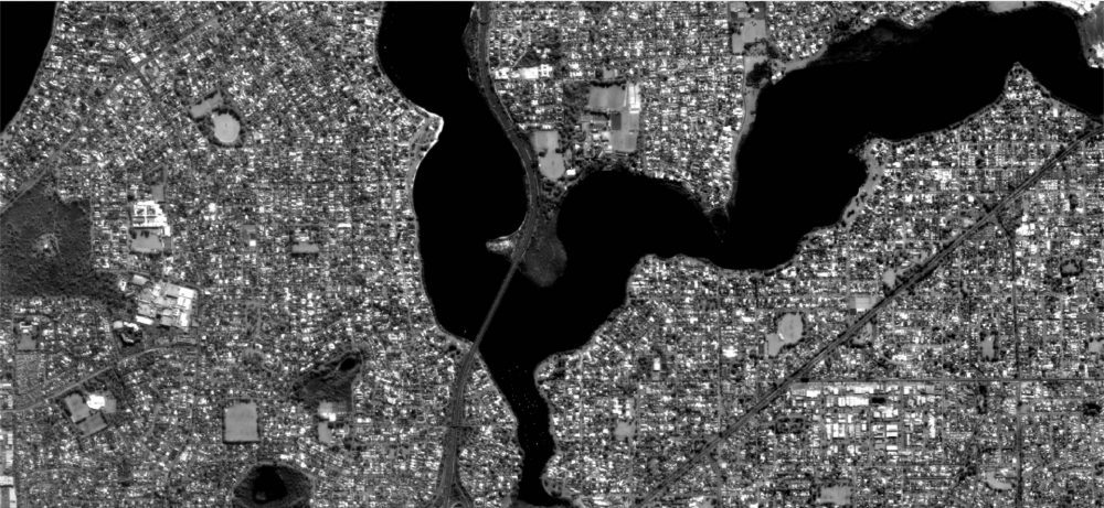
A high-resolution image of Perth, Australia, sent by Russian satellite Aist-2D was received by the LoReTT laboratory on June 15, 2018, the first time such a detailed image (two-meter spatial resolution) was sent via an antenna that doesn't have a traditional rotational device.
Image Shows Shanghai, Beijing, Massive Sedimentation
The Copernicus Sentinel-3A looks at an extremely populous portion of Asia, including Shanghai, China, home to more than 24 million people.
County Fire Lights Up the Night
Light from the County Fire illuminated the night skies of Northern California when the Suomi NPP satellite acquired this image overnight on July 1, 2018.
NASA Uses Earth as Laboratory to Study Distant Worlds
A new study uses Earth as a stand-in for an exoplanet, and shows that even with very little light”as little as one pixel”it's still possible to measure key characteristics of distant worlds.
NASA Study Solves Glacier Puzzle
A new NASA study explains why the Tracy and Heilprin glaciers, which flow side by side into Inglefield Gulf in northwest Greenland, are melting at radically different rates.
Restless Kilauea
Fiery lava continues to pour from the Kilauea volcano on Hawaii's Big Island. These Copernicus Sentinel-2 images from May 23, June 7, and June 12, 2018, show the relentless flow of lava and clouds of ash.
Recently Launched Twin Satellites Create ˜The Himalaya Plot'
Less than three weeks after launch, the Gravity Recovery and Climate Experiment Follow-On (GRACE-FO) mission has successfully completed its first mission phase and demonstrated the performance of the precise microwave ranging system that enables its unique measurements of how mass migrates around our planet.
Nutrient Delivery from African Deserts to Cabo Verde
Celebrating World Oceans Day on June 8, 2018, the Copernicus Sentinel-3A satellite takes us over the Atlantic Ocean and the Republic of Cabo Verde.
Guatemala's Fuego Plume
On June 3, 2018, the Copernicus Sentinel-5P satellite measured sulphur dioxide in the plume spewing from the Fuego volcano in Guatemala.
Satellites Warn of Refugee Island Flood Risk
With the Bangladesh government proposing a vulnerable low-lying island as a relocation site for thousands, Sentinel-1 satellite data have shown how unsuitable this site would be.