Cracks growing across Antarctica's Brunt Ice Shelf are poised to release an iceberg with an area about twice the size of New York City.
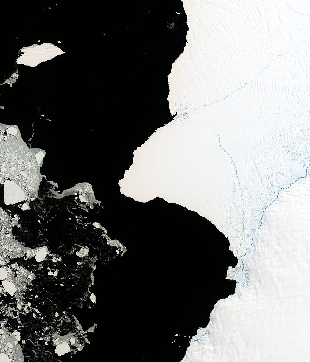
Cracks growing across Antarctica's Brunt Ice Shelf are poised to release an iceberg with an area about twice the size of New York City.
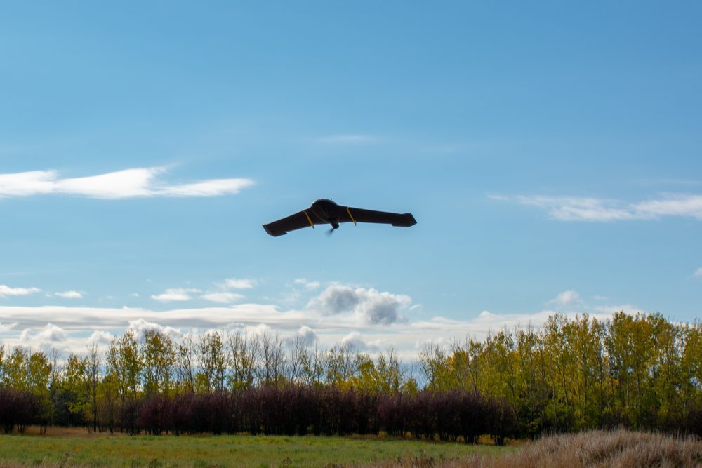
IN-FLIGHT Data was awarded three GUINNESS WORLD RECORDS for drone (UAS) flights recently carried out as part of a beyond-visual-line-of-sight (BVLOS) project.
NSR's Emerging Space Markets Analysis, 2nd Edition (ESMA2) report tracked more than $17.8 billion invested in Emerging Space companies from 2000-2018 for the more than 600 companies founded over that period.
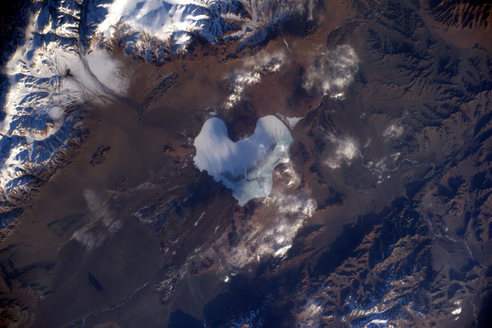
Valentine's Day has struck again, tweeted European Space Agency (ESA) astronaut Thomas Pesquet when he posted this image of a heart-shaped lake in Mongolia.

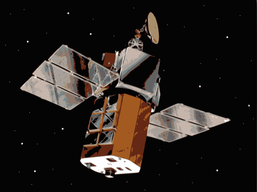
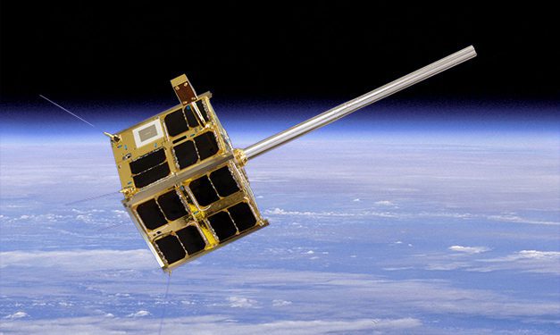
The Canadian Department of National Defence awarded a C$15 million contract to Space Flight Laboratory (SFL) at the University of Toronto Institute for Aerospace Studies (UTIAS) for development of multipurpose microsatellites to support Arctic surveillance.
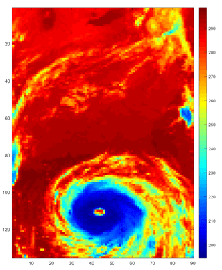
A new NASA study shows that warming of the tropical oceans due to climate change could lead to a substantial increase in the frequency of extreme rain storms by the end of the century.
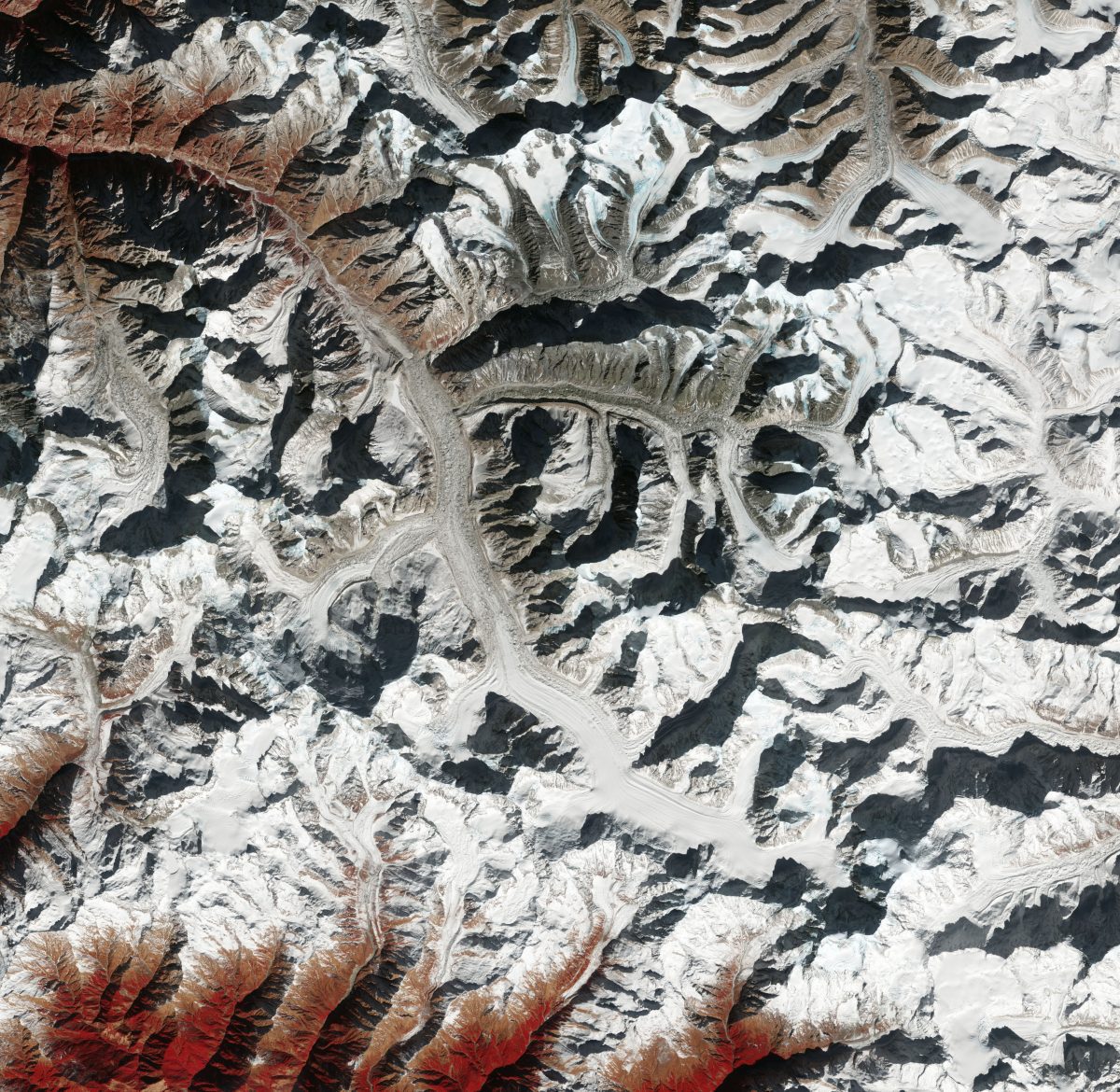
The Copernicus Sentinel-2 mission takes us over Gangotri, one of the largest glaciers in the Himalayas and one of the main sources of water for the Ganges River.
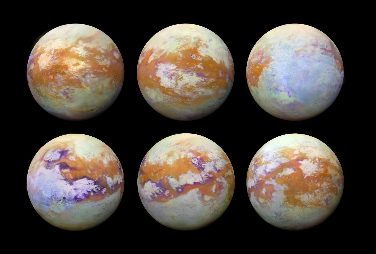
Saturn's moon Titan is enveloped in a thick atmosphere, but through the infrared eyes of the international Cassini mission, the moon's myriad surface features are revealed in this global mosaic.
Space Flight Laboratory (SFL) announced the successful launch of three formation-flying microsatellites built by SFL under contract to Deep Space Industries for HawkEye 360 Inc.
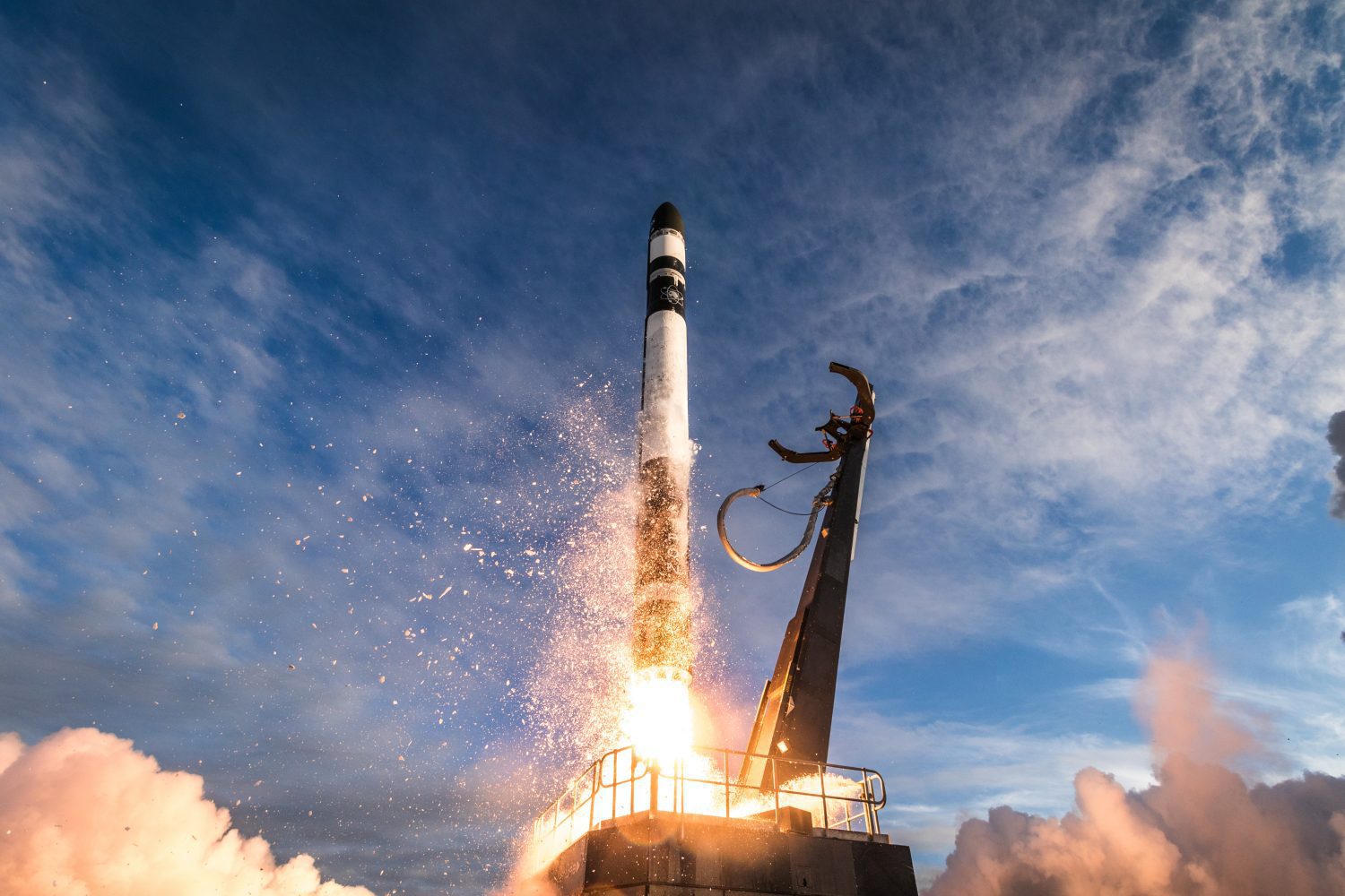
A series of new CubeSats now are in space, conducting a variety of scientific investigations and technology demonstrations, following launch on Dec. 16, 2018, of Rocket Lab's first mission for NASA under a Venture Class Launch Services (VCLS) contract.
