For a brief period in late summer, Greenland takes on an appearance like no other time of year.
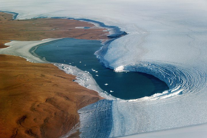
For a brief period in late summer, Greenland takes on an appearance like no other time of year.
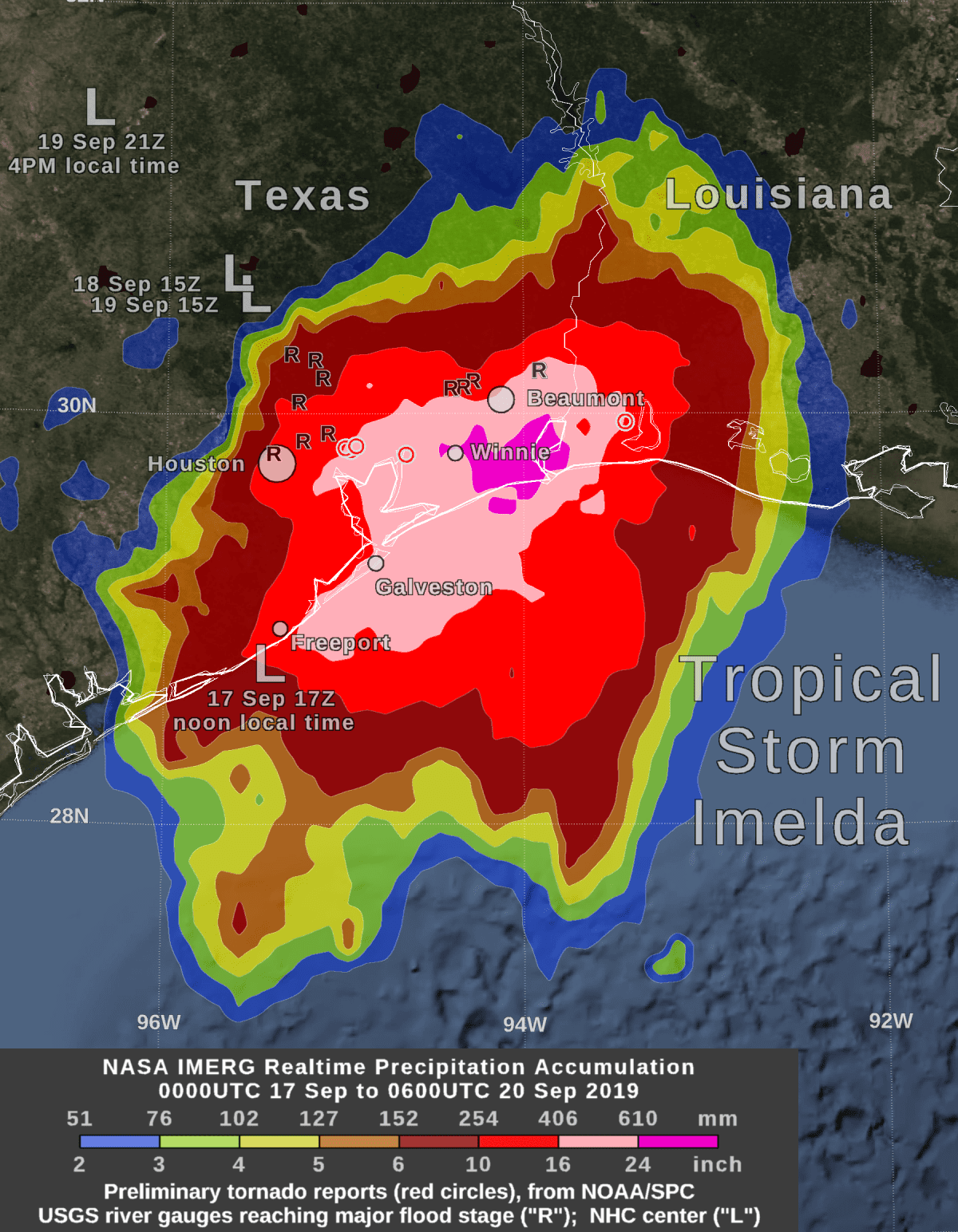
NASA estimated extreme rainfall over eastern Texas from the remnants of Tropical Depression Imelda using a NASA satellite rainfall product that incorporates data from satellites and observations.
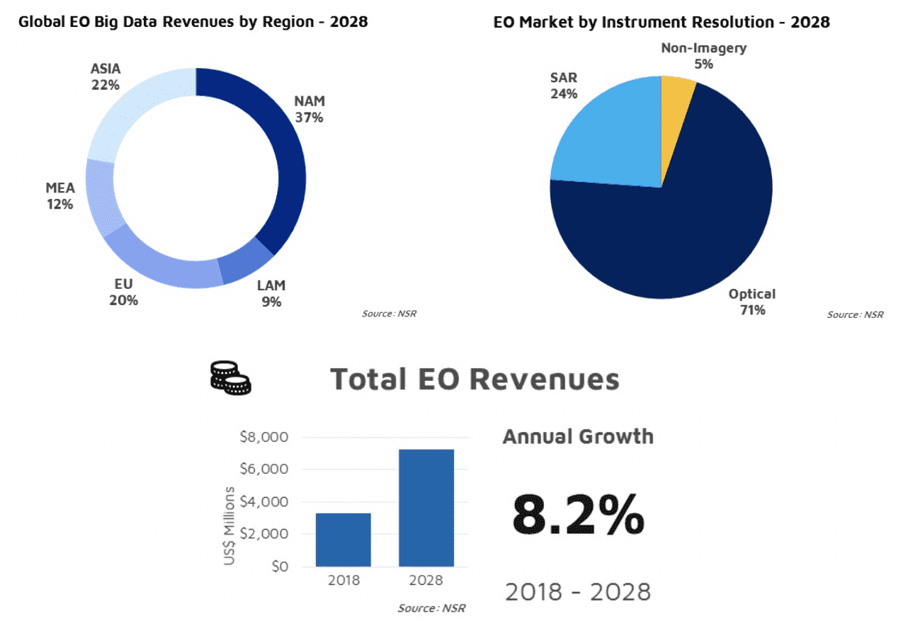
The demand for more data and insights will be driven by upcoming constellations, high-volume data pipelines, and subscriptions for insight services.
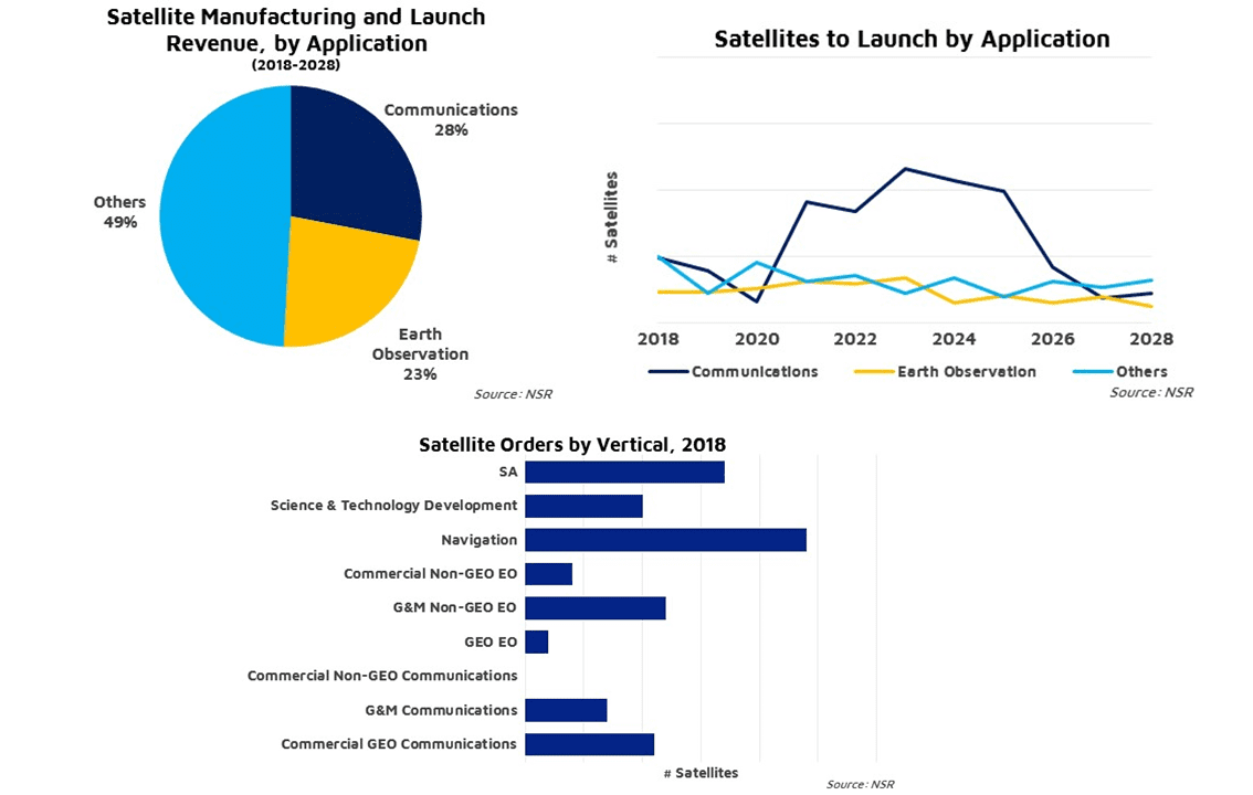
Between end-of-life replacement demand from most government and military applications, such as situational awareness, and new demand from science and communications applications, the market for satellite launch and manufacturing is expected to grow robustly over the next decade.
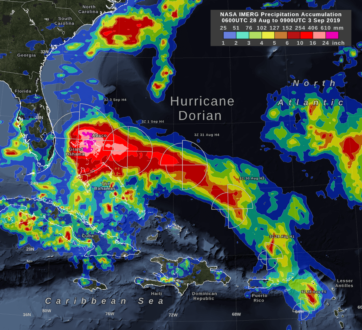
Storm-total rain accumulation over parts of Grand Bahama and Abaco Islands exceeded 24 inches, according to NASA satellite-based estimates.
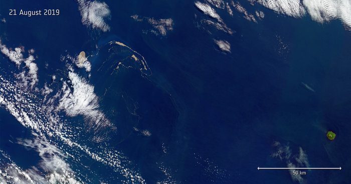
Captured by the Copernicus Sentinel-2 mission on Aug. 21, 2019, this image features a huge raft of pumice rock drifting in the Pacific Ocean.
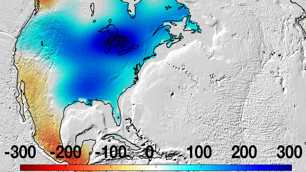
New data from NASA's Gravity Recovery and Climate Experiment Follow-On (GRACE-FO) mission, which launched in May 2018, showed there was an increase in water storage in the river basin, extending east around the Great Lakes.
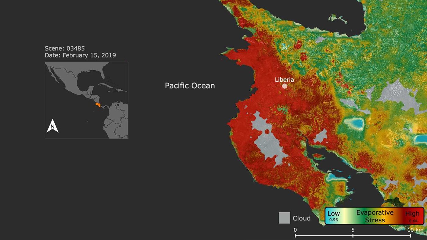
NASA's ECOsystem Spaceborne Thermal Radiometer Experiment on Space Station (ECOSTRESS) imaged the stress on Costa Rican vegetation caused by a massive regional drought that led the Central American nation’s government to declare a state of emergency on July 23, 2019.
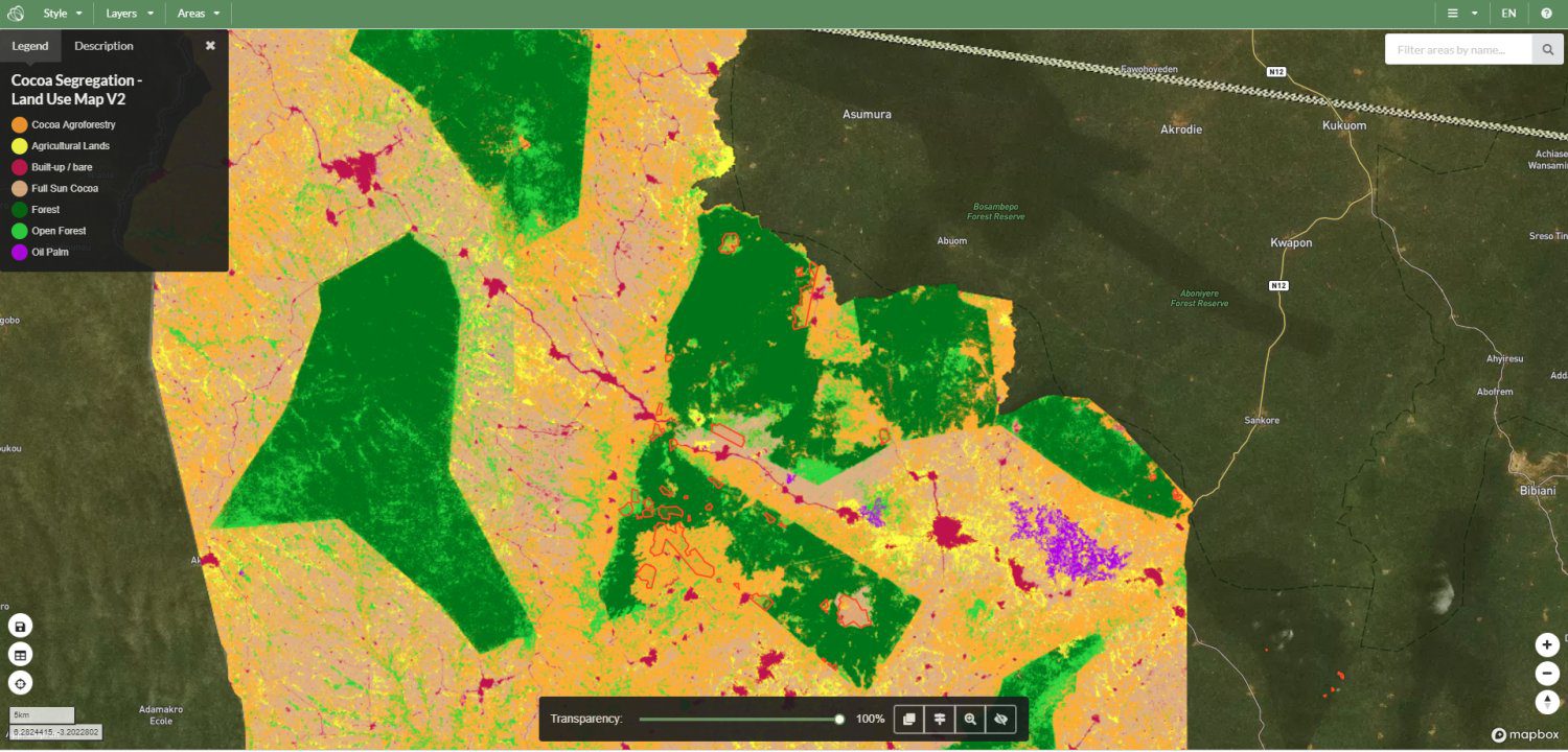
Forestry Commission of Ghana (FCG) is stepping up its commitment to help end deforestation due to cocoa farming by adopting the Ecometrica mapping platform in its production and delivery of maps and forest monitoring information, which are at the heart of the Cocoa & Forests Initiative Frameworks for Action (CFI), agreed by Ghana and Côte d'Ivoire at the COP23 UN Climate Change Conference.
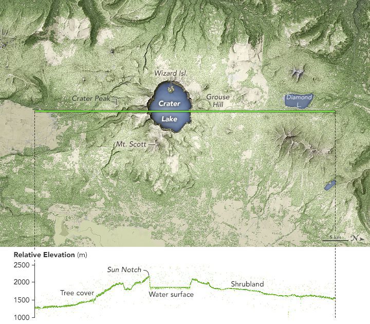
The elevation data show the distinct topography of Mount Mazama and the crater lake that fills its caldera.
