Some residents of High Level, Alberta, Canada, were told on May 20, 2019, to evacuate in the face of a large and out-of-control wildfire that has started advancing toward the town.
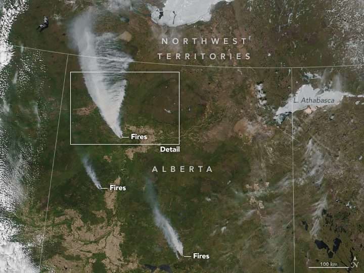
Some residents of High Level, Alberta, Canada, were told on May 20, 2019, to evacuate in the face of a large and out-of-control wildfire that has started advancing toward the town.
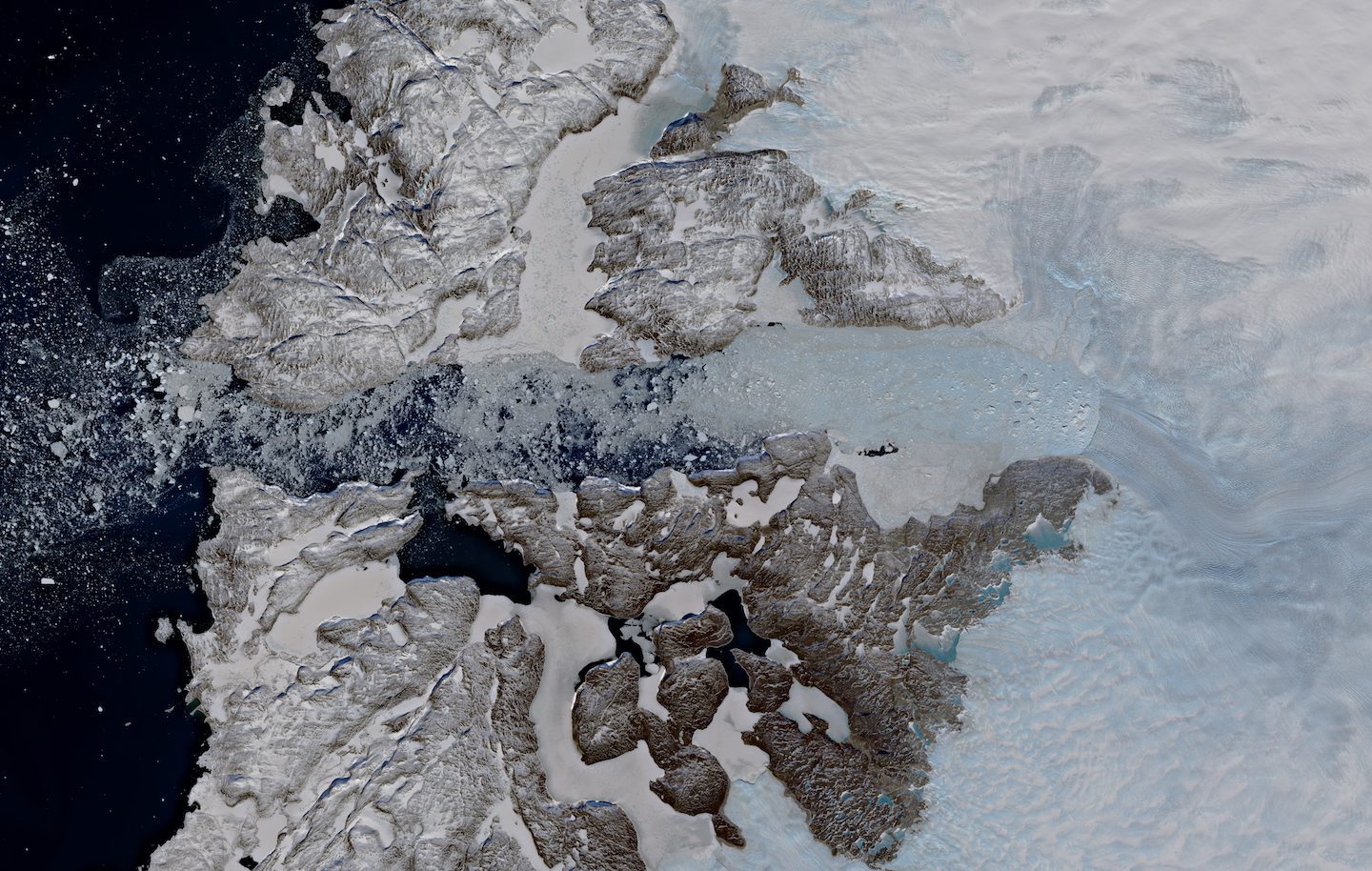
In recent years, Greenland has been losing more ice through the Jakobshavn Glacier than from anywhere else on this huge ice sheet.
NEWTON, MASSACHUSETTS (USA) - Maptitude 2019 dominates the space vacated by MapPoint, supporting Microsoft MapPoint-like tools & queries. With enhanced versions of the features that MapPoint users are familiar with, Maptitude retains the ease-of-use of MapPoint...
LIVERMORE, Calif. – Topcon Positioning Group announces its new real-time reality capture solution for building construction verification will be demonstrated at the SPAR 3D Expo and Conference — the GTL-1000. The new real-time verification solution includes a...
OAK BROOK, Ill.-Â CyberTech Systems and Software Ltd., the next-generation spatial analytics and IT solution leader, today announced the opening of its second technology support center for Esri's cutting-edge GIS products and technologies in Pune, India. The new...
Lokeren, Belgium – Orbit GT has launched version 19.5 for its full 3D Mapping portfolio, including a significant upgrade for the QGIS plugin. “Regular updates of our portfolio bring new features and updates to our customers in the fastest possible way, “Says...
EDMONTON, Alberta -Â ACAMP partnered with Alberta-based Luau Data Corporation to deploy weather sensors for the NASA demonstration in Reno, Nevada. This deployment supports NASA's Unmanned Aircraft Systems (UAS) Traffic Management (UTM) system, which is mandated to...
Orbit GT will be exhibiting and hosting a presentation at the GeoBusiness Conference, London, May 21st-22nd, 2019.  “At this year’s GeoBusiness show, we’re pleased to announce a joint booth with our partner LandScope“, says Peter Bonne, CEO of Orbit GT....
May 17th, people around the world are showing their support for the 13th annual Endangered Species Day. In an effort to promote the importance of protecting endangered species and help people learn more about these beautiful creatures, Technology...
Siegan, Germany- Microdrones is hosting GeoDays 2019 June 12th - 14th at their German location: Microdrones, Nerzweg 5, 57072 Siegen, Germany.  At GeoDays 2019 you can learn how to make drones a part of your surveying, mapping, LiDAR and inspection work. ...
