REDLANDS, Calif.- Esri, the global leader in location intelligence, today announced that the recipient of the 2018 Doug D. Nebert National Spatial Data Infrastructure (NSDI) Champion of the Year Award has been chosen by the Federal Geographic Data Committee (FGDC)....
Impossible Aerospace US-1 Drone Responds to California Fire
SANTA CLARA, Calif. -Â The US-1 unmanned aircraft from startup Impossible Aerospace made another public demonstration on Friday June 28th, this time at a four-alarm construction site fire burning only minutes away from the company's Santa Clara headquarters. Equipped...
MicaSense and FluroSat Partner to Offer Science-Based Imagery and Agronomic Analytics to Commodity Crop Growers
FluroSat and MicaSense today announced their partnership to offer high-quality imagery and analytics products to growers and crop advisors. The collaboration is built upon a strong belief that the collective capability of this agronomic solution will provide timely...
Esri Releases GIS and the 2020 Census
REDLANDS, Calif.- Esri, the global leader in location intelligence, today announced the publication of GIS and the 2020 Census: Modernizing Official Statistics. In preparation for the 2020 round of censuses comes a book providing statistical organizations with the...
GSSI Announces Appointment of Amber Onufer as New Technical Sales Support Team Member
GSSI, the world’s leading manufacturer of ground penetrating radar (GPR) equipment, is pleased to announce the hiring of Amber Onufer as Technical Sales Support. She will support GSSI’s Geophysical, Environmental, and Transportation Infrastructure teams. With a...
NTT DATA and RESTEC Launch AW3DFull Global 3D Map with 2.5-meter Definition
London, UNITED KINGDOM -Â NTT DATA, a leading IT services provider, and Remote Sensing Technology Centre of Japan (RESTEC), the heart of the remote sensing industry, announced today that they have begun selling AW3D Standard (2.5m resolution), a highly precise,...
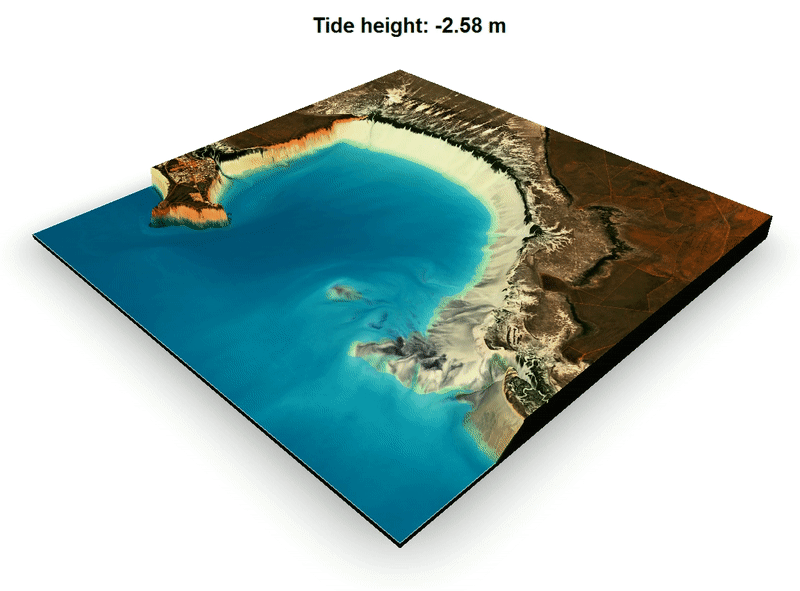
Mapping the Land Between the Tides
Thanks to the Moon, the Sun and gravity, the place where the land meets the sea is not a fixed line. What we see on a map is just a representation of where mean sea level is found, and the coast of any landmass is really a moving target between low and high tides.
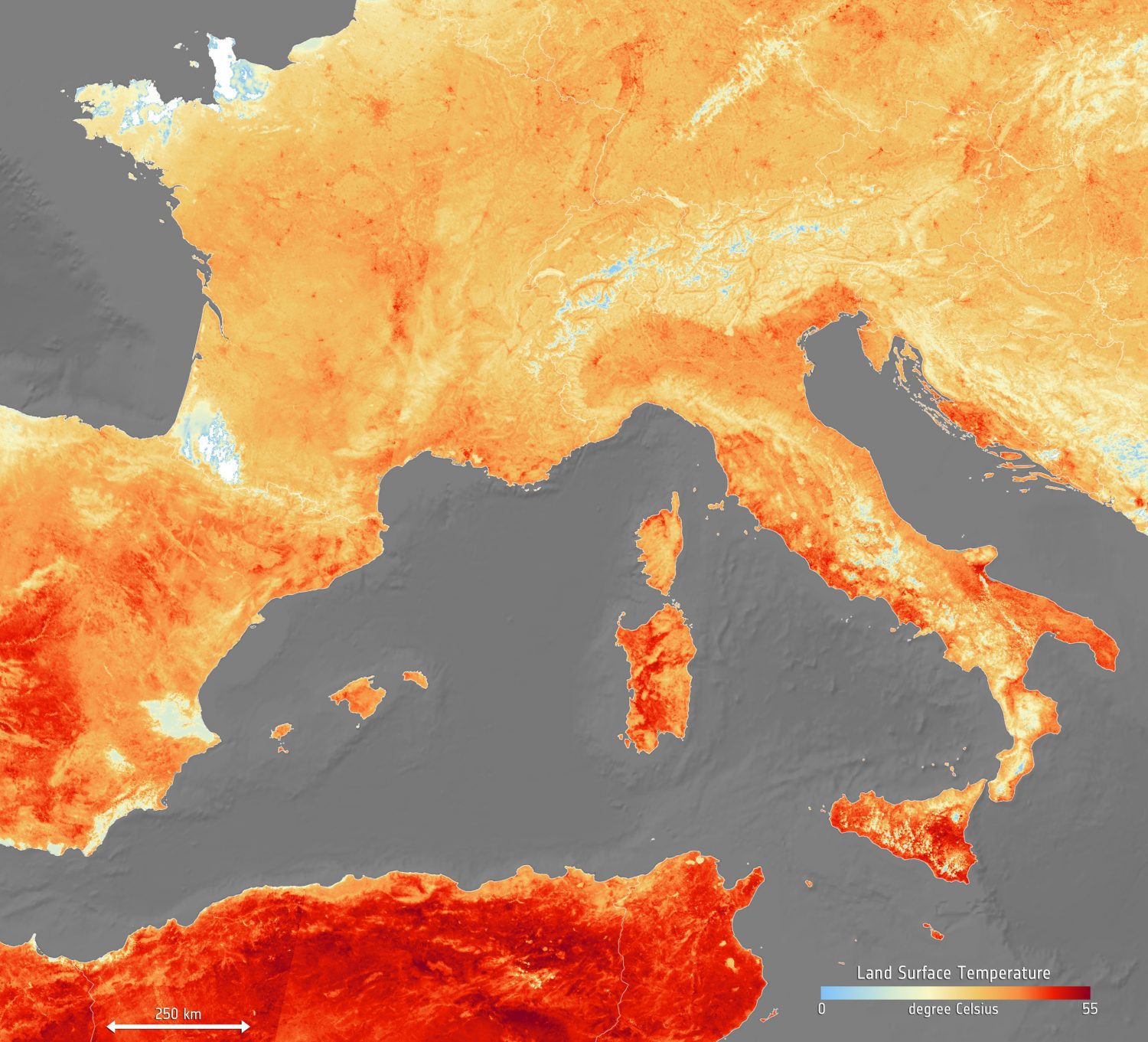
European Heat Wave
With some places recording air temperatures of more than 40°C (104°F), much of Europe is in the grip of a heatwave that set record highs for June.
Terra Drone invests in RoNik Inspectioneering to Grow Confined Space Inspection Portfolio in the Process Industry
Tokyo, Japan – July 2, 2019 – Terra Drone Corporation, one of largest providers of industrial drone solutions in the world, is announcing the completion of its investment in RoNik Inspectioneering, a leading Dutch company that performs visual and ultrasonic...
TravelTime Platform Releases QGIS Plugin
 TravelTime platform launches a new QGIS plugin that enables users to create travel time polygons, also known as isochrones, using many modes of transport. For example, a pizza restaurant owner can use the plugin to discover pizza delivery areas, such as where’s...
