A researcher at Queen’s University Belfast has invented a low cost telecommunication system using drones which provides early warning on natural disasters and acts as a wifi ‘hotspot’ when phone signal is disrupted during extreme weather such as earthquakes,...
Pointivo Introduces Cutting-Edge Spatial Intelligence Solution for Smarter Decision-Making & Facility Management, Spatial IQ: Facility Management
ATLANTA- Pointivo, a pioneer in spatial intelligence, today debuts its cutting-edge, data and analytics roof assessment solution, Spatial IQ: Facility Management (FM), at this year’s International Roofing Expo (IRE) in Dallas, Texas. Pointivo’s AI-powered FM...
TraceAir Will Showcase New Site Work Estimating Tool at CONEXPO 2020
REDWOOD CITY, Calif. -Â TraceAir will take part in CONEXPO 2020, North America's largest construction trade show, for the first time on March 10-14, 2020, to share TraceAir's vision of construction automation and announce a new Site Work Estimating Tool for grading...
vHive Launches New AI Driven Capabilities to Accelerate Tower Inspections for Enterprises Worldwide
HERZLIYA, Israel - vHive, the only software solution that enables enterprises to digitize their field assets and operations using autonomous drone hives, announced today the release of an AI driven Auto Discoveryâ„¢ capability for simplifying and shortening data...
International Lidar Mapping Forum Announces Second Keynote of 2020 Conference Program
Washington DC – The International Lidar Mapping Forum (ILMF) has announced that Dr. Michael Zanetti, Planetary Scientist at NASA’s Marshall Space Flight Center, will give a keynote presentation titled Bringing Light (Detection and Ranging) into Shadow: The...
Woolpert Promotes Chris Snyder to Aviation Market Director
INDIANAPOLIS — Woolpert is pleased to announce that Chris Snyder has been promoted to lead its Aviation market and guide the logistical and innovative expansion of its geospatial and design practices. Snyder said the firm plans to strengthen its presence in...
FLIR Launches First Thermal Imaging Building Inspection System: FLIR MR277
FLIR MR277 Combines a Built-In Thermal Imager with Moisture Hygrometer and FLIR Multi-Spectral Dynamic Imaging to Help Users Quickly Troubleshoot Moisture Issues ARLINGTON, Va. – FLIR Systems, Inc. (NASDAQ: FLIR) announced today the FLIR MR277 building...
Nearmap Brings Precise Roof Geometry Measurement to Your Fingertips Through API Integration
DALLAS - Nearmap, a company that delivers high-resolution aerial imagery as a service to businesses across the world, announced today the coming of a new roof geometry application programming interface (API) that enables users to remotely obtain a near real-time feed...
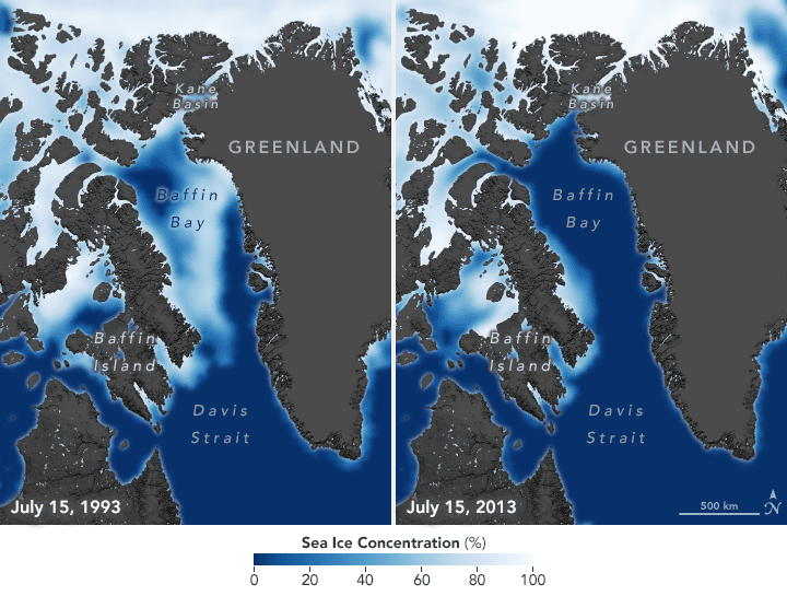
Polar Bears Struggle as Sea Ice Declines
Sea ice concentrations have declined by 13 percent each decade since 1979 due to increasing global temperatures. Arctic regions have warmed twice as fast as the rest of the world, so seasonal sea ice is also forming later in the fall and breaking up earlier in the spring.
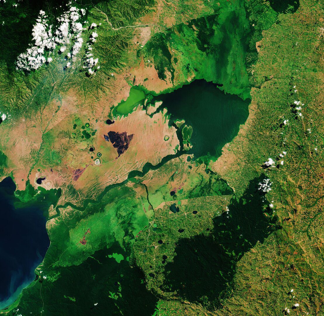
Lake George, Uganda
This Copernicus Sentinel-2 image takes us over Lake George, in western Uganda. In 1988, Lake George was designated as Uganda's first Ramsar site, given its importance as a center for biological diversity.
