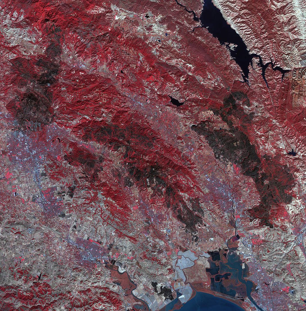
As firefighters continue to work toward full containment of the rash of wildfires burning in Northern California, a new image from the Advanced Spaceborne Thermal Emission and Reflection Radiometer (ASTER) instrument on NASA’s Terra satellite shows the growing fire scar on the landscape.
Geospatial Companies Join Forces to Fight Wildfires
Insitu, FireWhat and Esri partnered to help aerial reconnaissance for fighting wildfires. Insitu's INEXA Solutions professional aerial remote-sensing services group will work with FireWhat's fire professionals, using its GIS customized for firefighters and hosted on Esri's ArcGIS platform.
Madeira Island Adds to Portugal's Fire Count
While hundreds of wildfires raged over mainland Portugal, the normally peaceful and idyllic resort island of Madeira was also hit by deadly fires, killing three people and destroying more than 150 homes.
Wildfires Blaze in Portugal
Since early August 2016, hundreds of fires have been raging in Portugal and Spain. More than 4,000 firefighters and 30 aircraft battled blazes on mainland Portugal, but heat and strong winds hampered the firefighting efforts.
New Smallsat Technologies Targeted for Wildfire Response
Aquila Space is building briefcase-sized satellites that can capture and send back images of more than 12 million square miles of Earth daily. Meanwhile, its Silicon Valley partner Astro Digital is developing software that allows anyone to process and analyze the data.