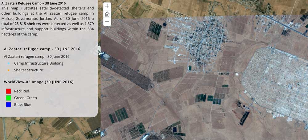
The United Nations Institute for Training and Research (UNITAR), through its Operational Satellite Applications Programme (UNOSAT), and Radiant.Earth agreed to explore new Earth observation data innovations supporting humanitarian disaster management, global health, climate change, sustainable water management and cultural heritage.
East View Partners with United Nations to Conduct Damage Assessments in Conflict Zones
MINNEAPOLIS - February 19, 2016 — East View Geospatial has teamed with the United Nations Institute for Training and Research Operational Satellite Programme (UNOSAT) to conduct damage assessments for conflict areas in Syria and Iraq. "We recognized an opportunity...