Satellite Imagery Helps Verify ˜Zero Deforestation' Commitments

Satellite Imagery Helps Verify ˜Zero Deforestation' Commitments

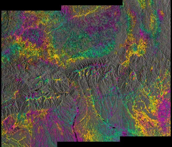
Airbus Defence and Space, The Forest Trust (TFT) and SarVision developed the Starling service, which enables companies to provide evidence of how they're implementing their No Deforestation commitments. Starling uses a combination of high-resolution optical satellite and radar imagery to provide unbiased monitoring of forest-cover change.

Faster Detection of Landmines Using Radar

Every 20 to 30 minutes, somewhere in the world, a person – often a child – steps on a landmine.  It is estimated that over 100 million anti-personnel mines are buried worldwide and a further 200 to 250 million are thought to remain in military storage facilities....

NEWEST V1 MEDIA PUBLICATION

April Issue 2024