In December 2016, Pix4D and Parrot announced we would award a climate innovation grant to help foster innovation around the impact of global climate change. Â We received over 250 proposals from researchers across a range of disciplines. We selected six projects,...
Pix4D Expands R&D in Berlin
Drone-mapping software developer Pix4D announces the opening of a research and development office in Berlin, Germany. Pix4D products rely on advanced principles of photogrammetry, computer vision, and machine learning. “By opening this office, we’re showing in a...
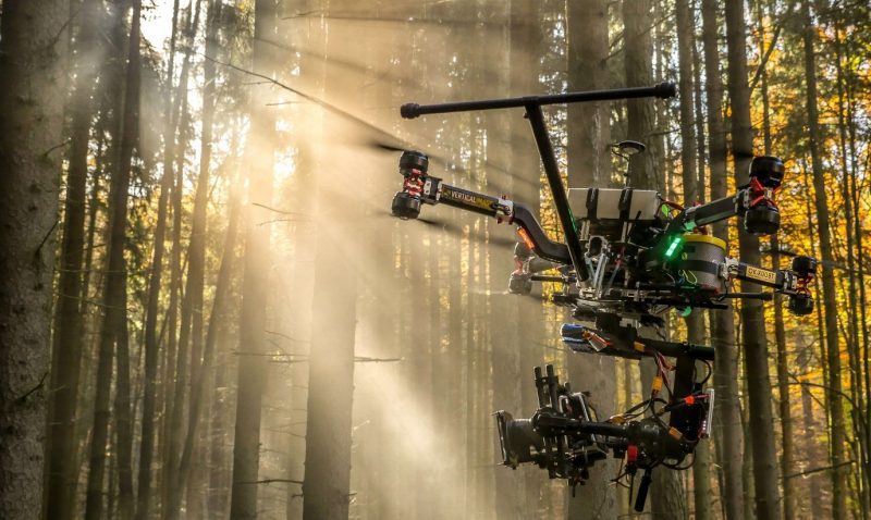
Vertical Images: From Film Making to Inspection, and Why the Future of Drones Doesn't Lie in Flying
Successful drone entrepreneur Petr LnÄ›niÄka went from award-winning filmmaker to drone inspection leader in his native Czech Republic. Here he lays out 3 pieces of advice and explains why for him, the transition seemed logical, and why he believes the future of drone mapping services will place less and less emphasis on drones and more and more weight on mapping data.
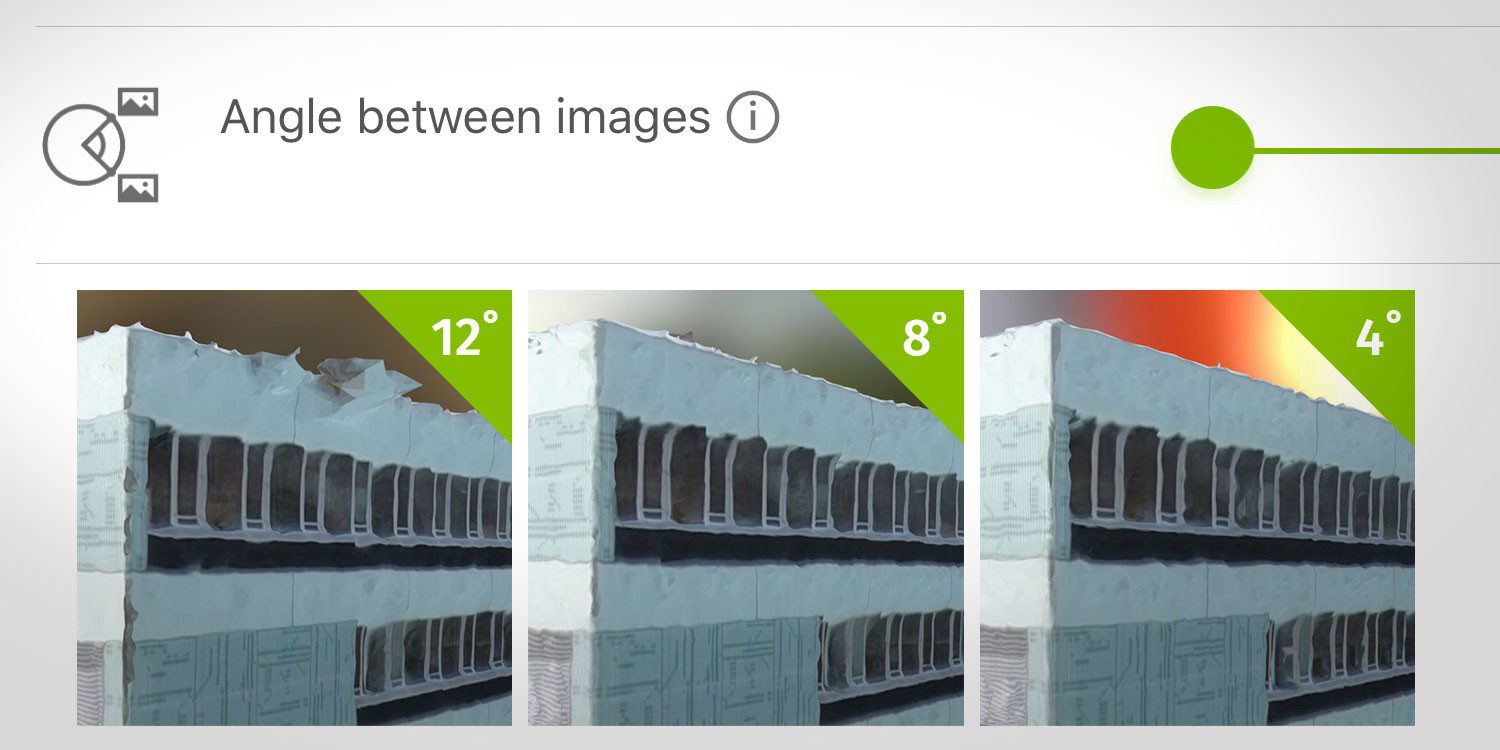
How Do I Choose the Correct Image-Capture Settings for 3D Models?
What are the effects of the angle between images setting in circular missions when it comes to 3D reconstruction?
Pix4D Launches World's First Crane Camera Solution for 3D Mapping and BIM at CONEXPO-CON/AGG 2017. Now in Store
Lausanne (Switzerland), March 7, 2017 - Pix4D, a Swiss developer of drone mapping software, and Liebherr, one of the world’s largest manufacturer of tower cranes, are launching a unique crane-based mapping solution at CONEXPO-CON/AGG in Las Vegas. The solution is...
Pix4D Speaks at UN Panel on Food Security
Today the United Nations Commission on Science and Technology for Development ( CSTD) will hold an expert panel meeting on the role of science, technology, and innovation in ensuring food security by 2030. Pix4D’s agricultural business manager Jorge Fernandez will...
Pix4D Launches MOBILE + DESKTOP + CLOUD Solutions for Drone Mapping at InterGeo 2016
Drone mapping software developer Pix4D launches hybrid solutions today that integrate mobile, desktop, and cloud platforms for more flexible mapping. “When we started Pix4D six years ago, we were a cloud processing company,†said Christoph Strecha,...
Drone Mapping Software Provider Pix4D Elevates Agriculture Software to Desktop & Cloud Solution, Launches Flexible Monthly Rental Option at InfoAg
Today Pix4D announces its first hybrid processing solution: this week, users of Sequoia with a license of Pix4Dmapper Ag will be able to process both locally in Pix4Dmapper Ag and on the Pix4Dcloud. Together with this announcement, Pix4D also introduces very flexible...
UAV Mapping & Surveying Workshop by Pix4D to Kick Off InterDrone
MELVILLE, N.Y., - BZ Media LLC today announced that Pix4D would be bringing a half-day technical workshop to the Paris Hotel in Las Vegas on September 6 to help educate and train professionals in the use of drones for mapping and surveying. InterDrone is being held...
Pix4D and Parrot Release Precision Agriculture Solutions
Date: February 8, 2016 — Today Pix4D launches Pix4Dmapper Ag: a photogrammetric software that converts multispectral images into agriculture-specific maps for better crop management and analysis. The software is being released in conjunction with Sequoia: a...
