Shiveluch, one of the world’s most active volcanoes, is seen poking through above a solid cloud deck, with an ash plume streaming to the west.
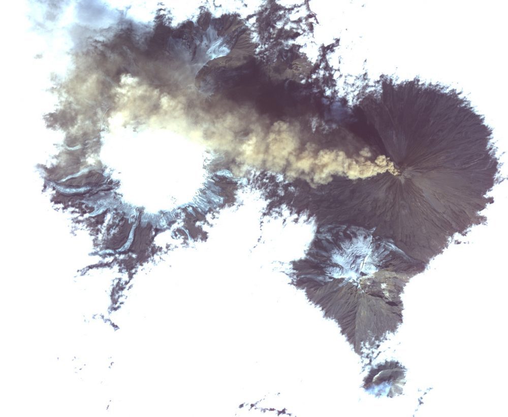
Shiveluch, one of the world’s most active volcanoes, is seen poking through above a solid cloud deck, with an ash plume streaming to the west.
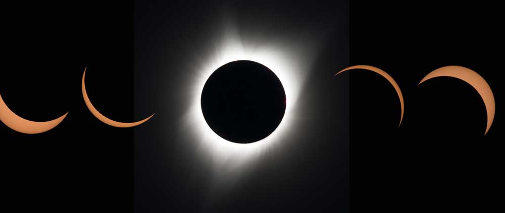
This composite image of 11 pictures shows the progression of a total solar eclipse at Madras High School in Madras, Ore., on Monday, Aug. 21, 2017.
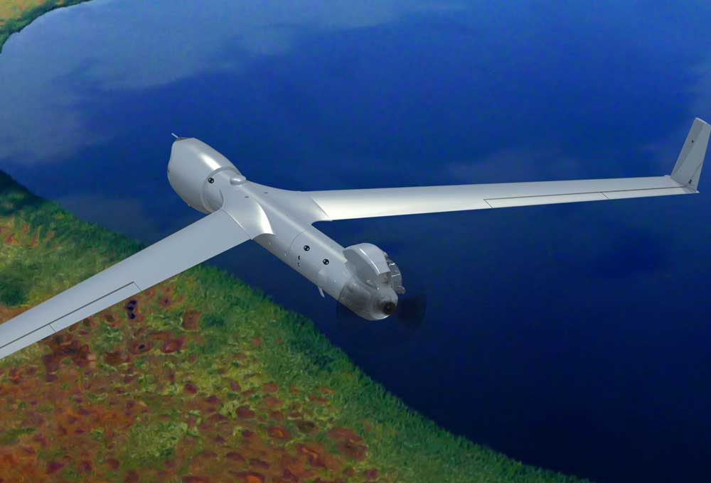
Insitu, FireWhat and Esri partnered to help aerial reconnaissance for fighting wildfires. Insitu's INEXA Solutions professional aerial remote-sensing services group will work with FireWhat's fire professionals, using its GIS customized for firefighters and hosted on Esri's ArcGIS platform.
Long, spiraling cloud patterns in the sky, von Kármán vortices, arise when winds are diverted around a blunt, high-profile area, often an island rising from the ocean. The alternating direction of rotation in the air forms swirls in the clouds.
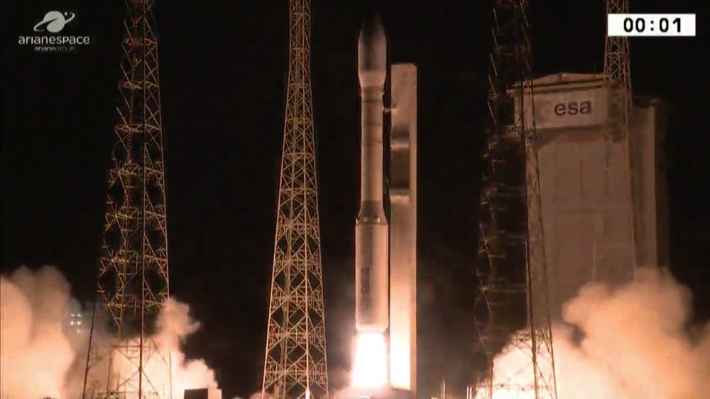
On Aug. 2, 2017, Arianespace launched a Vega rocket carrying two Earth-observation satellites for Italy, France and Israel. It took 97 minutes to deliver the Optsat-3000 and Venμs satellites into their planned orbits.
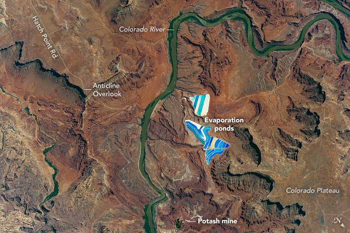
An astronaut aboard the International Space Station took this photograph of solar evaporation ponds outside the city of Moab, Utah.
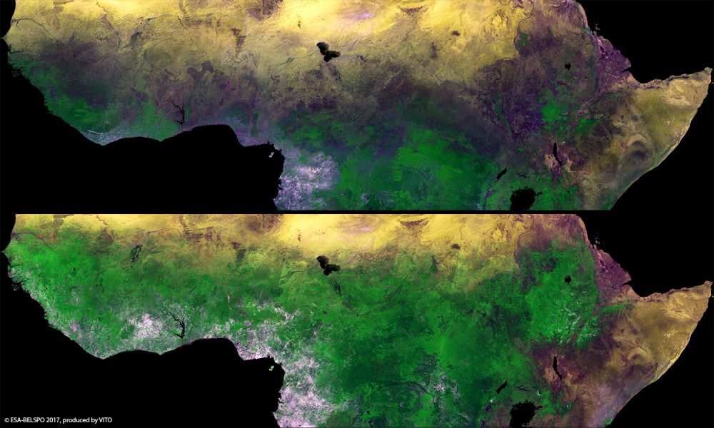
The European Space Agency (ESA) Proba-V minisatellite recorded the seasonal changes in Africa's sub-Saharan Sahel, which stretches more than 5,000 kilometers across Africa, from the Atlantic Ocean (Senegal, Mauritania) to the Red Sea (Sudan).
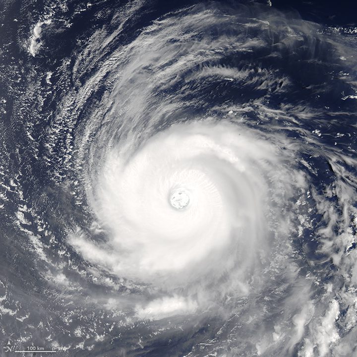
On July 31, 2017, the Moderate Resolution Imaging Spectroradiometer (MODIS) on NASA's Aqua satellite observed Super Typhoon Noru over the western tropical Pacific Ocean.
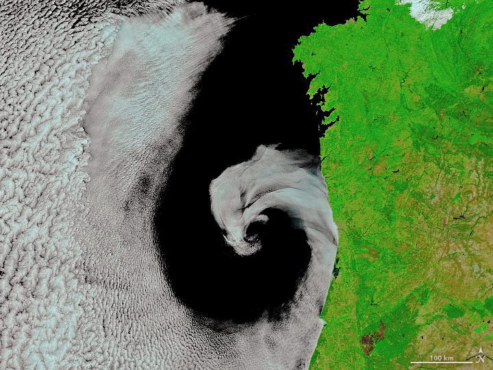
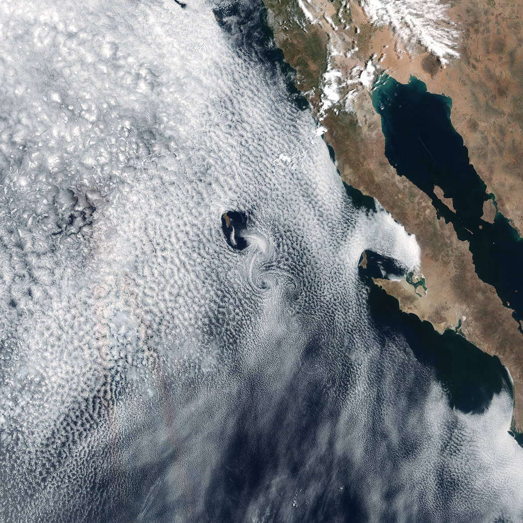
On July 16, 2017, the Moderate Resolution Imaging Spectroradiometer (MODIS) on NASA's Terra satellite captured this image of cyclonic rotation off the coast of Portugal.
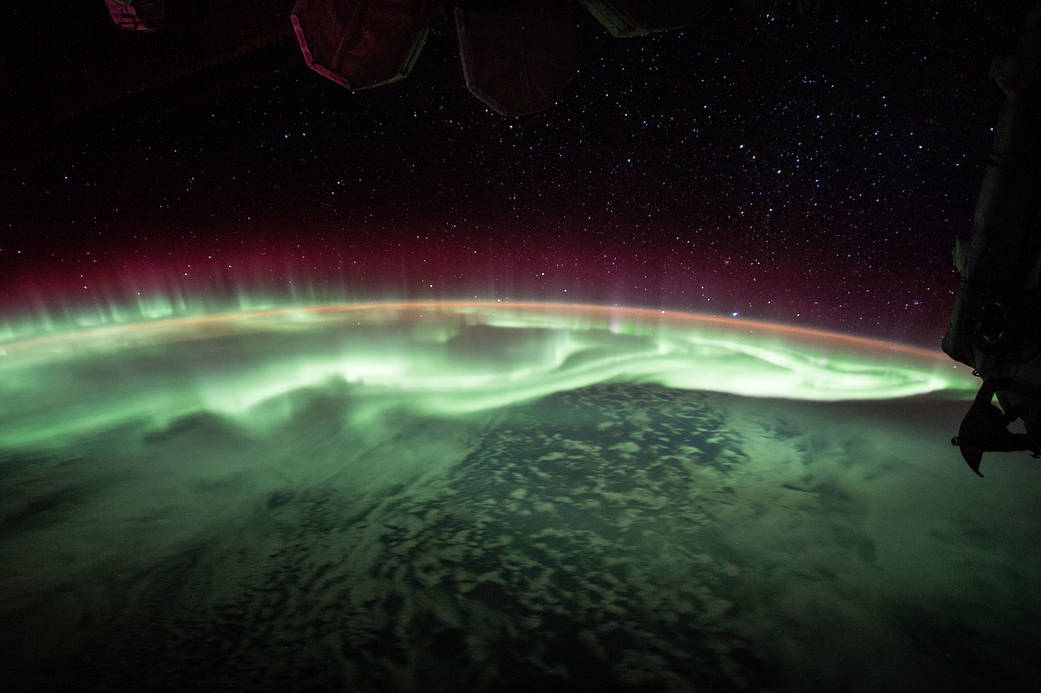
Expedition 52 Flight Engineer Jack Fischer of NASA shared photos and a time-lapse video of a glowing green aurora seen from his vantage point 250 miles up, aboard the International Space Station.
