The Moderate Resolution Imaging Spectroradiometer (MODIS) onboard NASA's Aqua satellite captured this true-color image of oceanic nonlinear internal solitary waves from Indonesia's Lombok Strait.
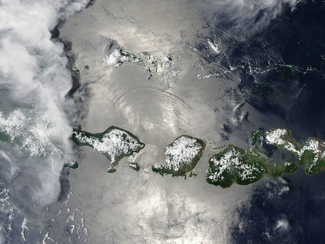
The Moderate Resolution Imaging Spectroradiometer (MODIS) onboard NASA's Aqua satellite captured this true-color image of oceanic nonlinear internal solitary waves from Indonesia's Lombok Strait.
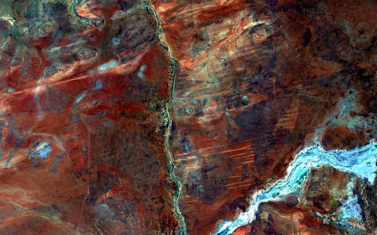
The European Space Agency (ESA) Copernicus Sentinel-2A satellite captured this image over the northern part of Western Australia in the Wolfe Creek Crater National Park.
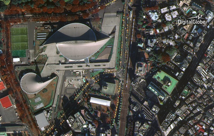
DigitalGlobe released the first public image from its recently launched 30-centimeter-resolution WorldView-4 satellite. Taken on Nov. 26, 2016, the image shows the Yoyogi National Gymnasium in Shibuya, Tokyo.
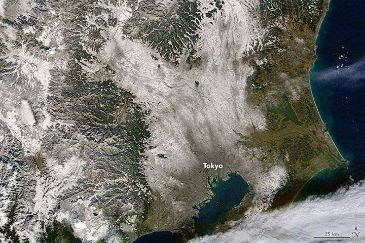
The Moderate Resolution Imaging Spectroradiometer (MODIS) on NASA's Terra satellite captured this natural-color image of Tokyo on Nov. 24, 2016, after it received its first November snowfall in more than half a century.
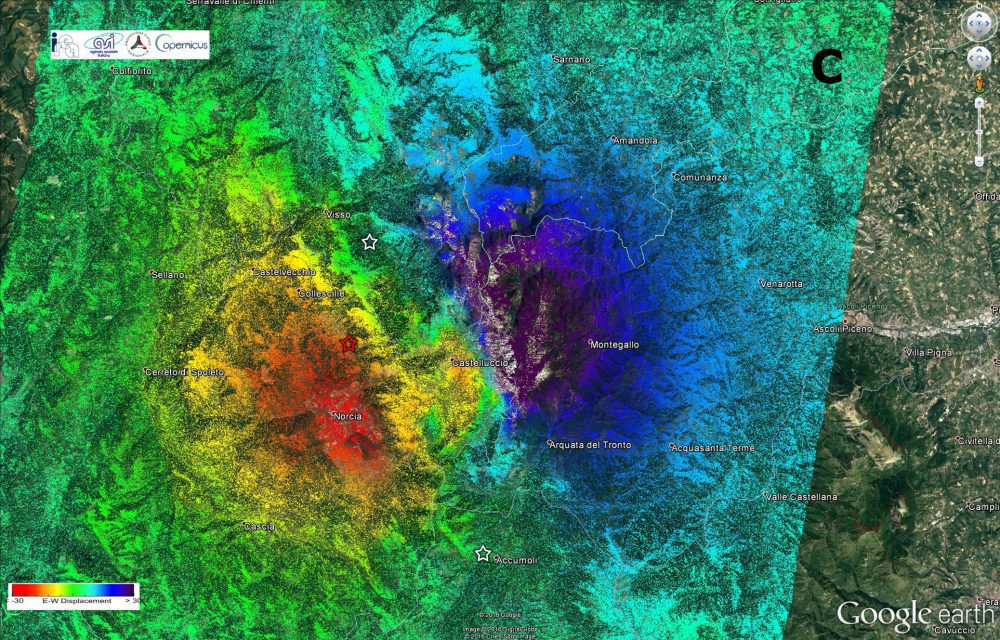
Scientists from Italy's Institute for Electromagnetic Sensing of the Environment of the National Research Council as well as the National Institute of Geophysics and Volcanology used radar imagery from the Copernicus Sentinel-1 satellites to identify significant east“west ground displacement in central Italy where an earthquake struck on Oct. 30, 2016.
Chile's Bernardo O'Higgins National Park includes much of the Southern Patagonian Ice Field, the world's second-largest contiguous ice field beyond the poles.
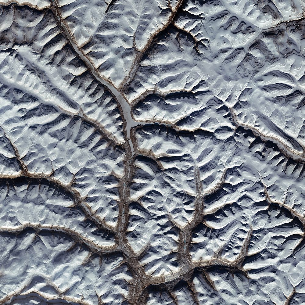
The European Space Agency (ESA) Sentinel-2A satellite collected this image of the Putorana Plateau in northern Central Siberia. Situated about 100 kilometers north of the Arctic Circle, the site serves as a major reindeer migration route and is one of the few centers of plant species richness in the Arctic.
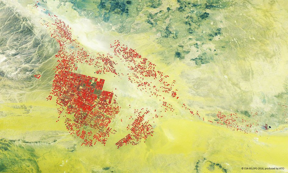
Although it may be difficult to irrigate fields in the middle of the the Wadi As Sirhan basin of Saudi Arabia, the practice does lead to stunning and beautifully contrasting imagery, as evidenced in this European Space Agency (ESA) false-color image from the Proba-V minisatellite.
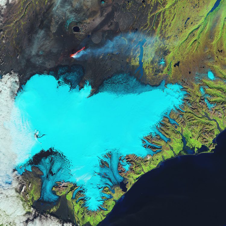
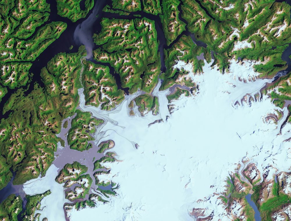
Glaciers cover 11 percent of Iceland's landscape, and the Vatnajökull (Vatna Glacier in English) is 8,000 square kilometers and the largest in Europe. The Landsat-8 satellite captured this false-color image over Iceland's southeastern coast and the Vatnajökull glacier.
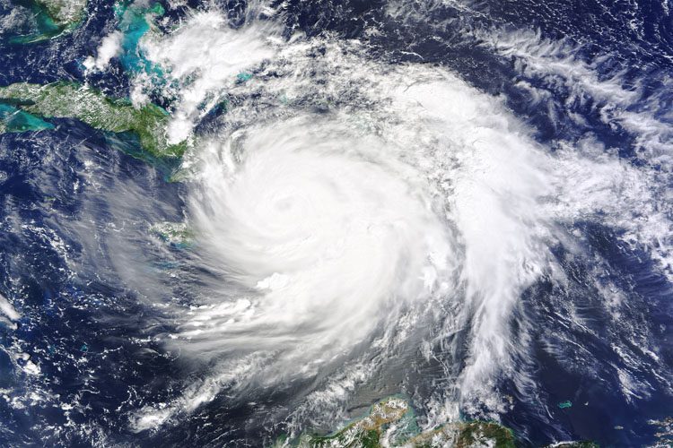
On Oct. 4, 2016, Hurricane Matthew made landfall on southwestern Haiti as a Category 4 storm”the strongest storm to hit the Caribbean nation in more than 50 years.
