On March 9, 2016, and approximately 1 million miles from Earth, NASA's Deep Space Climate Observatory (DSCOVR) captured the shadow of the Moon moving across Earth's sunlit face.

On March 9, 2016, and approximately 1 million miles from Earth, NASA's Deep Space Climate Observatory (DSCOVR) captured the shadow of the Moon moving across Earth's sunlit face.
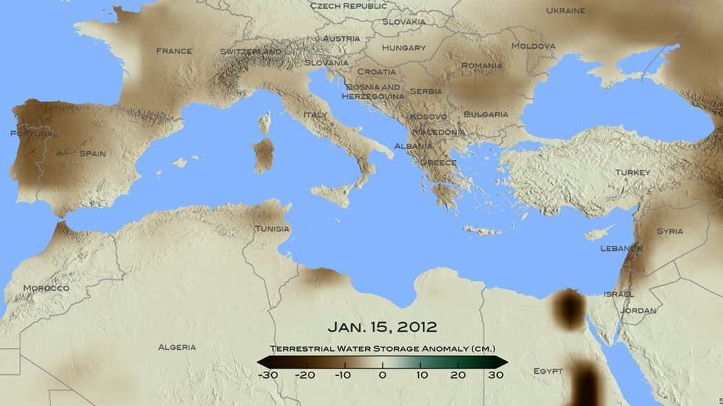
A new NASA study used remote-sensing and tree-ring data to conclude that the recent drought that began in 1998 in the eastern Mediterranean Levant region (Cyprus, Israel, Jordan, Lebanon, Palestine, Syria and Turkey) is likely the worst drought of the last nine centuries.

Two weeks after its successful launch on Feb. 16, 2016, the Copernicus Sentinel-3A satellite captured its first image, the transition from day to night over Svalbard, Norway.
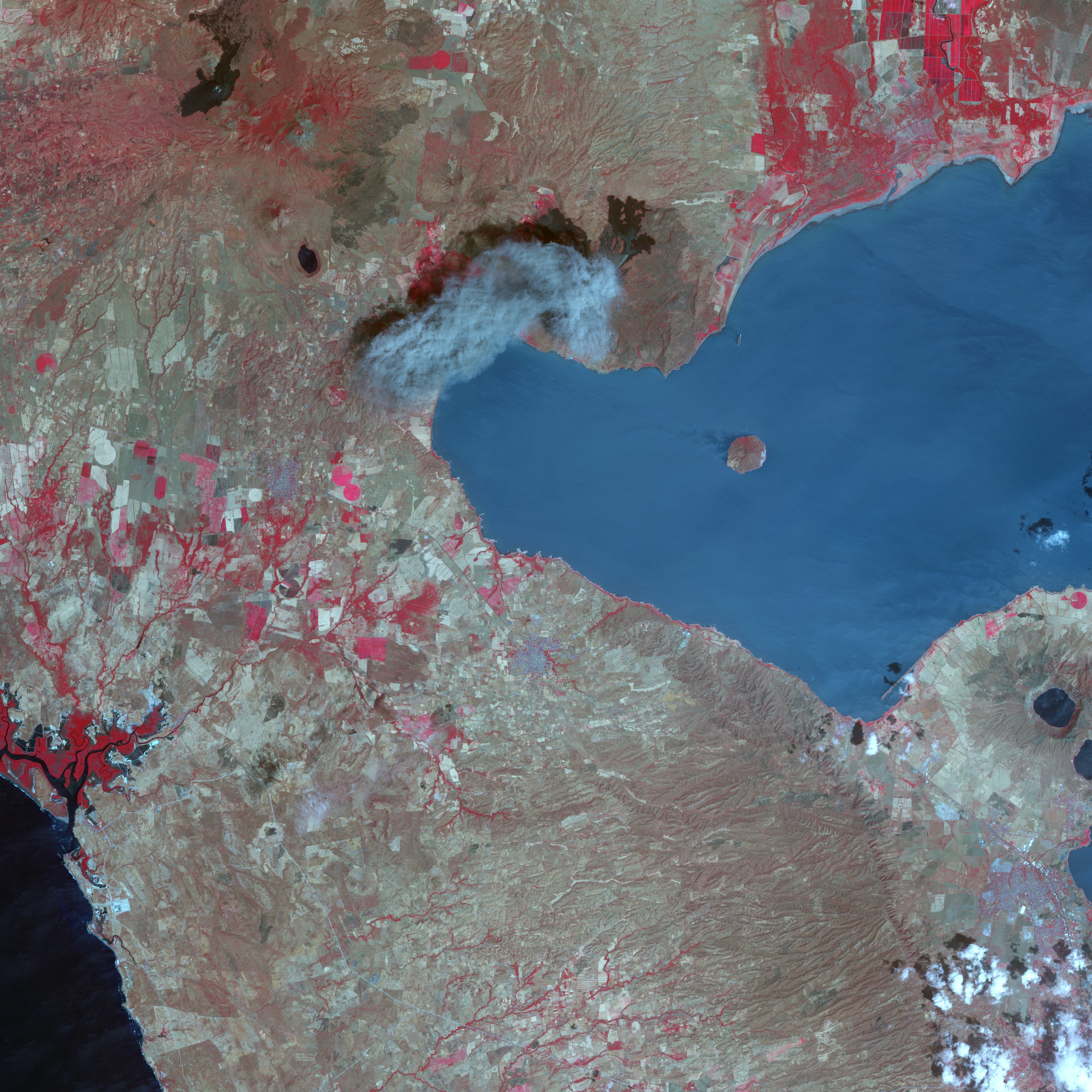
After more than 100 years of dormancy, Nicaragua's Momotombo volcano has erupted more than 80 times in the last three months. Momotombo rises from a chain of 19 active volcanos that run northwest to southeast in western Nicaragua, one of the most volcanically and seismically active areas on Earth.
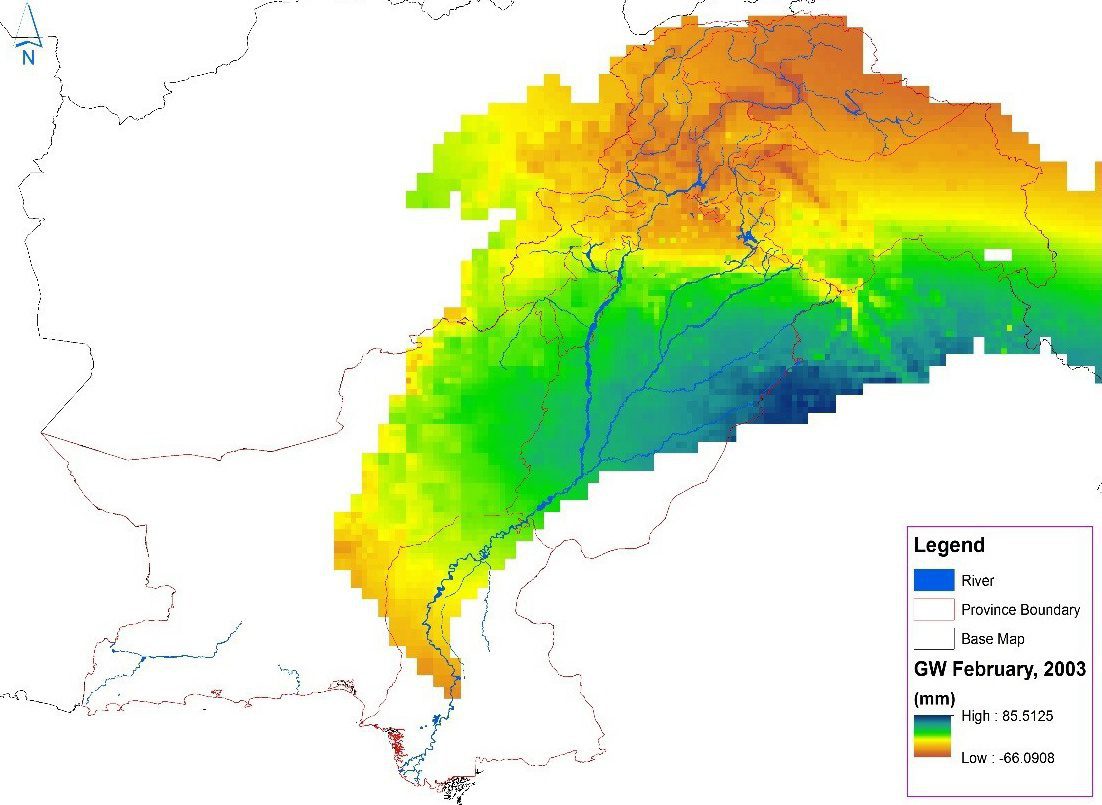
After decades of unchecked pumping from underground water reservoirs, the Pakistan Council of Research in Water Resources in January 2016 began using satellite data from NASA's Gravity Recovery and Climate Experiment (GRACE) mission to create monthly updates on groundwater storage changes in the Indus River basin.
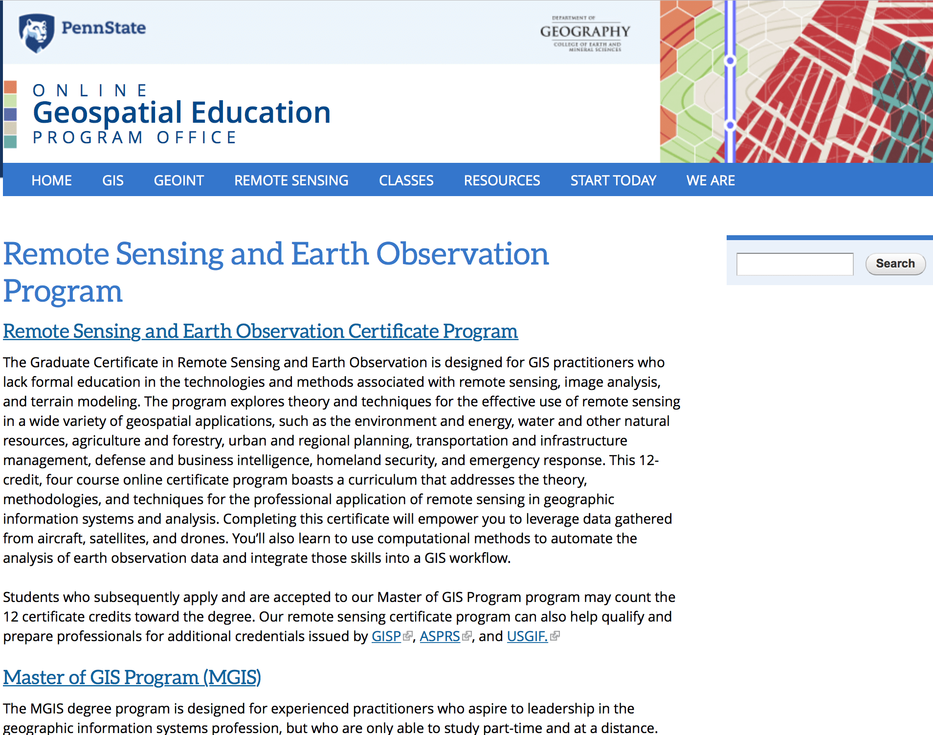
The Department of Geography in the College of Earth and Mineral Sciences at The Pennsylvania State University continues to lead academically in geospatial sciences through its Remote Sensing and Earth Observation Program and its Online Geospatial Education Program Office.
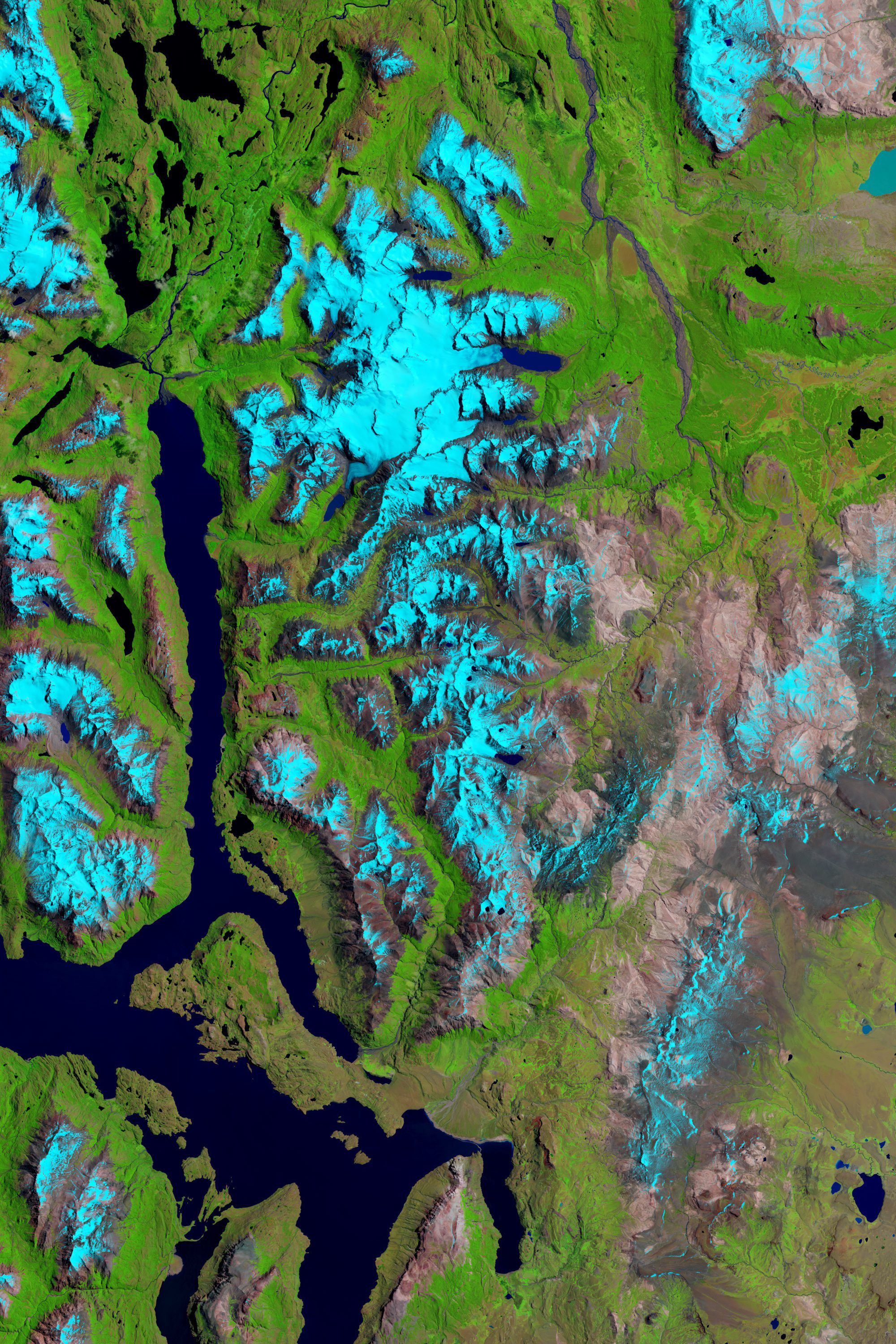
Reports and studies of shrinking glaciers and ice sheets in Greenland and Antarctica come in regularly, but an additional ice field can be added to the list: Patagonia, the mountainous area at the southern end of South America shared by Argentina and Chile.
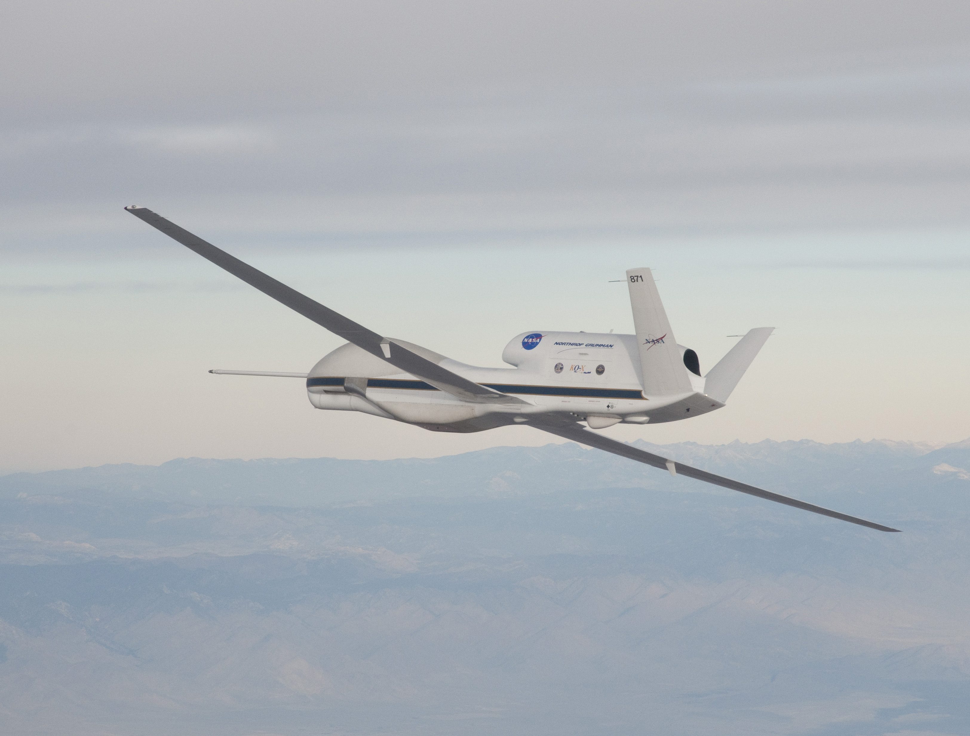
Extreme weather predictions on the U.S. West Coast could become more accurate with help from NASA’s Global Hawk unmanned aircraft system (UAS).
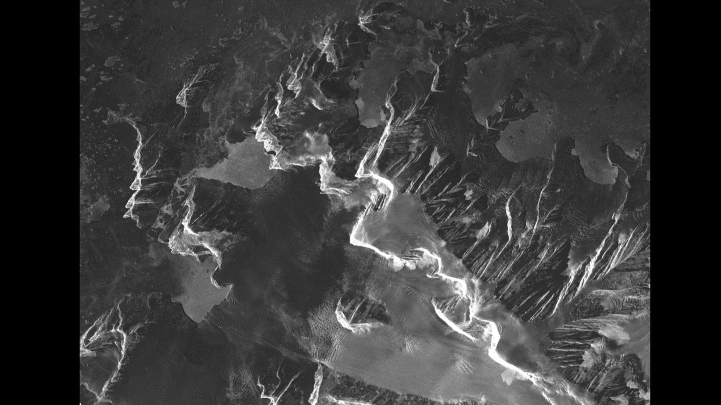
The crew aboard the Dagmar Aaen, a research ship traveling around the Antarctic Peninsula to investigate how climate change is impacting the local environment, is receiving high-resolution radar images from the German Aerospace Center (DLR) to help navigate the icy waters.
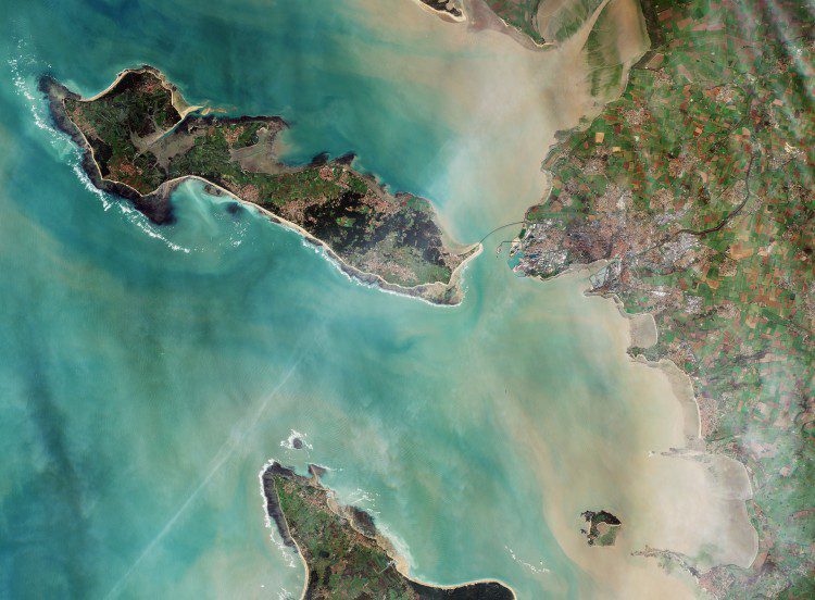
With approximately 80,000 inhabitants, La Rochelle, France, is a city and seaport on the Atlantic Ocean's Bay of Biscay, connected to the Île de Ré by a 2.9-kilometer bridge that's visible in the center of this image captured by the European Space Agency (ESA) Sentinel-2A satellite.
