Satellite Sentinel Project Aims to Deter War in Sudan DigitalGlobe collaborated with the Satellite Sentinel Project, the brainchild of actor George Clooney, to deliver the first images and analysis of the evolving situation in Sudan, following the country’s...

Sensor-Knowledge System Protects Critical Infrastructure
Threat Detection and Assessment A development team led by TerraEchos and its sister company, GCS Research, both of Missoula, Mont., have introduced a commercial sensor-knowledge system capable of detecting, locating and classifying threats to remote high-risk...
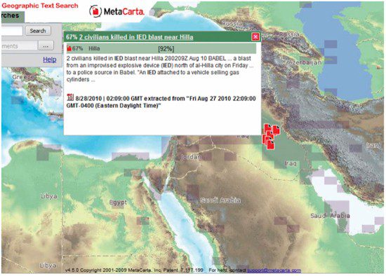
Protecting the Nation and the Warfighter with Location-Based Intelligence
Geographic Search and Referencing It’s not a lack of information that hinders today’s homeland security and military defense
operations; it’s a lack of information convergence necessary to deliver relevant information about threats in a timely and efficient...
Imagery in the News: Satellite Images Reveal Earthquake/Tsunami Damage in Japan
Satellite imagery provided dramatic before-and-after perspectives after an 8.9-magnitude earthquake and resulting tsunami struck Japan’s coast on March 11, 2011. The imagery provided an assessment of the damage seen at the two Fukushima nuclear power plants...

Full-Motion Video Architecture Delivers Homeland Security Benefits
Law Enforcement Using the same commercial broadcast technologies that have been proven in demanding television networks around the world, Harris offers the latest architecture of FAME™ — the full-motion video asset management engine — now optimized for federal...
Satellite Images Reveal Earthquake/Tsunami Damage in Japan
Satellite imagery provided dramatic before-and-after perspectives after an 8.9-magnitude earthquake and resulting tsunami struck Japan’s coast on March 11, 2011. The imagery provided an assessment of the damage seen at the two Fukushima nuclear power plants...
Rapid Mapping Bolsters Security and Disaster Response
High-Resolution Airborne Imagery Security and disaster mapping specialists have an insatiable appetite for imagery; fortunately, there’s an ever-expanding menu of sensors to meet the demand. From large-format digital aerial photos to sub-meter-resolution satellite...
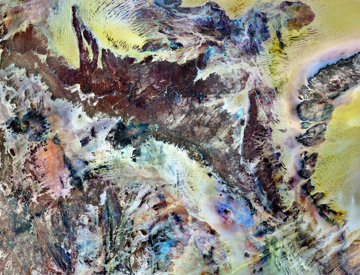
Tassili n'Ajjer National Park
Tassili n’Ajjer National Park covers 72,000 square kilometers (27,800 square miles) in southeastern Algeria. Part of the Sahara Desert, the park has a bone-dry climate with scant rainfall, yet does not blend in with Saharan dunes. Instead, the rocky plateau rises...
Transportation Management: LiDAR, Satellite Imagery Expedite Infrastructure Planning
By Waheed Uddin, professor of civil engineering and director, Center for Advanced Infrastructure Technology (www.olemiss.edu/projects/cait), University of Mississippi, University, Miss. For years, transportation projects have benefitted from aerial photography and...
Industry Updates
NASA Satellites Capture a Stronger La Nińa
A new Ocean Surface Topography Mission (OSTM)/Jason-2 satellite image of the Pacific Ocean indicates the current La Nińa event in the eastern Pacific remained strong during December 2010.
“This latest event appears to be one of the strongest ones over this time period,” says Climatologist Bill Patzert of NASA’s Jet Propulsion Laboratory. “It’s already impacting weather and climate all around the planet.”
