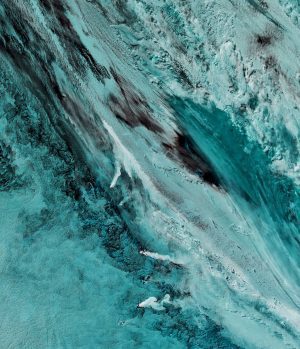
On Sept. 29, 2016, the Moderate Resolution Imaging Spectroradiometer (MODIS) on NASA's Aqua satellite captured this false-color image (MODIS bands 7-2-1) showing volcanic activity in the South Sandwich Islands. (Credit: NASA Earth Observatory image by Joshua Stevens, using MODIS data from the LANCE sensor)
Located in the South Atlantic Ocean, the uninhabited South Sandwich Islands include several active stratovolcanoes. Due to their remote location, these volcanoes are some of the least studied in the world, although satellites often catch them erupting.
The combination of clouds and ice can make it difficult to see plumes of volcanic ash in natural-color imagery. Using portions of the electromagnetic spectrum that are typically invisible to the naked eye”such as infrared”enables satellites to distinguish ice from ash and clouds or reveal hotspots underneath a smoky wildfire.
Captain James Cook discovered the southern eight islands of the Sandwich Islands Group in 1775. The word South was later added to distinguish them from the Sandwich Islands, now known as the Hawaiian Islands.

