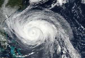
 On Sept. 24, 2017, the VIIRS instrument aboard NASA-NOAA’s Suomi NPP satellite provided this visible image of Hurricane Maria when it was northeast of Bahamas and east of the Florida east coast.
Photo Credit: NOAA/NASA Goddard Rapid Response Team
On Sept. 24, 2017, the VIIRS instrument aboard NASA-NOAA’s Suomi NPP satellite provided this visible image of Hurricane Maria when it was northeast of Bahamas and east of the Florida east coast.
Photo Credit: NOAA/NASA Goddard Rapid Response Team
