The convergence of smart GIS, 3-D and LiDAR technologies is enabling more decision makers who aren't GISpros to better manage our ever-changing world.
By Mladen Stojic, vice president, Geospatial, Intergraph Security, Government & Infrastructure (www.intergraph.com/sgi), Norcross, Ga.
The world is changing rapidly, with significant population expansion and unprecedented levels of natural and man-made disasters. The reality is that we're dealing with confounding global uncertainties that must be addressed swiftly and precisely.
To tackle these global challenges, geospatial technologies and solutions are clearly the answer. During the last few years, the geospatial sector has experienced an innovation renaissance. Geospatial technology has reached a point at which it truly can meet real-time needs, ultimately making our world a safer place and enterprises more effective.
Now users can exploit a wealth of content collected from a variety of sources for enhanced decision making. Remote sensing, photogrammetry and geographic information system (GIS) technologies are merging like never before and being implemented every day to help resolve global issues.
We can address these issues head on, manage change and help ensure a safe future for our planet. The key is to give decision makers new and highly relevant information based on continual, accurate and timely updates to geospatial data. However, it's vital for users to recognize and eliminate obstacles that hinder such information sharing.
Meeting Real-Time Needs
Making geospatial data actionable in real time is the ultimate goal for many organizations. Unfortunately,GISitself can become a source of gridlock, as the technology often is stuck in a department and limited to a handful of users.
Despite the fact that stakeholders across organizations may know the value of geographic information, they often lack the expertise to run a traditional desktopGIS. Online maps delivered by a webGISare helpful, but these implementations may not support an organization's technical geospatial functions or workflows. Today's users require vertical market-focused geospatial workflows, not horizontal technology.
Addressing urgent needs means we have to break down the data silos that exist within large organizations. When departments within the same organization use different geospatial software and data formats, data silos emerge that form obstacles to effective collaboration within the enterprise.
This can be even more problematic when sharing geospatial data with users outside an organization. We live in a world that requires instant access to information, and data silos within organizations only decrease efficiencies and overall effectiveness. When geospatial data are required to save lives, silos can be deadly.
The concept of data silos didn't reach national consciousness until 9/11, which showcased some of the information-sharing challenges in the intelligence community (IC). The need for real-time geospatial intelligence was further brought to light during military engagements in Afghanistan and Iraq.
Empowering the warfighter with real-time geospatial data is similar to the vision vertical industries and government agencies have for sharing geospatial data. A wide variety of organizations need access to real-time spatial data.
As the IC has leaned on the geospatial industry for answers, many companies have developed solutions for breaking down silos. ERDAS APOLLO and GeoMedia SDI Portal are among several such solutions.
Being able to collaborate with professionals who aren't trained inGISbut have a vested geospatial interest in their workflows also has been a challenge. Along these lines, many geospatial solutions address the unmet demand for geospatial information and services among non-GISexperts, enabling direct access to geospatial data from the source without the need for translation.
Enter Smart GIS
Today, there's a growing untapped user base between those working with a rigid and technically demanding desktopGISand a static lightweight browser-basedGIS. These users are eager to geospatially accelerate their business workflows.
It's possible for organizations to embrace a smartGIS, which essentially removes the growing disparity between the status quo and what aGISneeds to be. A smartGISconnects and equips all users with the power ofGIS, breaking down the legacy walls that have resulted in closed, passive and one-dimensional systems. The new paradigm provides a platform for a smarter world”a digital world in which geographic information is the key ingredient for jumpstarting the critical workflows needed to understand our changing planet.
For example, Intergraph's GeoMedia Smart Client solution lets organizations create a single deployment that can be configured for an unlimited number of applications. It facilitates geographic changes that are interactively implemented across an enterprisewide smartGISand seamlessly integrated into configurable workflows.
Users from multiple departments can leverage advanced geospatial functionality via map-based tools, streamlining processes and honing their expertise. In addition, a broader group of individuals and departments across an organization can create data, maps and reports for their projects instead of relying on aGISspecialist. Such workflows are sustainable and support ongoing, long-term business processes.

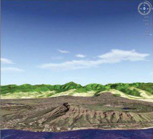
GIS add-on products, such as Intergraph's GeoMedia 3D, create realistic 3-D representations by draping imagery over 3-D surfaces.
Enhancing Smart GIS with 3-D and LiDAR Data
In terms of usingGISfor addressing real-world needs, 3-D and LiDAR technologies now play a major role in enhancing decision making and information sharing. Working in 3-D allows users to create a compelling geospatial visual connection among internal stakeholders and the public, providing clear and realistic project information.
In the urban planning world, 3-D enables organizations to better exploit the precision and power of their geospatial data, leading to quicker, more confident decision making and visual communication to support location-centric tasks. For example, the city of Virginia Beach, Va., has taken some unique steps to produce more intuitive 3-D appraisal maps”showing the location, dimensions and other information pertaining to a parcel of land subject to property taxes”as well as maps requested by other city departments.
In addition, the South Carolina Department of Transportation is visualizing 3-D surface models in pre-construction project planning. This effort is producing a more accurate estimate of expenditures associated with the engineering of project alternatives.

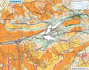
Urban planners use 3-D models from a variety of sources to provide clear, realistic project information.
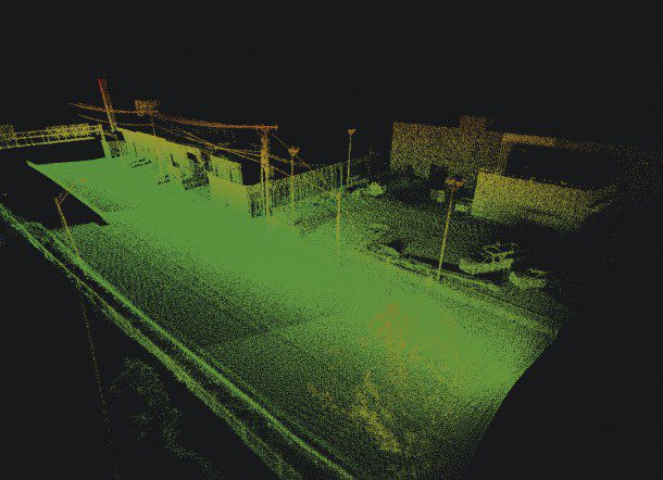
Light detection and ranging (LiDAR) technology also has become a key solution for providing situational and geographic awareness for many industries, as well as the military and government. However, as a result of today's LiDAR boom, it's becoming more difficult for users to manage, distribute, exploit and visualize their point data from the desktop to the server and out to the world itself.
Managing terabytes of LiDAR data is no small task. Organizations need to automatically find, describe and catalog their LiDAR data, thereby enabling internal and external customers to discover, view, analyze and download the data, as well as value-added derivative information products. As more methods for collecting LiDAR data become available, it's critical for organizations to ensure they use the right tools for managing and processing high volumes of LiDAR data.
Real-Time Advantages
MostGISprofessionals don't have the luxury of time. The core foundation ofGISis to provide a better understanding of our planet to help us solve serious global issues in real time. Whether it's for the warfighter or first responders during a natural or man-made disaster, imagery and mapping data serve as the guide for effective decision making, and this has to happen nearly instantaneously.

As more methods for collecting LiDAR data become available, organizations need to ensure they use the right tools to manage and process high volumes of LiDAR data.
Our industry is changing as the traditional silos segmenting geospatial functionality are being dissolved, providing a more cohesive picture of our changing world and speeding up the time lapse between capture and delivery. With a growing number of geospatially aware individuals not specifically trained in GIS, the idea of the smart GIS has emerged, bringing 3-D, LiDAR and advanced geospatial functionality to configurable and intuitive workflows. The vision of a dynamic GIS is being realized, bringing all the geospatial disciplines together and including a broader field of users with tools that meet the needs both novice and expert users alike.


