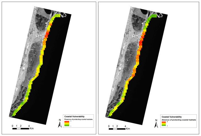
The coastline of Mexico's Yucatan peninsula is susceptible to wave erosion, but the coral reef and sea grass beds protect the coastline. The importance of this ecosystem service was assessed using wave energy and coastal erosion information. The EO-derived data on benthic habitats and depths were compared to a scenario without these habitats. The map displays coastal vulnerability in the absence (right) and presence (left) of marine vegetation and coral reefs. Red marks high vulnerability and green low vulnerability.
Under the Space for Ecosystems project, the European Space Agency (ESA) is working with international partners to exploit Earth observation (EO) satellites as an information source for many types of ecosystem service assessments.
For example, ESA's EO satellites play an important role in forest modeling activities, ensuring various aspects within an ecosystem are estimated correctly. Recently, on the coast of Mexico's Yucatan peninsula, satellite data were used to assess how coral reef and sea grass beds protect the coastline from wind and wave erosion. This information now can be used by coastal authorities and local entrepreneurs to assess how to develop the coastline while sustainably protecting the reef, allowing important revenue from ecotourism to continue.
Image courtesy of ESA/GeoVille.
