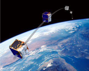
RapidEye is a commercial remote sensing satellite mission developed by MDA for the German firm RapidEye. The unique satellite-based Earth observation system delivers timely, reliable information products and services to the agricultural industry for agricultural crop monitoring and mapping, yield predictions and disaster assessment.
RapidEye announced it has generated more than 16 million km² of cloud-free imagery across 28 U.S. states and three Canadian provinces.
Program subscribers had access to new imagery as it was collected, including more than 30,000 Level 3A ortho products at the end of the collection windows. The products have an average cloud cover of 5 percent. The bulk of the imagery (72 percent) was acquired with low viewing angles of +/- 10 degrees.
According to AGRI IMAGIS Technologies' President Lanny Faleide, RapidEye’s imaging capabilities have greatly expanded the use of Satshot's agricultural imagery analysis system this past season. In 2013, RapidEye has provided Satshot immediate access to products, many times within 24 hours of image capture.
Image courtesy of MacDonald, Dettwiler and Associates Ltd. (MDA).

