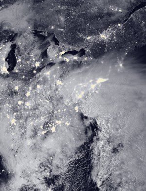
The Visible Infrared Imaging Radiometer Suite (VIIRS) on NASA-NOAA's Suomi NPP satellite acquired this nighttime image of the blizzard on Jan. 23, 2016. The VIIRS day-night band detects faint light signals such as city lights, moonlight, airglow and auroras. (Credit: NOAA/NASA)
Satellites tracked and helped warn of a major winter storm that hit the eastern United States on Jan. 22-24, 2016, with two low-pressure systems merging to drop heavy snow from Virginia to New England. Snowfall totals approached records in several states, and hurricane-force winds battered coastlines and caused flooding.
The National Weather Service reported snow totals of 40 inches in Glengary, W.V.; 33 inches in Frederick, Md.; 23.5 inches at Dulles Airport near Washington, D.C.; and 16.2 inches at the National Zoo in Washington.
According to evolving news reports, at least eight people died from storm-related deaths, and thousands were temporarily stranded in cars and trucks on highways. More than 9,000 flights were canceled, and citizens were ordered to stay off the roads in some cities and towns.

