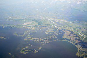
A natural sedimentation process is helping Louisiana's Wax Lake Delta grow in size. This area was a focus for recent imaging by three instruments tasked with documenting change.
NASA regularly captures data about Gulf Coast fluctuations, measuring change as well as ongoing loss of land. These measurements are particularly helpful after storms and hurricanes to understand wetland change and obtain a complete picture of coastal zone change.
NASA's Earth System Science Formulation Office at NASA's Jet Propulsion Laboratory in Pasadena, Calif., developed the three instruments that were flown on research aircraft based at NASA's Armstrong Flight Research Center in Palmdale, Calif.:
- The Uninhabited Aerial Vehicle Synthetic Aperture Radar (UAVSAR) instrument, an imaging radar uniquely designed to measure how Earth locations change between repeat flights over the same path.
- The Next-Generation Airborne Visible/Infrared Imaging Spectrometer (AVIRISng), which observes changes in light reflected from Earth to obtain accurate, quantitative characterizations of the composition and features of Earth's surface.
- The Air Surface Water and Ocean Topography (AirSWOT) instrument, an airborne prototype of a planned spaceborne precision radar instrument that will use a new technique to measure changes in Earth's water surfaces through time.
During this latest flight, special attention was given to the Wax Lake Delta that, contrary to trends in the region, actually is growing in size thanks to a natural sedimentation process.
Read the full story here.

