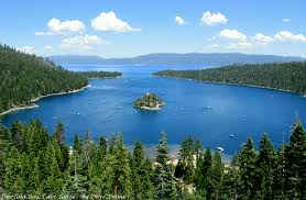
Scientists using light detection and ranging (LiDAR) Earth observation technology have uncovered more substantial seismic hazards than previously thought to exist near Lake Tahoe. The steep, fault-formed range west of the lake could generate relatively strong earthquakes with magnitudes from 6.3 to 6.9, according to the study led by the U.S. Geological Survey (USGS).
This study is yet one more stunning example of how the availability of LiDAR information to precisely and accurately map the shape of the solid Earth surface beneath vegetation is revolutionizing the geosciences, said USGS Director Marcia McNutt. From investigations of geologic hazards to calculations of carbon stored in the forest canopy to simply making the most accurate maps possible, LiDAR returns its investment many times over.
View a video to see how LiDAR penetrates dense forest cover to reveal active fault lines.


