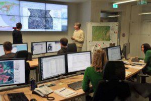
Scientists in a DLR situation room use satellite data to monitor a developing crisis. (Credit: DLR)
The German Aerospace Center (DLR) set up the EO4HumEn+ Project to better provide satellite data for humanitarian aid organizations worldwide. Of growing importance is the use of such imagery to monitor and estimate the size of refugee camps, which is very difficult for those on the ground. The Austrian Red Cross is a partner in the project.
Often we do not know where and in what numbers people are living in a geographical area, because the distances are great, and access to areas of conflict is very difficult, explained Elmar Göbl from the Austrian Red Cross.
The project will run for two years, and the first step is to determine which regions should be the first set up for satellite evaluation for humanitarian purposes.
For aid organizations, the project is a practical form of support for their work; for the scientists, it is an opportunity to drive forward the research, to exchange information, and to learn from one another, noted Elisabeth Schöpfer from the German Remote Sensing Data Center.

