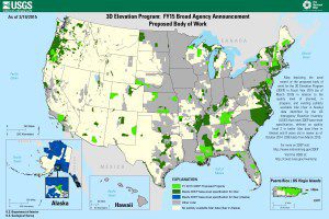
A map depicts the proposed body of work for USGS 3DEP in fiscal-year 2015, adding more than 95,000 square miles of 3DEP-quality LiDAR data to the national database.
Under its Geospatial Products and Services Contract with the U.S. Geological Survey (USGS), Dewberry is executing a task order to evaluate two new forms of LiDAR to determine if single-photon LiDAR (SPL) and Geiger-mode LiDAR (GML) can satisfy USGS LiDAR Base Specification version 1.2 for quality level (QL2) LiDAR for use in the USGS 3D Elevation Program (3DEP).
Using approximately 500 square miles of existing QL2 data from traditional linear-mode LiDAR (LML) and quality-control checkpoints in northern Connecticut, Dewberry will determine the capabilities and limitations of SPL and GML, acquired day and night during leaf-on conditions, to deliver QL2 LiDAR or better for 3DEP. Dewberry will evaluate absolute and relative horizontal and vertical positional accuracies as well as noise levels from sunlight, data smoothness and repeatability, data spatial distribution and density, and other parameters as needed.

