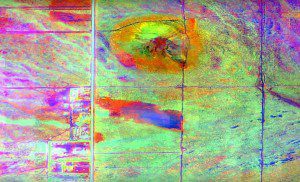
Merrick & Company's Data Fusion Predicts Habitat Quality project used multispectral imagery to monitor Edwards Air Force Base impacts on local habitat.
Merrick & Company was recently honored by the American Council of Engineering Companies of Colorado (ACEC Colorado) at its annual Engineering Excellence Awards competition, which recognizes engineering projects that demonstrate a high degree of ingenuity and include significant technical, economic and/or social advancements. The Data Fusion Predicts Habitat Quality project, completed by Merrick's geomatics group, received an Engineering Excellence Award in the Surveying & Mapping Technology category.
The Mojave Desert is home to unique and threatened species, such as the desert tortoise, Joshua tree and desert cymopterus. Edwards Air Force Base monitors impacts of its operations in this environment by using multispectral satellite imagery as well as traditional aerial and field approaches. Recently, hyperspectral imagery and LiDAR remote-sensing technologies were used for more cost-effective methods to collect, evaluate and analyze spatial data related to habitat quality.
Merrick was on a team led by Johnson-Frank & Associates, who held a contract with the U.S. Army Corps of Engineers (USACE), Sacramento District. As the primary mapping consultant, Merrick was responsible for the overall technical implementation, aviation coordination, sensor integration, LiDAR acquisition and point cloud post-processing.

