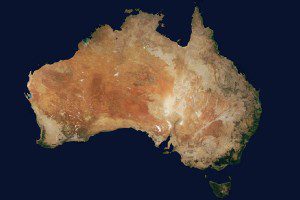
To provide a seamless mosaic of Australia, Landsat 8 scenes were color balanced and radiometrically corrected in PCI Geomatica OrthoEngine prior to mosaicing.
Australian company geoshepherds created a complete Landsat 8 Mosaic (L8M) of Australia, consisting of more than 7.6 million square kilometers of imagery that has been orthorectified, radiometrically color balanced and pansharpened. The imagery used is primarily captured in the dry season to provide a uniform appearance.
L8M Australia is supplied in uncompressed GeoTIFF 1deg x 1deg tiles in Geographic Latitude Longitude and 110,575.61-meter tiles in Universal Transverse Mercator WGS84, and they're roughly 150MB in size. Compressed versions are provided on a state and/or countrywide basis formatted in JPEG2000 (Australia file size: 3.7GB and Australia States average file size: 380MB).
The Landsat 8 satellite, launched on Feb. 11, 2013, was built by Orbital Sciences Corp., and is a collaboration between NASA and the U.S. Geological Survey. Its sensors include the Operational Land Imager and the Thermal Infrared Sensor.

