Mississippi Swampland Seen from Space

Mississippi Swampland Seen from Space

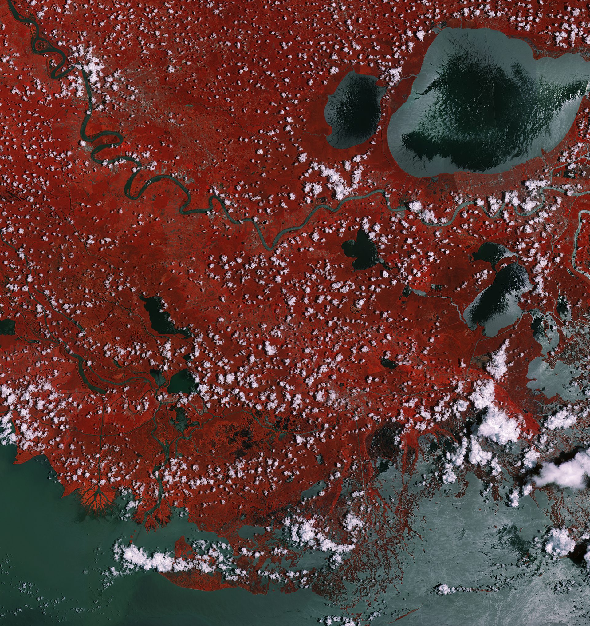
This Sentinel-2A ˜color vision' image captures part of the Mississippi swamps on the east and west banks of the Mississippi River, south of New Orleans and north of the Mississippi Delta. The red color shows vegetation, while gray represents bodies of water.

Hubble Records Twin Jet Nebula Expansion

Hubble Records Twin Jet Nebula Expansion

A new image from the NASA/ESA Hubble Space Telescope captures the Twin Jet Nebula's shells and knots of expanding gas, as two iridescent lobes of material stretch outwards from a central star system. Within these lobes, two huge jets of gas are streaming from the star system at speeds in excess of 1 million kilometers (621,400 miles) per hour.

Typhoon Goni Covers Southern Half of Sea of Japan

Typhoon Goni Covers Southern Half of Sea of Japan

On Aug. 25, 2015, the Moderate Resolution Imaging Spectroradiometer (MODIS) instrument aboard NASA's Aqua satellite captured a visible picture of Typhoon Goni after it moved out of the East China Sea and north into the Sea of Japan. The MODIS image also showed that the storm's western quadrant was over North Korea and South Korea, while the eastern quadrant stretched over most of the big island of Japan.

Landsat Sees Eye of the Sahara

Landsat Sees Eye of the Sahara

Located near the western edge of the Sahara Desert, the Eye of the Sahara is a feature that resembles a large eye when viewed from space. Also known as the Richat Structure or Guelb er Richat, the Eye is a symmetrical dome of eroded sedimentary and volcanic rock.

Marine Plankton Brighten Clouds over Southern Ocean

Marine Plankton Brighten Clouds over Southern Ocean

New research using NASA satellite data and ocean biology models suggests tiny organisms in vast stretches of the Southern Ocean play a significant role in generating brighter clouds overhead. Brighter clouds reflect more sunlight back into space, affecting the amount of solar energy that reaches Earth's surface, which in turn has implications for global climate.

NASA's New Blue Marble

NASA's New Blue Marble

This Blue Marble image is the first fully illuminated snapshot of Earth captured by the DSCOVR satellite, which will capture and transmit full images of Earth every few hours. The information will help examine a range of Earth properties, such as ozone and aerosol levels, cloud coverage, and vegetation density, supporting a number of climate-science applications.

NEWEST V1 MEDIA PUBLICATION

April Issue 2024