Heavy rainfall, flooding and tornado outbreaks affected areas of the United States from the Southwest through the Midwest in late December 2015. Fourteen deaths were attributed to the deadliest tornadoes that hit Benton, Miss., on Dec. 23, 2015.
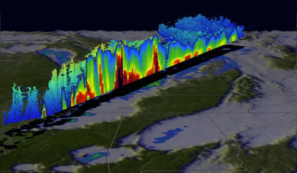
Heavy rainfall, flooding and tornado outbreaks affected areas of the United States from the Southwest through the Midwest in late December 2015. Fourteen deaths were attributed to the deadliest tornadoes that hit Benton, Miss., on Dec. 23, 2015.

User of UAS aerial images must be open to the idea that an exempted UAS operator might not be able to fly the mission as planned due to the many operational restrictions imposed by the FAA. Be flexible, knowing that operating within regulations is, in the long run, the best approach.
Aviation safety is always at the forefront of airfield operations. The Federal Aviation Administration (FAA) and Department of Defense (DOD) have stringent criteria regarding location and classification of airfield obstructions, which is any feature that breaks a specified plane in relation to an airfield, including terrain, vegetation, buildings, electric poles and antennas.
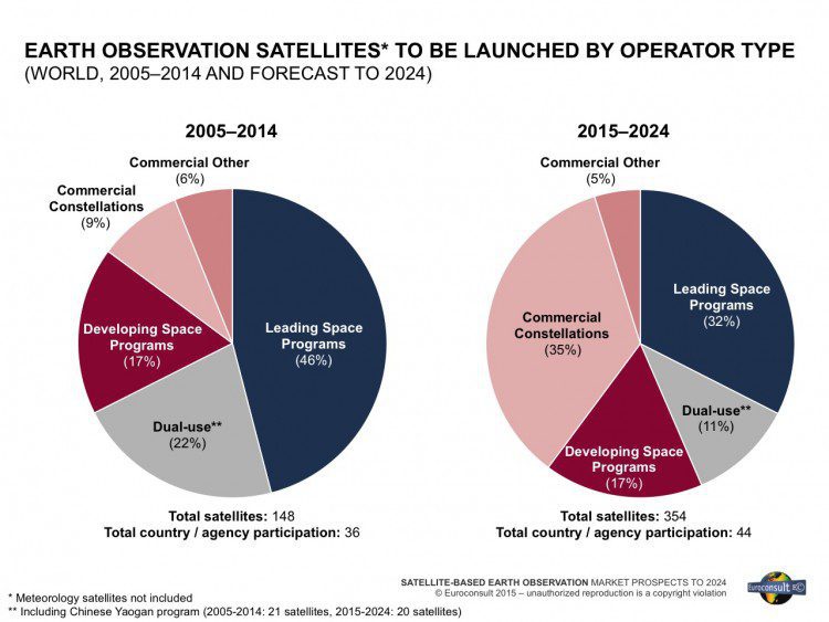
Between 2005-2014, 179 Earth-observation (EO) satellites (> 50 kilograms) were launched by civil government and commercial entities from 36 countries. Supply is expected to go through significant expansion, resulting in the launch of 427 satellites from 2015-2024. This will translate to $38.8 billion in manufacturing revenue during this period.

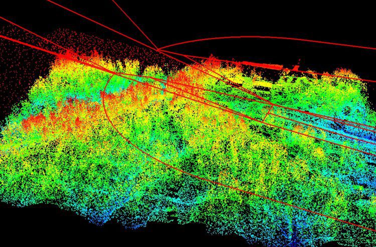
In response to growing needs for high-quality topographic data and a wide range of other 3D representations of natural and constructed features, the U.S. Geological Survey (USGS) National Geospatial Program (NGP) is leading the development of the 3D Elevation Program (3DEP).

Starting in 2004, the NASA Goddard Earth Sciences Data and Information Services Center (GES DISC) has provided an innovative and useful way to look at NASA Earth science data using the Web.

Everywhere we turn these days, there's yet another disruptive technology seemingly set to take the world by storm with increased automation and reduced cost.

Those of us who have been following infrastructure for more than a couple of decades are astonished, and unimpressed, by the seemingly sudden emergence of unmanned aircraft systems (UASs) as critical technology for infrastructure solutions of all sorts, particularly mapping and surveying.

When commodity markets are fragile, it's important for companies, banks and countries to understand how the supply and prices of natural resources are affected by local and global conditions.

Having spent most of my professional career in the Washington, D.C., area, I've learned some lessons about how the U.S. government works”or doesn't. One frustrating phenomenon is the false narrative: when a story at odds with reality is developed about a particular situation.
