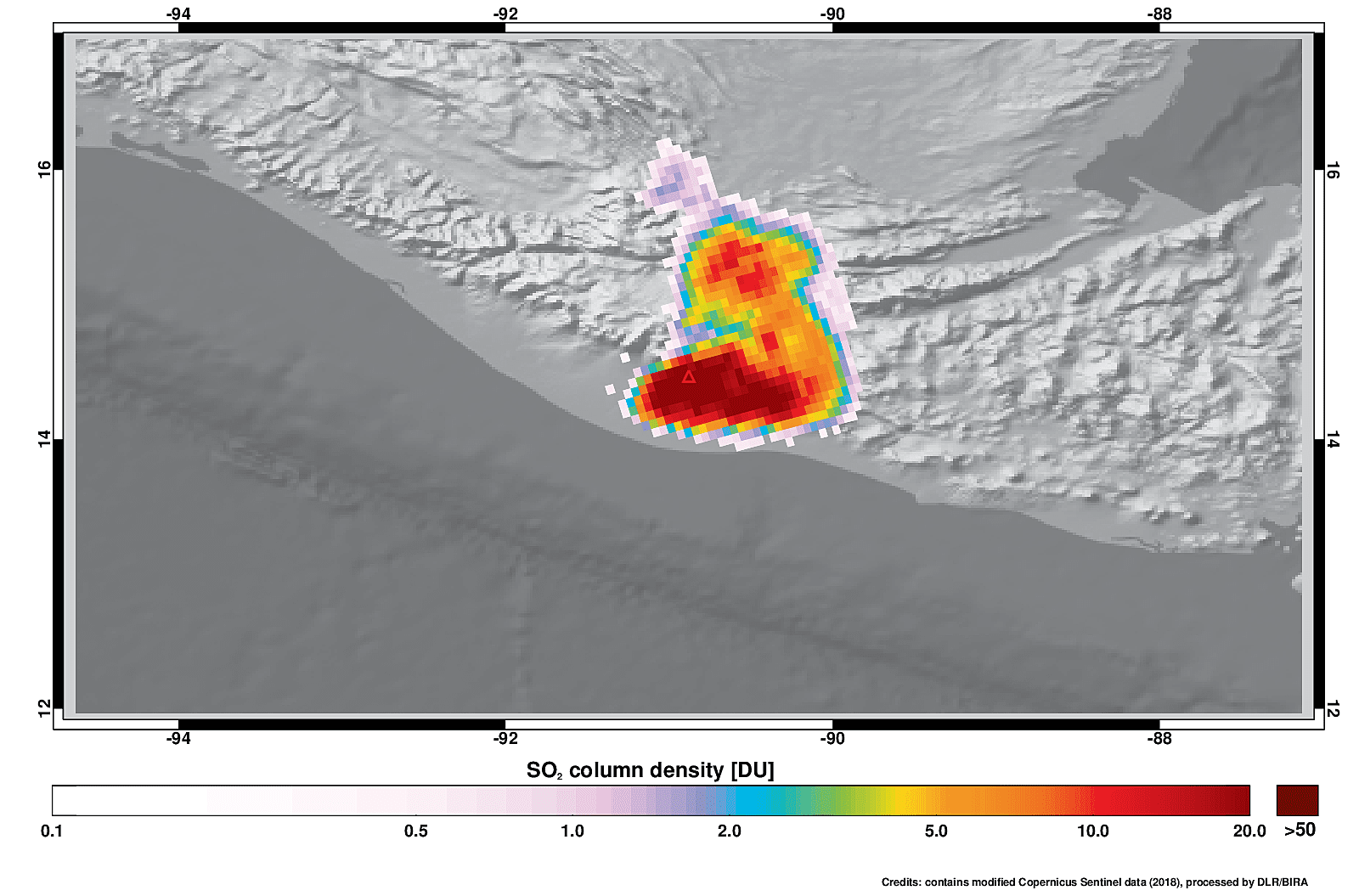
On June 3, 2018, the Copernicus Sentinel-5P satellite measured sulphur dioxide in the plume spewing from the Fuego volcano in Guatemala.
On June 3, 2018, the Copernicus Sentinel-5P satellite measured sulphur dioxide in the plume spewing from the Fuego volcano in Guatemala.
“This is quite some upgrade : full of new capabilities at very aggressive prices,â€, says Peter Bonne, CEO of Orbit GT. “With this upgrade, 3D Mapping Cloud basically renders all other platforms obsolete. We’ve got all Reality Capture systems covered, we’ve...
Point Cloud software specialist demostrates Autodesk BIM integration and a new auto classification feature Pointfuse will demonstrate how its point cloud software bridges the gap between reality capture and digital construction at SPAR 3D Expo (5-7 June, Anaheim...
Toulouse, 05/06/2018 - Aeolus, the European Space Agency’s wind sensing satellite, is now ready for its upcoming launch. It will be shipped across the Atlantic on the Airbus vessel “Ciudad de Cádiz" to Kourou, French Guiana, where a Vega launcher will send it to...
June 04, 2018 (Anaheim, California, USA) – With SPAR 3D Expo & Conference just one day away, event organizers have announced that they are expecting a record number of attendees to fill the already largest exhibit hall of the event’s history. Combined with an...
Since its first international conference in 1996 and especially after its formal constitution in 2004, the GSDI Association has led a global campaign to advance awareness and implementation of Spatial Data Infrastructures worldwide. Throughout this time, the...
Calgary, Canada / Cheseaux, Switzerland, June 04, 2018—One of Canada's leading commercial drone operators, IN-FLIGHT Data, this week is embarking upon Canada's largest BVLOS UAS Operations trial to date, with support from senseFly, the industry’s leading provider...
TORONTO - Drone Delivery Canada ("DDC") (TSX.V:FLT – OTCQB: TAKOF), is pleased to announce that Transport Canada has selected DDC to participate in the department's Beyond Visual Line-of-Sight Pilot Project (the "Pilot Project"). The Pilot Project will advance its...
Shenzen, China: At the 9th China Satellite Navigation Conference (23rd-25th May in Harbin), Boshengshang Technology (known as BSS), a start-up based in Shenzhen China, announced a new high precision satellite position receiver realized by patented RAC(Real-time...
USGIF is pleased to announce it has partnered with Boundless, a USGIF Organizational Member, to collaborate on educational initiatives in the geospatial intelligence (GEOINT) Community as well as to offer open-source resources to colleges and universities under the...
