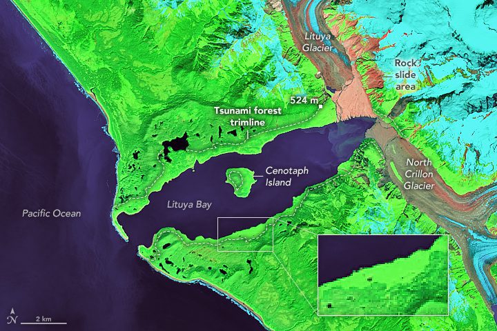
The event at Lituya Bay still stands as one of the tallest tsunami waves known to science.
The event at Lituya Bay still stands as one of the tallest tsunami waves known to science.
The satellite will benefit society through numerous disciplines such as cartography, agriculture, forestry, urban development and water management.
NASA has funded 11 new projects as part of the agency's Earth Science Data Systems' Advancing Collaborative Connections for Earth Systems Science (ACCESS) program. Proposals submitted in 2019 and funded in 2020 focused on three areas: machine learning, science in the cloud and open source tools.
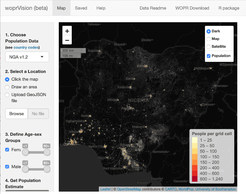
Models based in part on a method NASA has used to track and count wild salmon in Nevada can now be used by governments and humanitarian organizations to more accurately estimate populations and allocate aid to remote regions of the world.
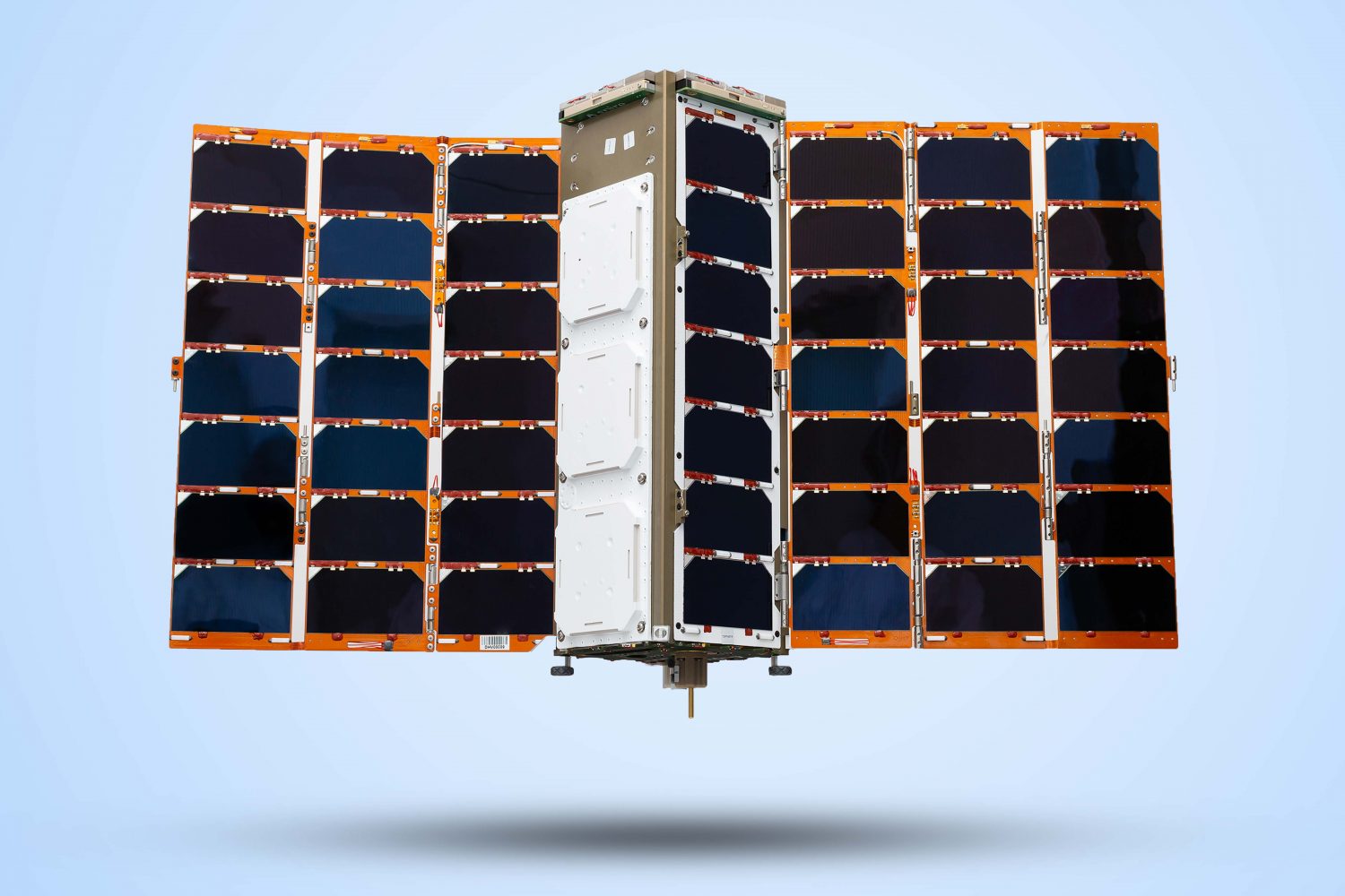
On Sept. 28, 2020, Glaswegian-built nanosatellites joined a fleet of about 100 objects in low-Earth orbit that help to predict the movement of the world's resources so businesses and governments can make informed decisions.
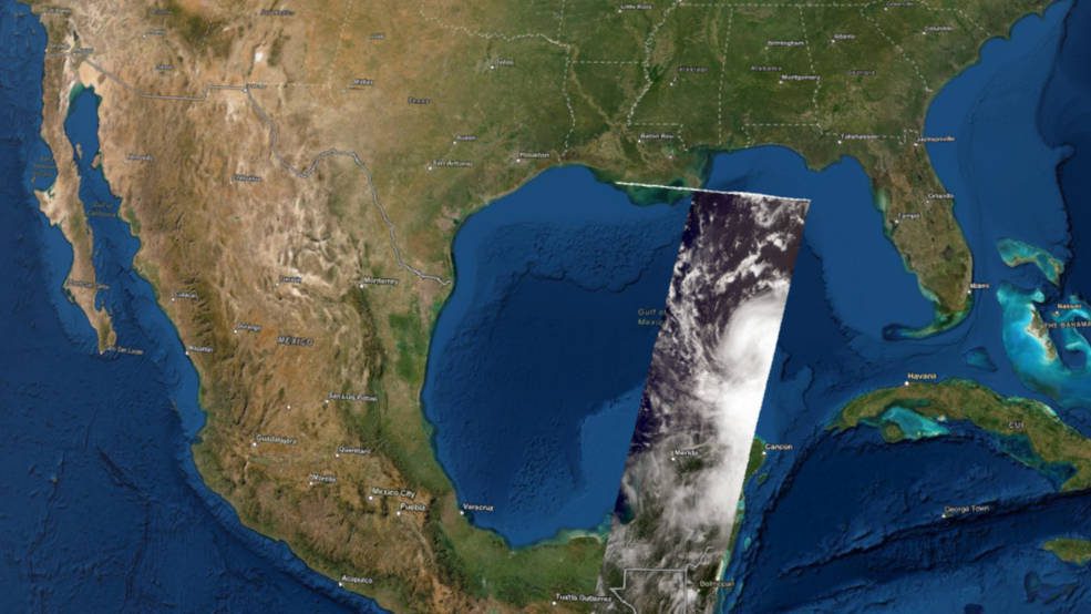
NOAA/NASA's Suomi NPP satellite captured recent images of the United States showing that the winds have changed yet again, blowing the smoke from western fires back to the East and crossing the continental United States.
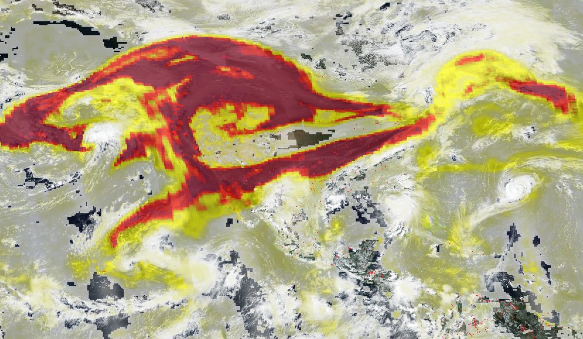
The NASA Earth Applied Sciences Disasters Program Geographic Information Systems (GIS) team worked closely with representatives from the Esri 3D team to produce the first-ever interactive 3D visualization of MISR cloud-top height data and publish it to the NASA Disasters Mapping Portal.
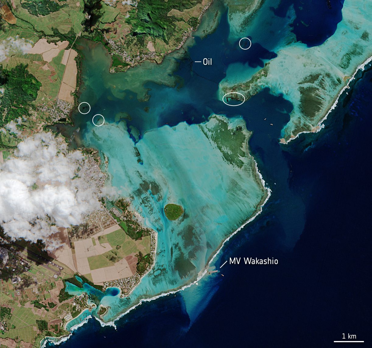
The island of Mauritius has declared a ˜state of environmental emergency' after a grounded vessel began leaking metric tons of oil into the Indian Ocean. Satellite images, which show the dark slick spreading in the nearby waters, are being used to monitor the ongoing spill.
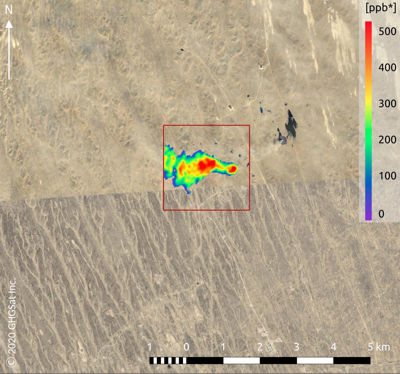
GHGSat is a New Space initiative that draws on Copernicus Sentinel-5P data for mapping methane hotspots, and its Claire satellite has now collected more than 60,000 methane measurements of industrial facilities around the world.
NASA's Advanced Spaceborne Thermal Emission and Reflection Radiometer (ASTER) instrument aboard the Terra satellite imaged some of the burned area on June 29, 2020.
